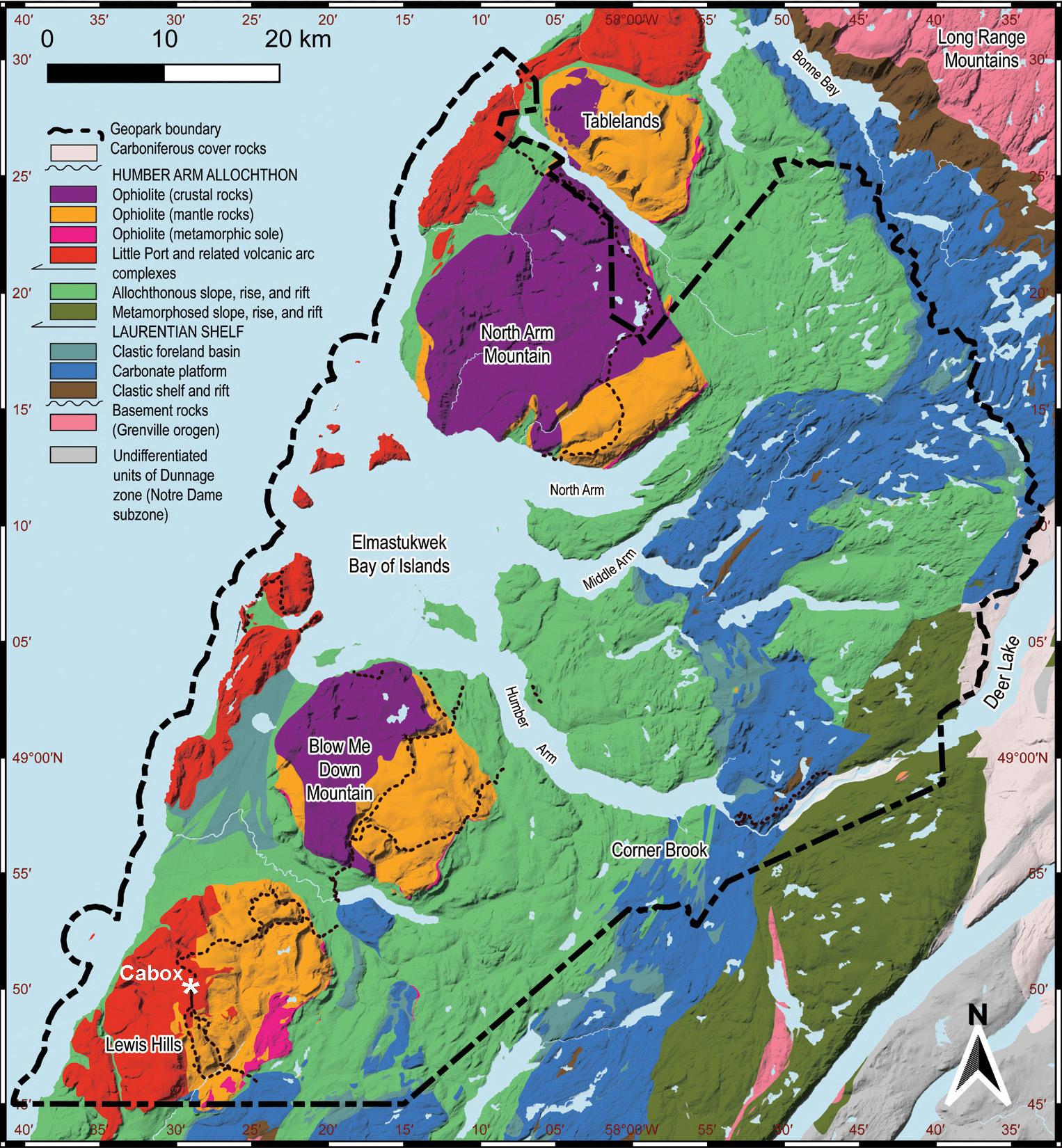
Cabox is the name of the highest point on the island of Newfoundland and the name of an Aspiring Global Geopark spanning the Bay of Islands Ophiolite (representing Paleozoic oceanic lithosphere (i.e., Earth’s crust and upper mantle)), Little Port Complex (representing an ancient island arc in the Iapetus Ocean) and adjoining Paleozoic sedimentary rocks of the continental margin of ancient North American.
The name “Cabox” originates from the Spanish, Portuguese, and Galician word “Cabos”, meaning capes, which reflects the area’s dramatic geographical features, including towering peaks and rugged coastal landscapes. The Cabox summit rises to a height of 814 meters (2,670 ft) and holds historical significance as a landmark for early exploration and navigation. It is located in the Lewis Hills, the most southerly of the four Bay of Islands Ophiolite Massifs, thought to have been named after a King Louis of France when the coastline was part of the French Shore of Newfoundland. The other three massifs are Blow-Me-Down Mountains, North Arm Hills/Gregory Mountains and Table Mountain (aka Tablelands), the latter located within Gros Morne National Park, a UNESCO World Heritage Site.
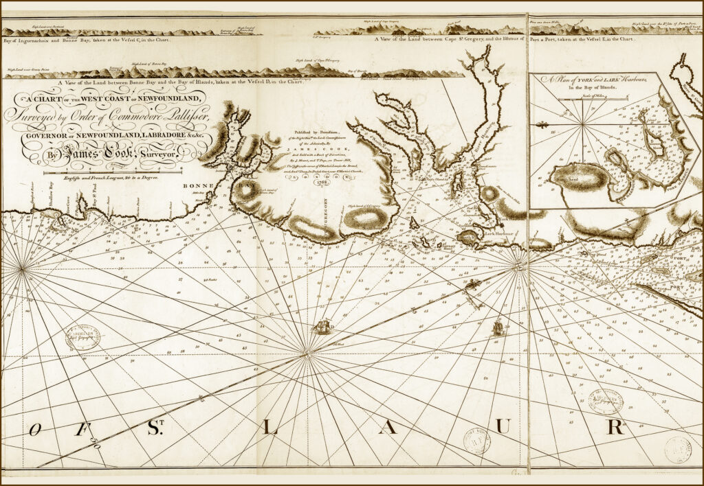
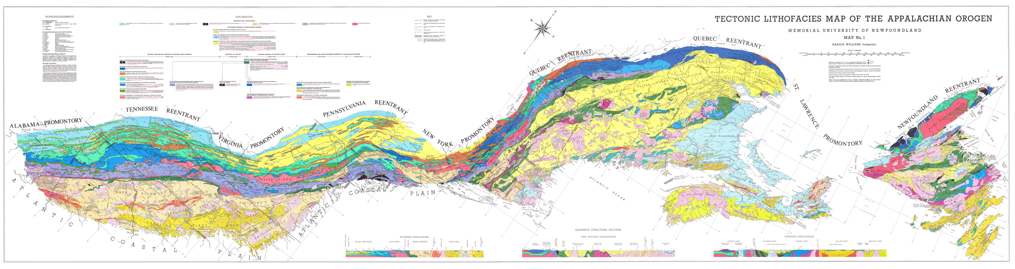
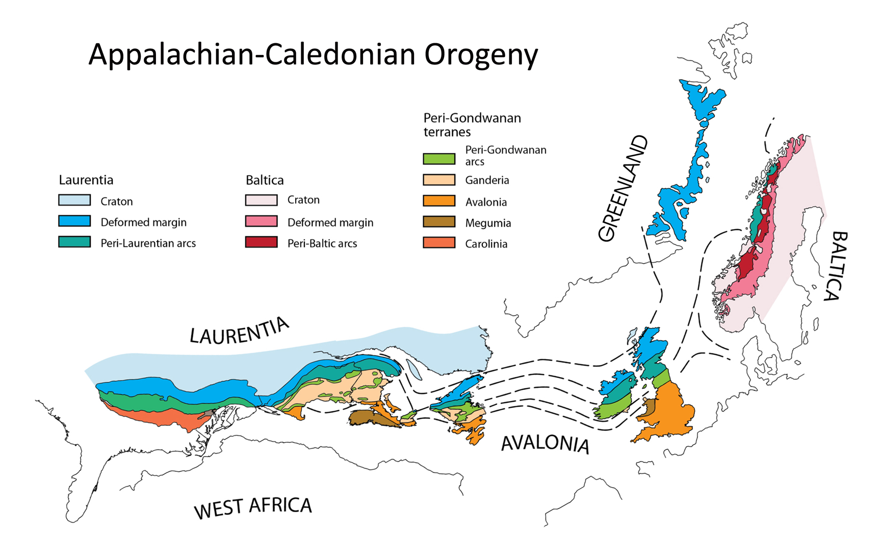
In 18th century, the coastline of the Bay of Islands region was mapped by renowned explorer and cartographer James Cook. In the centuries that followed, Cook’s outline was “colored in” by a series of accomplished geologists including J.B. Jukes, Alexander Murray, James Howley, A.K. Snelgrove, David Baird and Harold Williams, who in 1978 published his highly-regarded Tectonic Lithofacies Map of the Appalachian Orogen, on which the deformed margin of Laurentia is named “Humber Zone” after Humber Arm, Bay of Islands. The map was the first to depict orogen-scale tectonic elements in terms of their original settings and its influence has pervaded all subsequent studies of the Appalachians Mountains and contributed to the understanding of ancient orogens around the world.
Portion of James Cook's Chart of the West Coast of Newfoundland, published in1768 prior to his departure on the first of three voyages of discovery to the Pacific Ocean
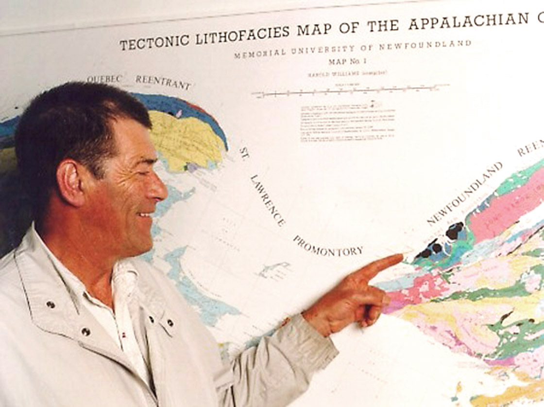
Harold Williams points to the Bay of Islands Ophiolite - and Cabox Geopark - on his Tectonic Lithofacies Map of the appalachian Orogen
William’s colourful tectonic map reflects the varied and unique geological landscapes of Western Newfoundland, in particular the Bay of Islands Ophiolite, which may be characterized as the pot of gold at the end of the Appalachian rainbow!
However our story doesn’t end there, as the island of Newfoundland lies at the center – and is widely regarded as the “type area” – of the greater Appalachian-Caledonian Orogen, which extends from the Southeastern United States through Eastern Canada and Greenland to the British Isles and Norway.