Widely considered the greatest mariner of all time, British Navy explorer, surveyor and cartographer James Cook charted the Bay of Islands and Humber River in 1767. While preparing his ‘Chart of the West Coast of Newfoundland’ in April 1768, the British Admiralty and Royal Society selected him to command a voyage to the Pacific Ocean to witness the Transit of Venus and search for the fabled southern continent. In all Cook commanded 3 voyages to the Pacific, where he discovered and surveyed the coasts of New Zealand and eastern Australia, circumnavigated Antarctica, explored the northwest coast of North America, searched for the western entrance to the Northwest Passage, and discovered numerous Pacific Islands, including the Hawaii Islands where he was killed by natives in 1779. During his 5 years surveying the coasts of Newfoundland, Cook produced the first large-scale accurate maps of the island and the first large-scale hydrographic surveys using precise triangulation to establish land outlines. He then anticipated Captain James T. Kirk and professed his intent to go not only “farther than any man has been before me, but as far as I think it is possible for a man to go”.
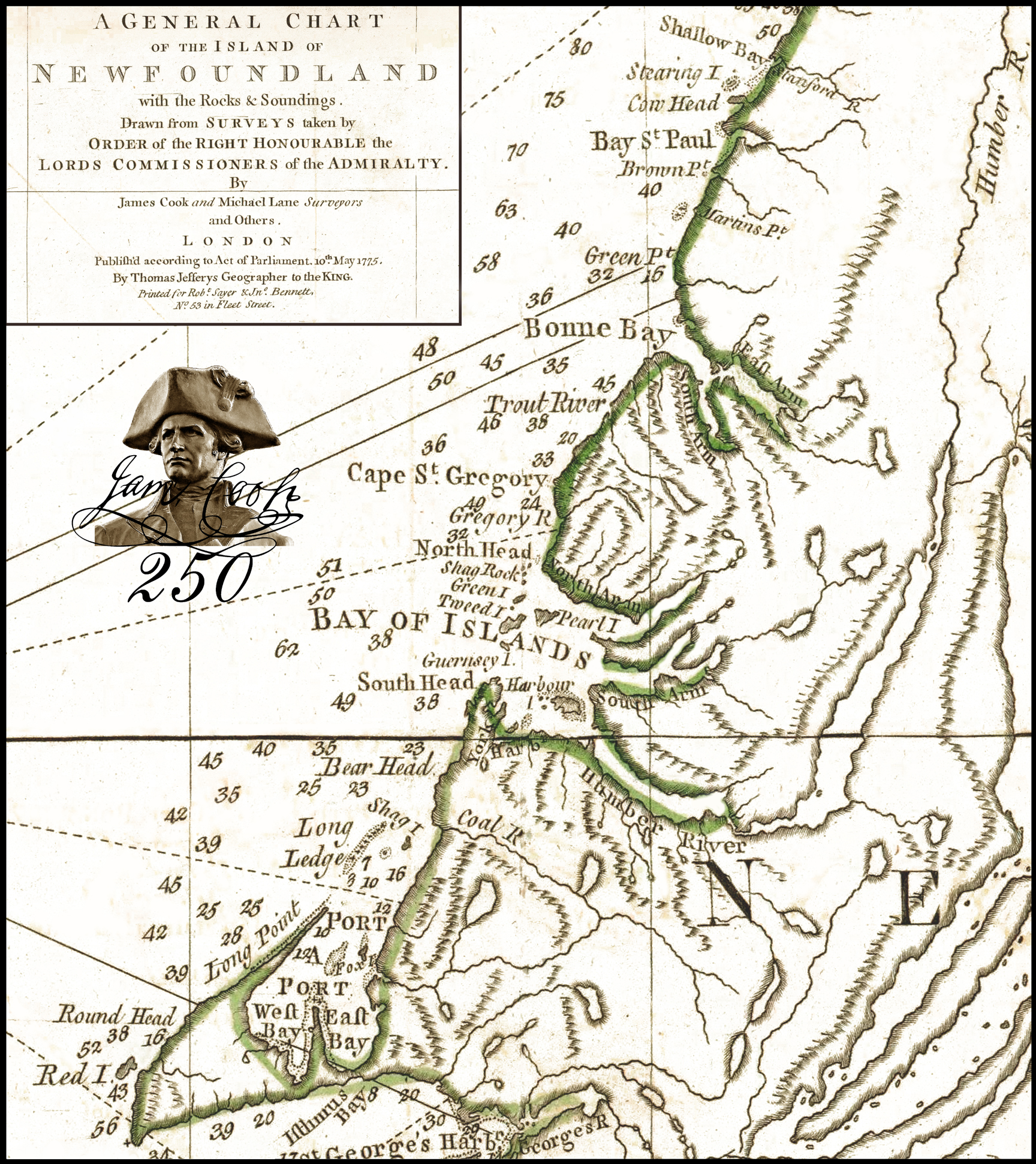
Bay of Islands and Bonne Bay on Cook’s General Chart of the Island of Newfoundland (1775)
The story of James Cook begins in the village of Marton in Yorkshire, England, where in 1728 he was born the second of eight children to a Scottish farm labourer and his Yorkshire wife. In 1736 his family moved to nearby Great Ayton where his father’s employer paid for his schooling. In 1745 at the age of 16, Cook moved to the ocean, first to the fishing village of Staithes and 18 monthes later to the seaport of Whitby, where he worked for John and Henry Walker as merchant navy apprentice. His training included algebra, geometry, trigonometry and astronomy. After three years of plying the east coast of England, Cook began working on trading ships in the Baltic Sea and in 1755 volunteered for service in the Royal Navy, just one year before the outbreak of the Seven Years War. In 1757 Cook passed his Master’s examination and was soon headed to Canada as Master of the 64-gun HMS Pembroke.
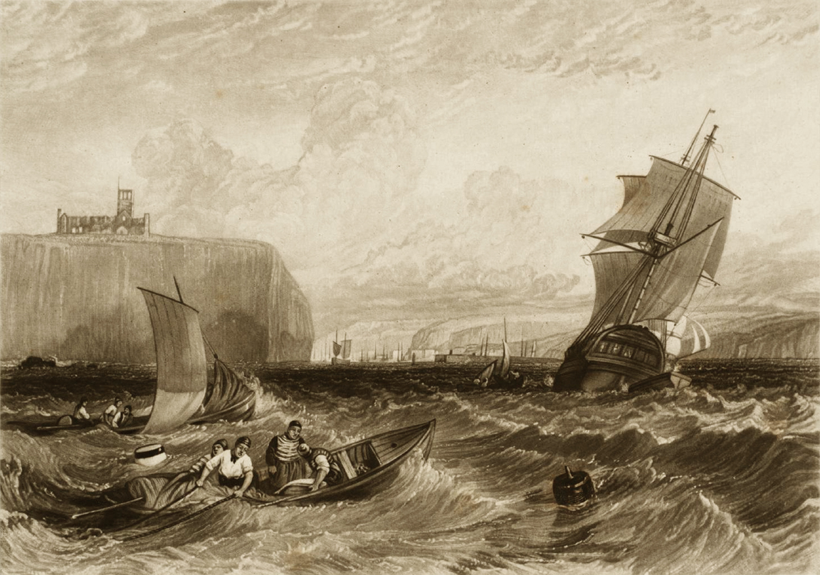
Whitby after Joseph Mallord William Turner, 1826
As Master of a Royal Navy vessel, Cook was responsible for sailing the ship as directed by the Captain, whose primary role was carrying out the Navy’s strategy and tactics while engaging the enemy. The Master’s primary duty was navigation, which required determining the vessel’s position, speed and direction, while observing the weather and setting the sails. The Master was also responsible for making charts, fitting out the vessel and stowing the hold, as well as docking and undocking the ship at port.
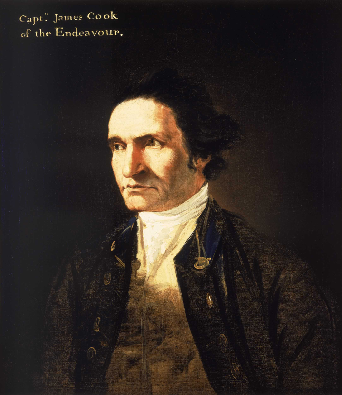
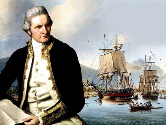
Portrait of James Cook by William Hodges (c. 1775-76), official artist on Cook’s Second Voyage to the Pacific Ocean (1772-74)
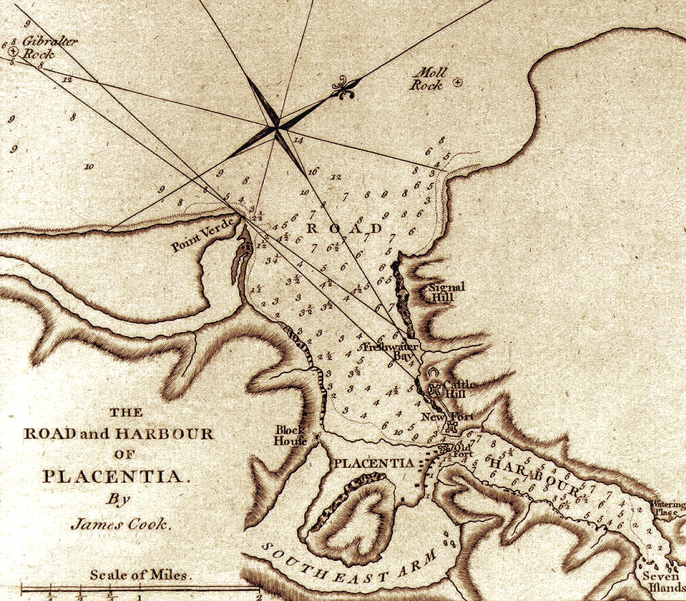
A year after arriving in Canada and taking part in the successful attack on the fortress of Louisbourg in Nova Scotia, Cook met Royal Navy Engineer Samuel Holland who taught him the latest techniques in surveying and map making, including use of the plane table. Soon after during the summer of 1759, Cook played a major role in surveying the St. Lawrence River in preparation for the assault on Quebec, where Major General James Wolfe and his forces defeated the French on the Plains of Abraham. In recognition of his role in the victory, Cook was promoted to Master of the 70-gun Northumberland, flagship of Commander-in-Chief Lord Colville. For the next three years he honed his new skills while stationed in Halifax. They were put to use again in July 1762 when a last French attempt to secure bargaining power in the peace treaty to end the Seven Years’ War led to an attack on St. John’s and other ports on Newfoundland’s Avalon Peninsula. Northumberland took part in the combined fleet that successfully forced the French out of Newfoundland waters, with Cook producing charts of Placentia and St. John’s harbours and the fishing ports of Harbour Grace and Carbonear.
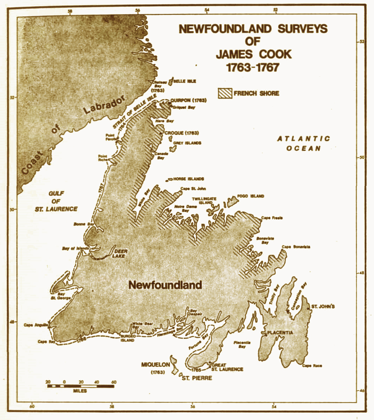
With the French defeat in North America, Great Britain acquired new territories which required surveying and mapping. After being impressed by the quality of Cook’s work on the Avalon Peninsula, Governor Thomas Graves urged the Admiralty to commission Cook to continue surveying the coasts of Newfoundland and the newly acquired Labrador. The Admiralty agreed and in the summer of 1763 Cook became the Surveyor of Newfoundland, beginning with the south coast islands of St Pierre and Miquelon which were soon to be handed over to the French under the Treaty of Paris. Cook then surveyed the Strait of Belle Isle (1763-64), south coast between the Burin Peninsula and Cape Anguille (1765-66) and the west coast between Cape Anguille and Point Ferolle (1767), when he penetrated up the Humber River as far as Deer Lake in the first official attempt to delineate the inland topography of the island. In autumn of each year Cook would return home to his family in London where he would spend the winter completing the previous summer’s charts and sailing directions, then prepare for the next summer’s exploration and surveys.
To save time and reduce dependency on British Navy vessels, Governor Graves provided Cook with a New England schooner re-rigged as a brig, with square sails better suited to inshore maneuvers. Cook’s role as its commander, navigator and surveyor combined with his knowledge of astronomy ( in 1766 Cook scientifically observed an eclipse of the sun near Burgeo) brought him to the attention of the British Admiralty and Royal Society when they were planning an expedition to the Pacific Ocean to witness the Transit of Venus and search for the fabled southern continent. In April 1768 while working on his ‘Chart of the West Coast of Newfoundland’, Cook accepted the position of commander of HMS Endeavour and readied the bark for an August departure. His surveying assistant Michael Lane continued his work in Newfoundland and together they produced the ‘General Chart of the Island of Newfoundland’.
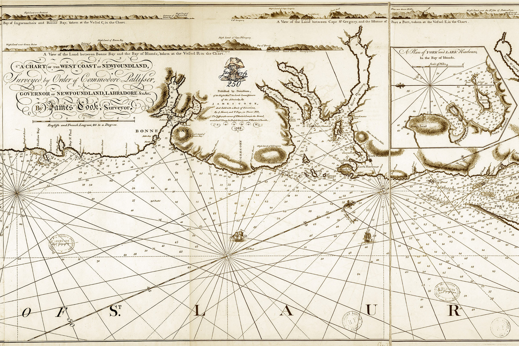
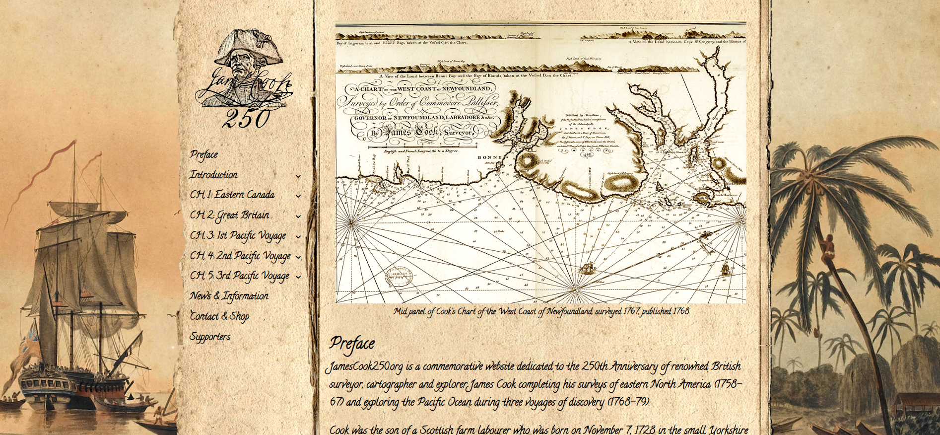
Mid section of Cook’s Chart of the West Coast of Newfoundland, including Geopark region
Cook’s contribution to the British Empire were many and included victory in North America during the Seven Years War, creation of highly accurate charts for the Newfoundland fishery, expansion of the empire into the Pacific Ocean and Northwest North America, and health and dietary innovations for the British Navy. According to his monument near Admiralty Arch, London: “Captain James Cook, Circumnavigator of the globe and explorer of the Pacific Ocean, he laid the foundations of the British Empire in Australia and New Zealand, charted the shores of Newfoundland, and traversed the ocean gates of Canada both east and west.” Cook’s contribution to Newfoundland also included the designation of many place names and the cartographic delineation of the island, to be “coloured in” by generations of geologists, from J. B. Jukes to Alexander Murray, James Howley, Harold Williams, Robert Stevens and their esteemed colleagues at the Newfoundland & Labrador Geological Survey.
Route 450 on the South Shore of the Bay of Islands is named Captain Cook’s Trail in honour of James Cook. James Cook Heritage Trail in Blow Me Down Provincial Park and Cape Blow Me Down Trail in York Harbour were named in 2017 to commemorate the 250th Anniversary of Cook’s surveying and charting the West Coast of Newfoundland, including the Bay of Islands and Bonne Bay.
To learn more about James Cook in Newfoundland, check out the below documents from our information archive
- James Cook in Newfoundland, 1762-1767
- The Making of a Maritime Explorer, James Cook In Newfoundland, 1762-1767
- The French Raid on the Newfoundland Fishery, 1762
or visit our James Cook 250 Anniversary website.