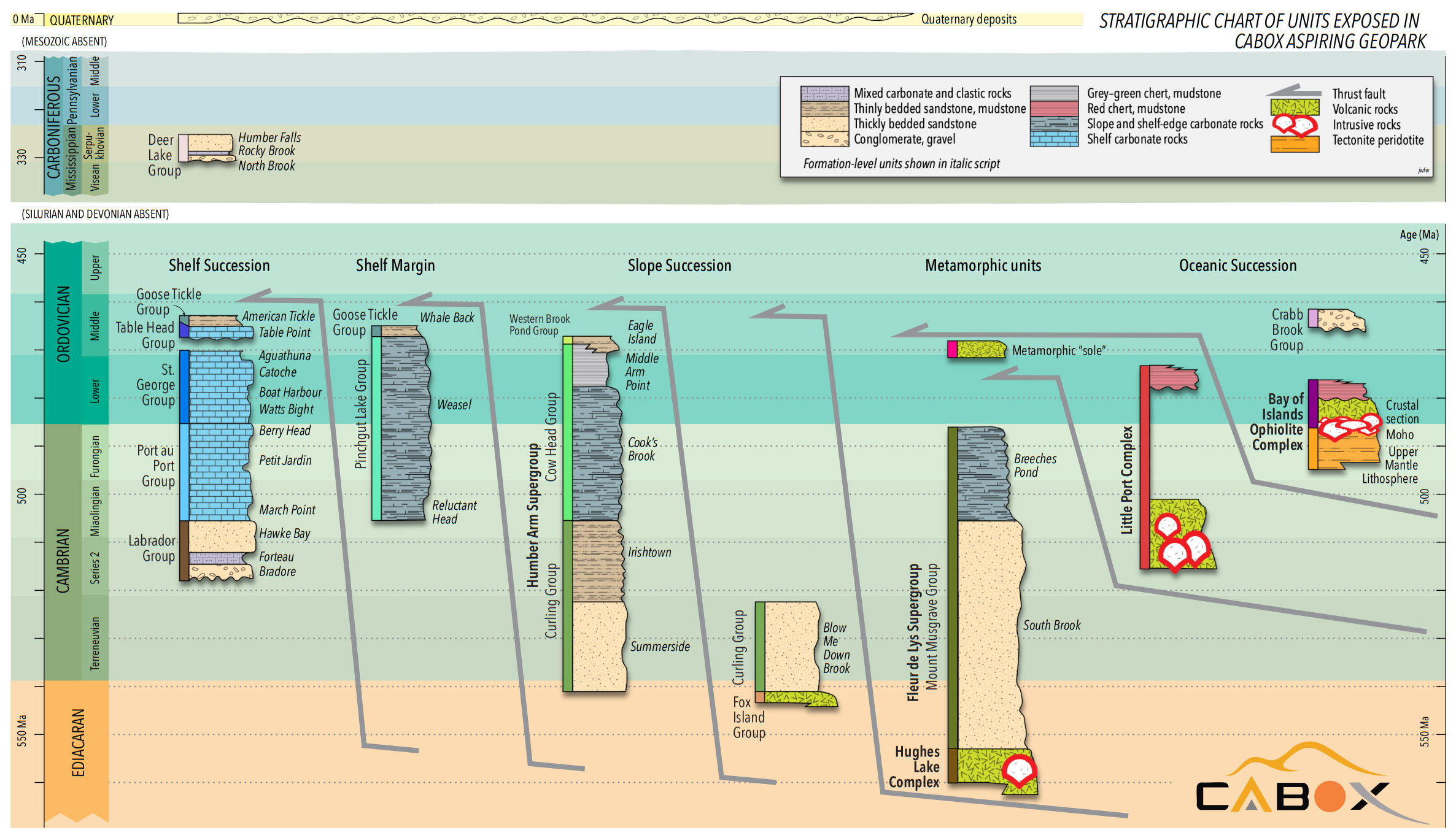
The geological units surrounding Bay of Islands and Bonne Bay South (which comprise Cabox Geopark) provide a potent record of the formation and demise of the Iapetus Ocean (pre-cursor of the Atlantic Ocean) and building and erosion of the Appalachian Mountains. Subsequent glaciation and climate change during the Quaternary Period shaped the landscape into what we see today.
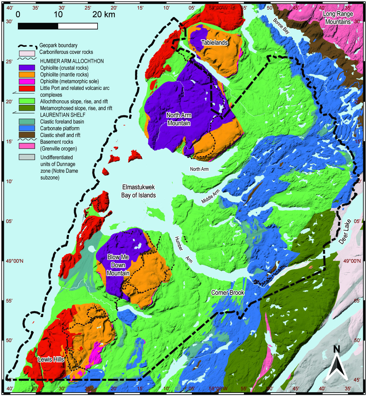
Rocks of these units belong to four main geological assemblages:
Shelf Succession and accompanying shelf margin
Slope Succession and likely metamorphosed equivalents
Oceanic Successions, such as Oceanic Crust and Upper Mantle
Quaternary Features, including glaciation and isostatic rebound
The shelf succession formed during the Cambrian to Ordovician periods on the edge of the ancient continent Laurentia, the precursor to North America, that existed before the Appalachian orogen was built. These rocks are primarily sedimentary and were deposited in shallow water on the continental shelf surrounding Laurentia. The earliest units (Labrador Group) are mainly clastic, but because Laurentia lay close to the Equator from mid Cambrian time onwards, shallow-marine organisms were able to produce thick carbonate deposits (Port au Port and St. George Groups) keeping pace with subsidence. Fossils of various reef and mound-building organisms are locally preserved, alongside trilobites and other shelly fossils.
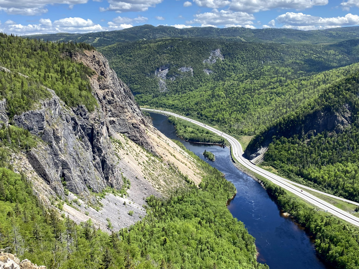
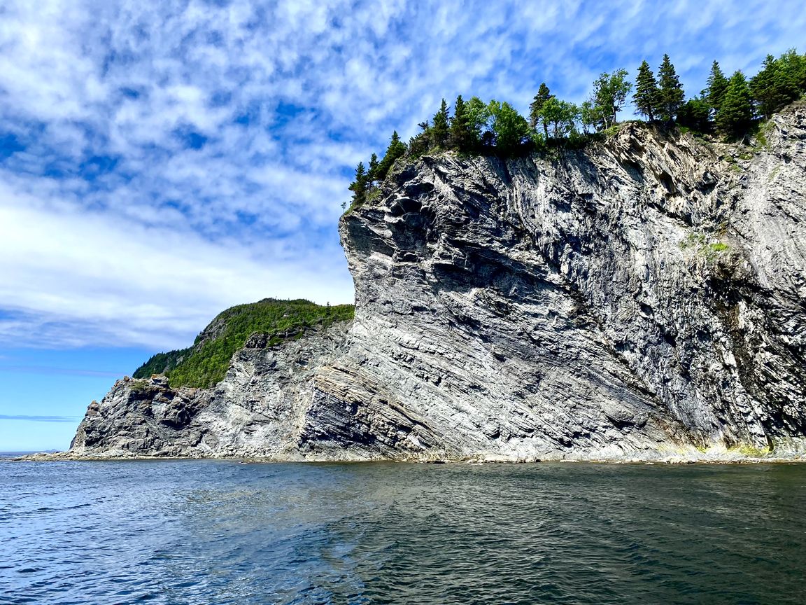
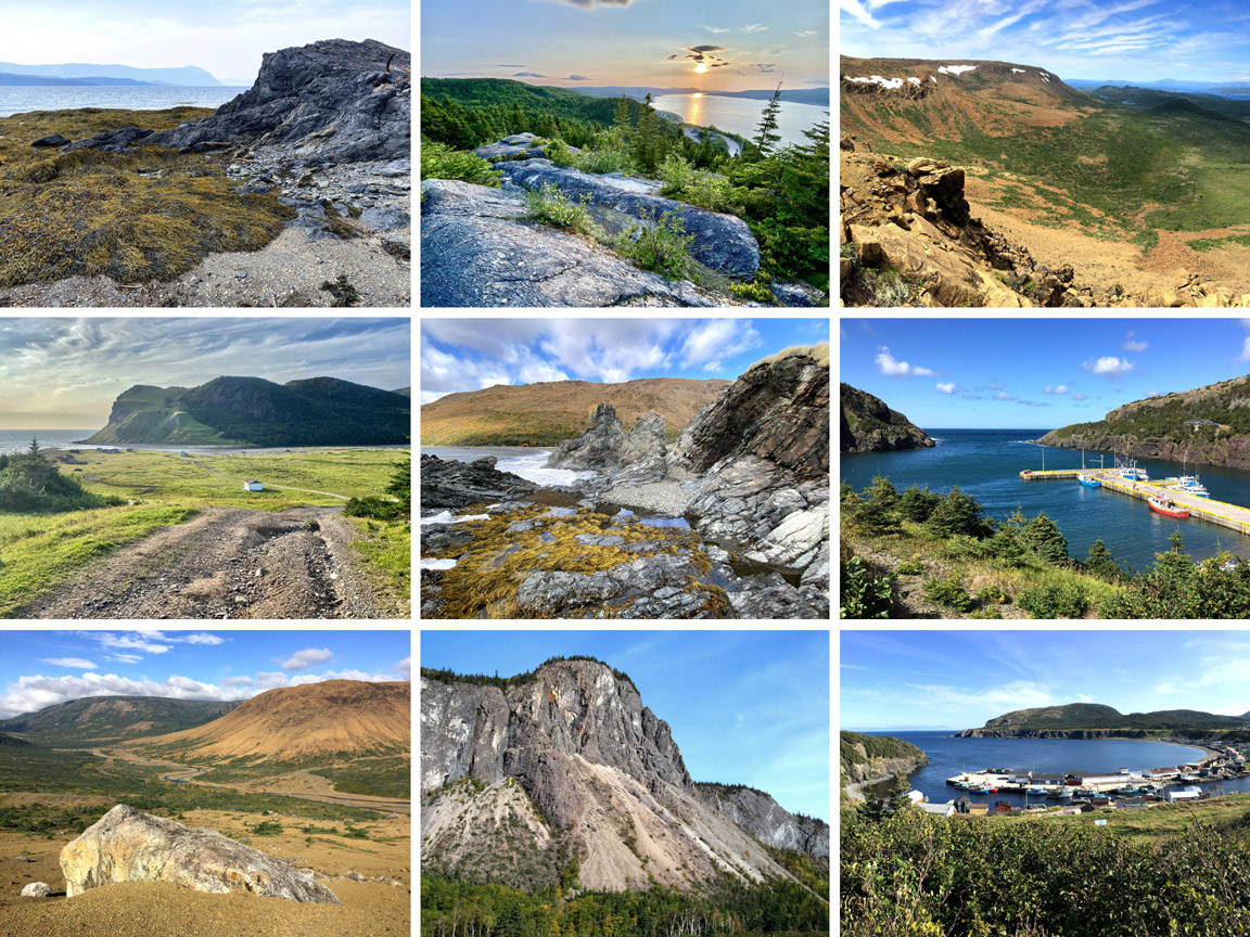
A second group of rocks formed in deeper water on the continental slope and rise that surrounded Laurentia. Pillow lava is preserved at the base of this succession, while overlying sections include abundant mudstone, interbedded turbidite layers, and structureless cobble to boulder conglomerates deposited by sediment gravity flow. Many outcrops have a striped appearance that make them distinguishable from the more massive shelf succession. The slope succession rocks were intensely deformed during several orogenic episodes during the building of the Appalachian Mountains, providing spectacular examples of geologic structures such as folds, faults and fabrics.
The third group of rocks consists of oceanic igneous and metamorphic rocks assigned to two large complexes named for the Bay of Islands and Little Port, both within the Geopark region.
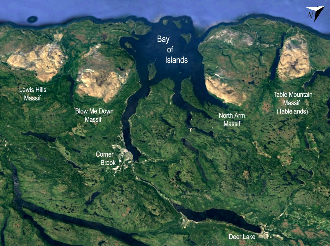
The Bay of Islands Ophiolite Complex preserves oceanic crust and upper mantle and was influential in the early history of plate tectonics by providing a cross-section of oceanic lithosphere unobservable beneath modern oceans. Modern interpretations suggest that it formed approximately 488 million years ago during the subduction process that led to the closure of the Iapetus Ocean. The four rugged massifs of the BOI Complex are Lewis Hills, Blow Me Down Mountains, North Arm Hills/Gregory Mountains and Tablelands in Gros Morne National Park. They contain examples of pillow basalt from the ocean floor, gabbro from oceanic crust, and peridotite from Earth’s upper mantle.
The Little Port Complex forms the outer islands and headlands of the Bay of Islands and adjacent coastline of the Gulf of St. Lawrence. It consists of igneous and sedimentary rocks that more clearly formed in arc environments above the subduction zones that closed the Iapetus Ocean, starting in Cambrian time around 514 million years ago, well before the Bay of Islands Complex was formed. The rocks of the Little Port Complex also include spectacular pillow lavas which, together with lava breccias and tuffs, record explosive episodes of arc volcanism. Intrusive diorite and granodiorite, formed by hydrous melting and differentiation in the mantle wedge, are also well represented.
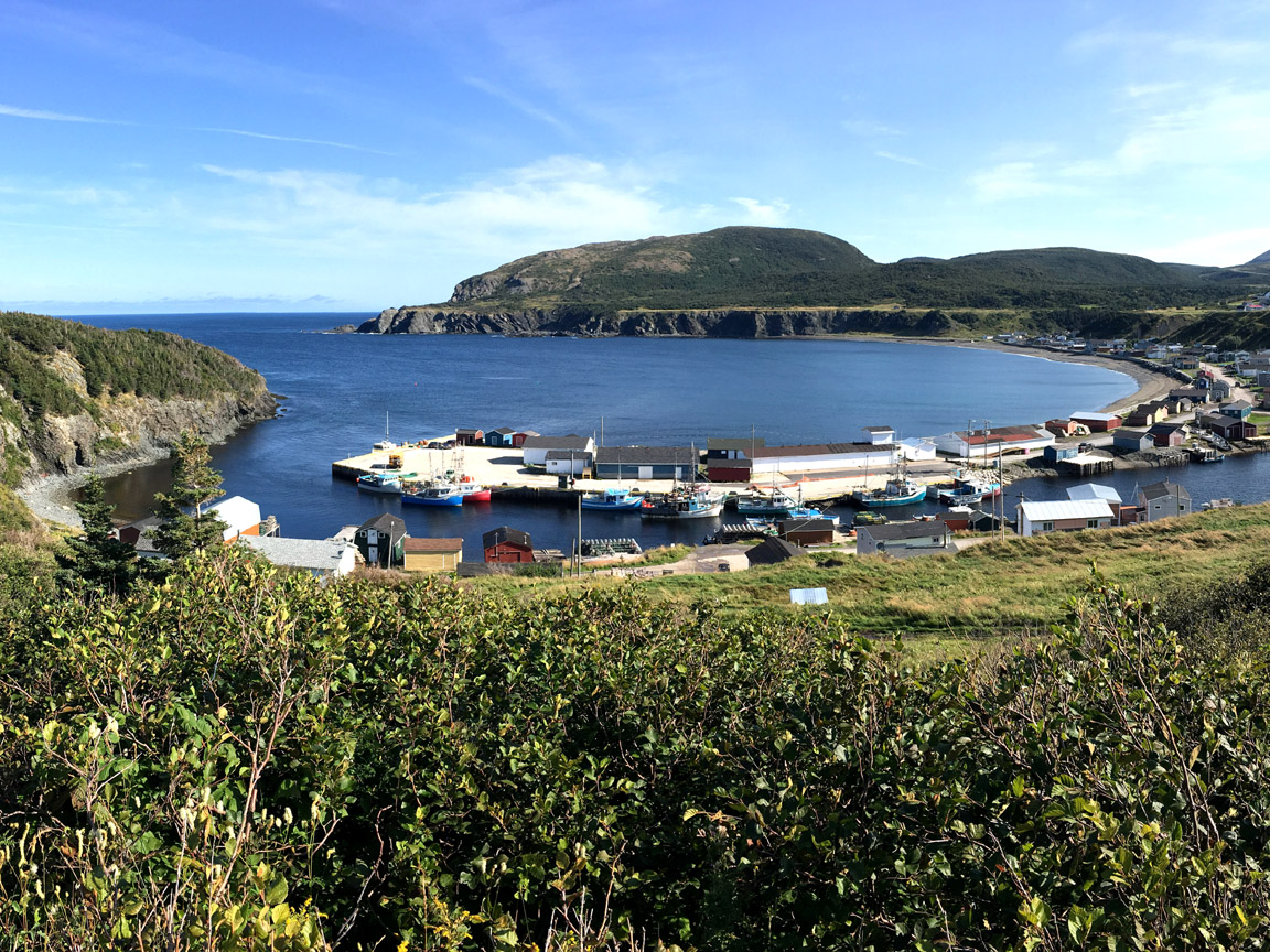
Much of the scenic character of Cabox is the result of Quaternary glaciation and climate change, which produced striking erosional, depositional, and coastal landforms. Several magnificent fjords drain into the Bay of Islands, formed by valley glaciers that flowed from an ice cap over the Island of Newfoundland. The weight of ice depressed the lithosphere, leading to pronounced isostatic rebound during deglaciation following the last glacial maximum approximately 20,000 years ago. Marine terraces abound along the coasts, and most communities are built on such platforms, three to 10 m above present-day sea level. A lower terrace is typically occupied by fishing cabins and brightly coloured fishing dories used by lobster fishers.
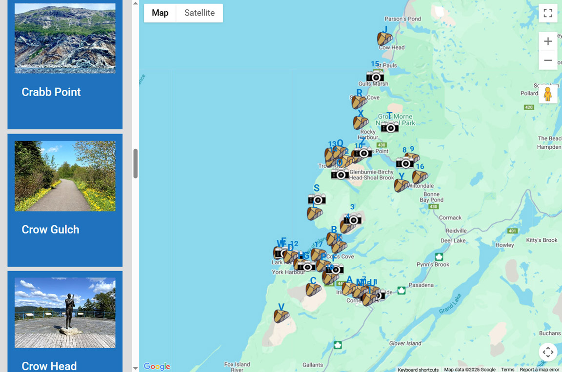
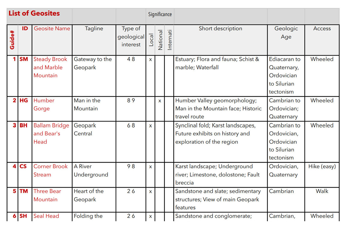
As of 2025, Cabox has identified 32 geological sites of interest, or geosites, which sample one or more of the four main geological units identified above (i.e., shelf succession, slope succession, oceanic successions and quaternary features).