Cabox Presents at GAC-MAC 2026 Annual Meeting

Paul WylezolNews

The Geological Association of Canada (GAC®) and Mineralogical Association of Canada (MAC) returned to St. John’s, NL from May 25th to 28th for their 2026 Joint Annual Meeting. The event, which was held at the St. John’s Convention Centre in the heart of downtown, featured an exciting lineup of symposia, workshops, short courses, special sessions, and a wide range of presentations, including two PowerPoint and one poster presentation by Cabox Aspiring Geopark. It was followed by a series of field trips across Newfoundland, including one of Cabox Aspiring Geopark and Bonne Bay South.

The motto of this year’s meeting, From Shore to Core, reflected the diverse geological heritage and abundant natural resources with which Newfoundland and Labrador is endowed. “Newfoundland and Labrador boasts world-class, diverse geology featuring 3.8-billion-year-old rocks, ancient Appalachian mountain remnants, and some of the earliest evidence of complex life.”
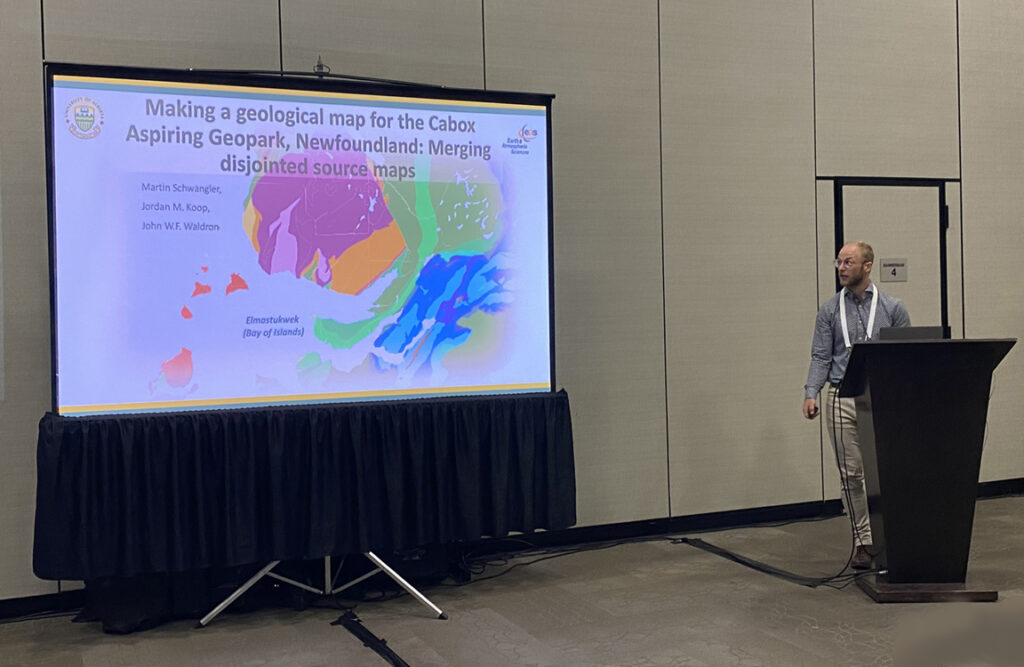
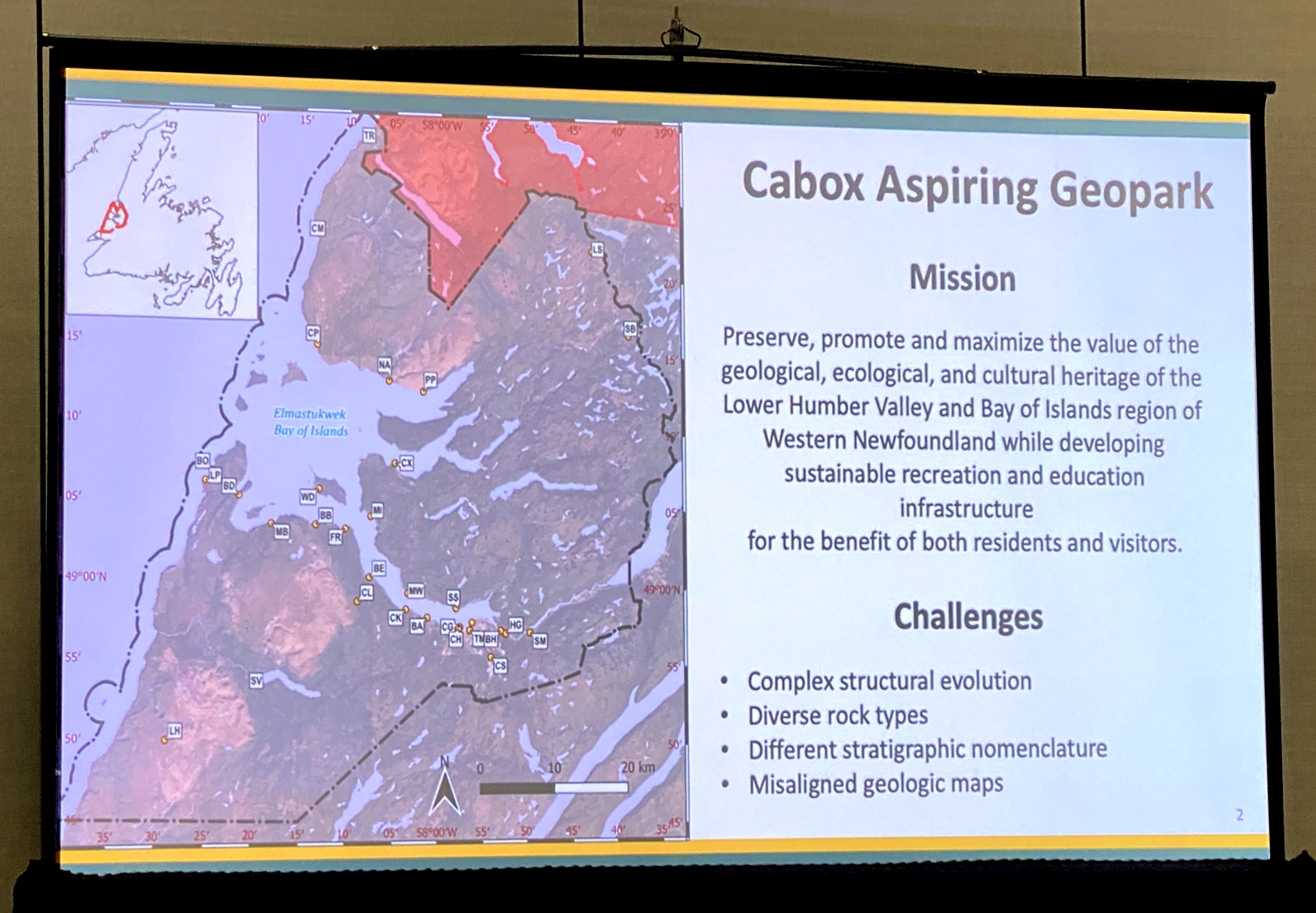
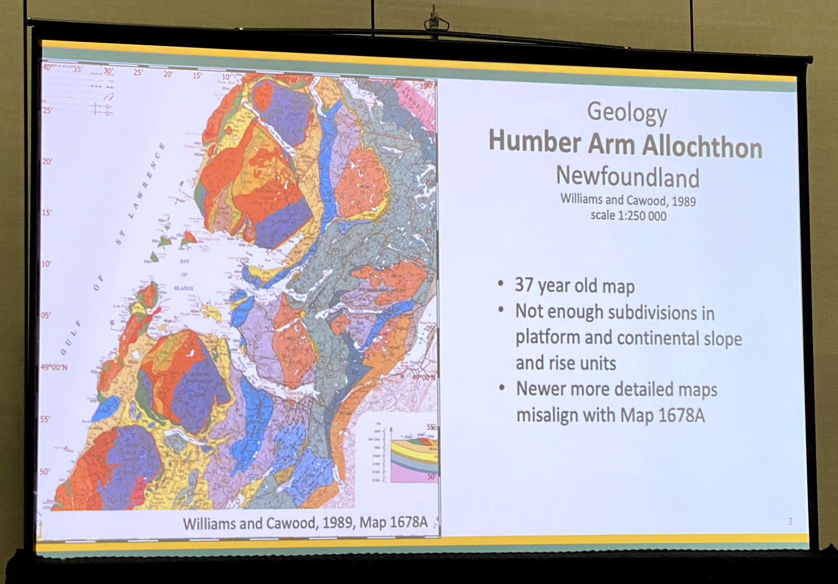
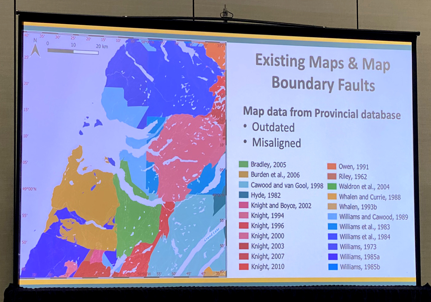
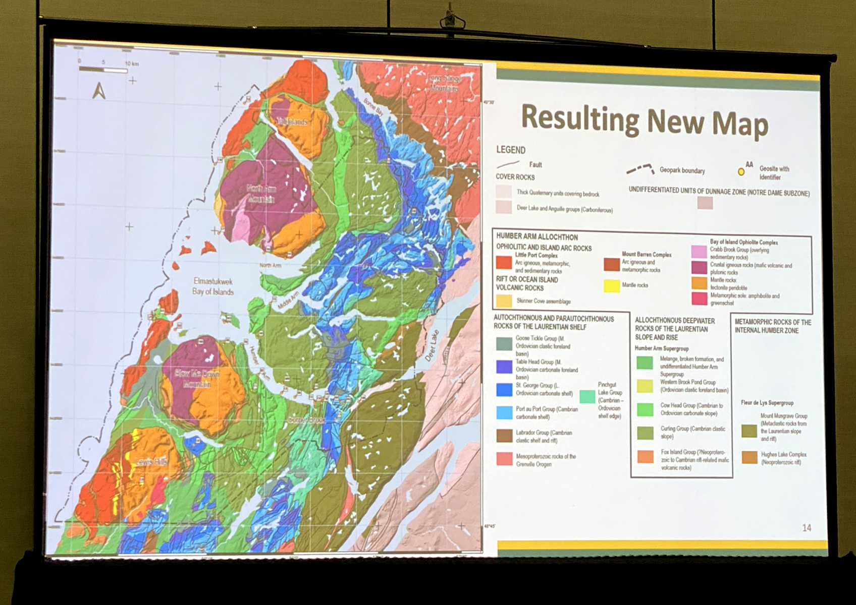
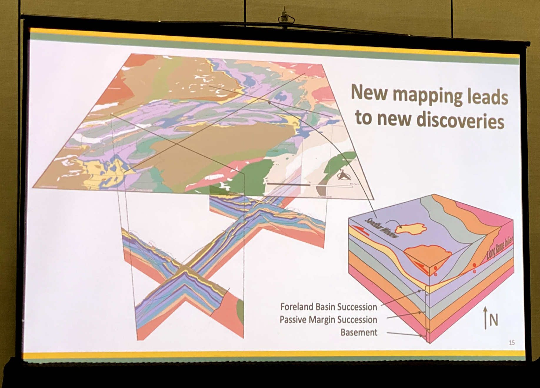
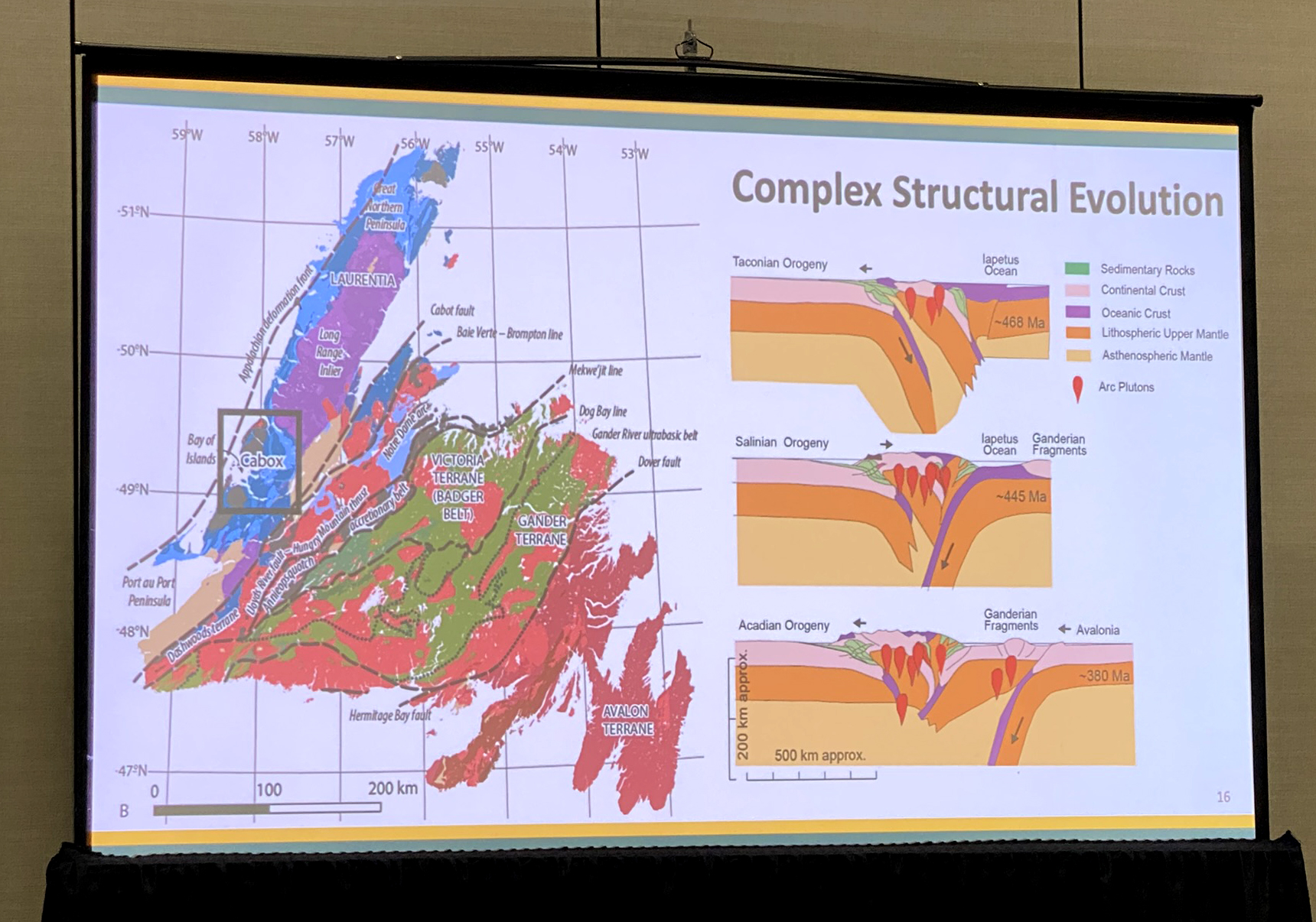
Cabox’s first PowerPoint presentation was given by Martin Schwangler, a former University of Alberta student of Cabox geological adviser Dr. John Waldron.  Entitled Making a geological map for the Cabox Aspiring Geopark, Newfoundland: Merging disjointed source maps, it was created with the help of fellow student Jordan Koop and Dr. Waldron.

Presentation Abstract

“Public outreach initiatives such as the Cabox Geopark are essential in sharing geological information with interested members of the public, and the Bay of Islands area of western Newfoundland contains exceptional rocks which have aided in the development of geologic thought. Early reconnaissance and biostratigraphic studies noted the complexity in the area and initially described ophiolitic rocks as intrusive complexes. After the theory of plate tectonics was developed, researchers recognized the allochthonous nature of the ophiolite and many of the sedimentary rocks. Subsequent stratigraphic, sedimentological and structural studies yielded a modern understanding of the formation of the Appalachian Orogen. Multiple projects created a patchwork of geologic maps using different stratigraphic schemes, producing challenges for public outreach. In addition, new mapping supported by the Cabox Aspiring Geopark led to the separation of structures generated by three distinct orogenic episodes and the recognition of a tectonic window through sedimentary strata of the Laurentian shelf. To address these challenges, a compilation shapefile containing the geology of the region was updated using GIS (Geographic Information System) software. Boundary issues between different map sources were resolved using geological knowledge, GIS principles and project-specific GIS techniques. The resulting map presents a unified picture of the geology, suitable for use in outreach projects.”

The Geological Association of Canada (GAC ®) is a national multidisciplinary geoscience organization. Its academic, industrial, and government members come from all areas of Earth Science. The Association promotes and offers opportunities for the discussion and dissemination of geological knowledge. The GAC® makes significant contributions to the promotion and development of the geological sciences in Canada through publications, awards, conferences, meetings, and exhibitions. It’s journal, Geosciences Canada, welcomes technical papers of broad interest.

To Be continued ….