Intro
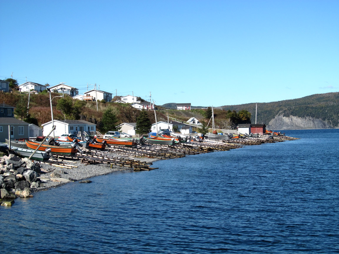
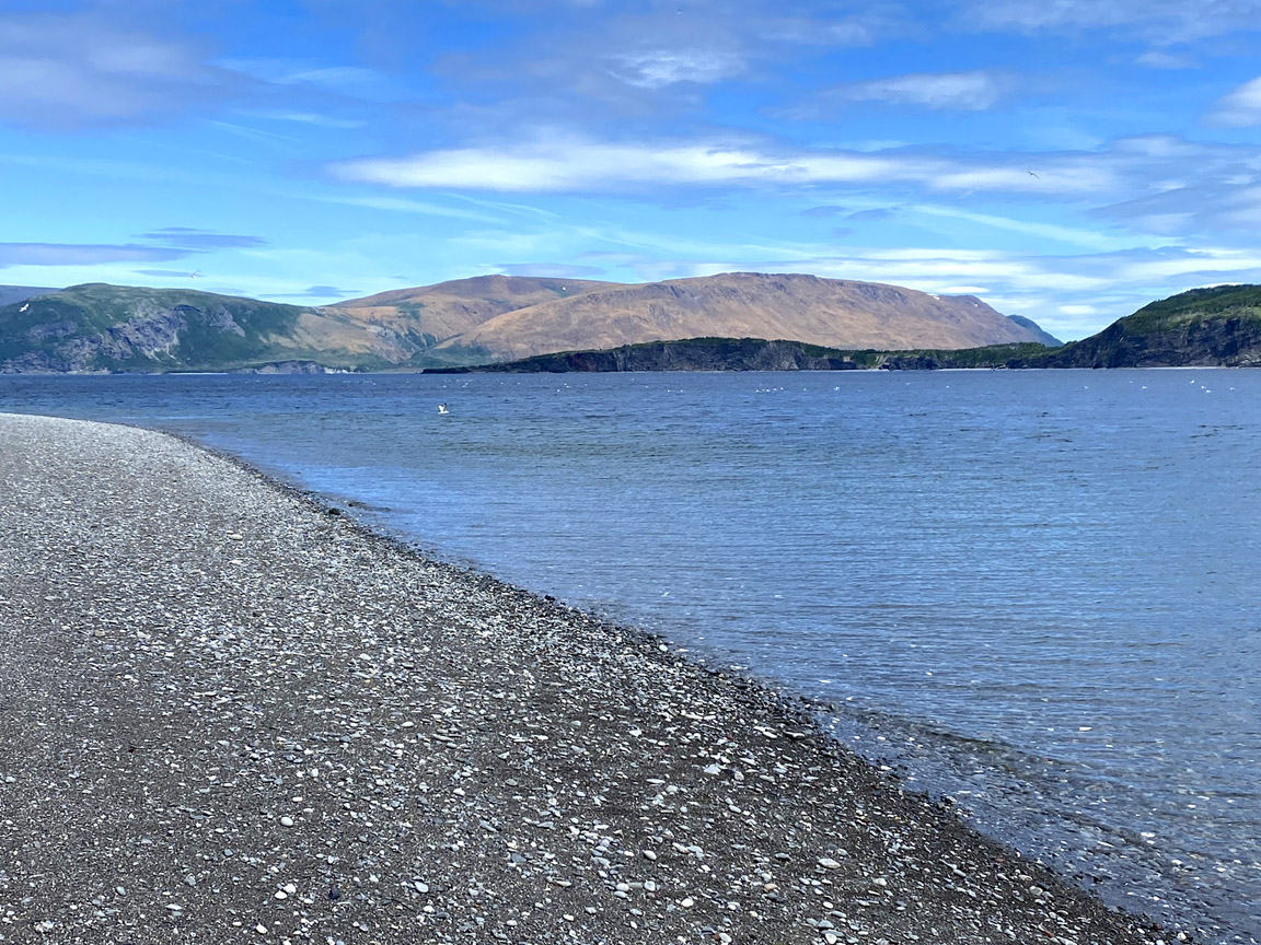
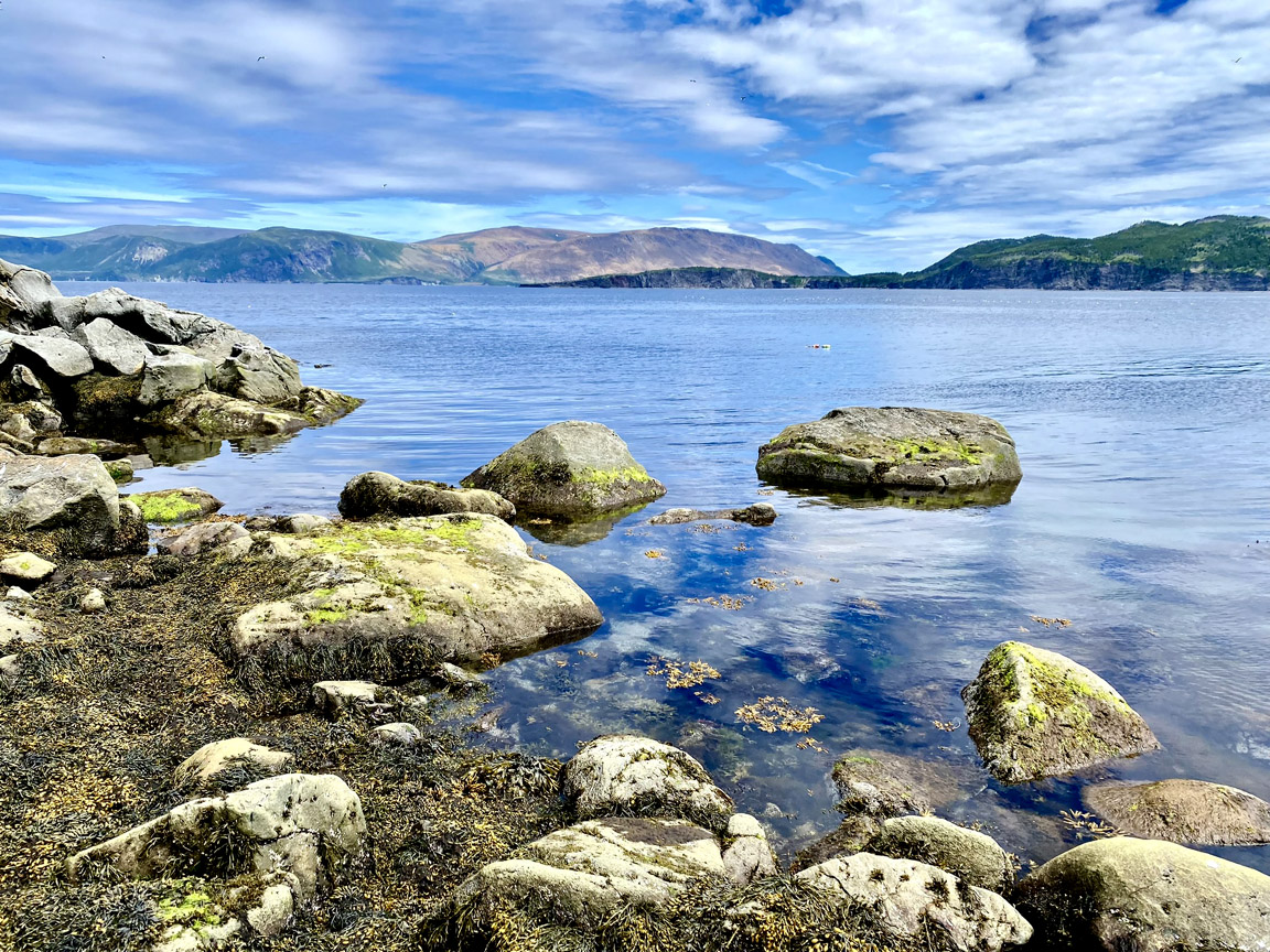
Cox’s Cove is one of the largest communities in the Bay of Islands and a centre for the local fishing industry. Located on the south shore of Middle Arm at the end of Route 440, its harbour provides boat access to more remote parts of the bay, including Goose Arm, Penguin Arm and North Arm. Like the other arms of the bay, Middle Arm is an example of a fjord, a deep valley carved by glaciers but now filled by the sea. The town lies on raised beaches formed as Earth’s lithosphere rebounded upward between 13,000 and 8,000 years ago following the retreat of glaciers.
Geological Features
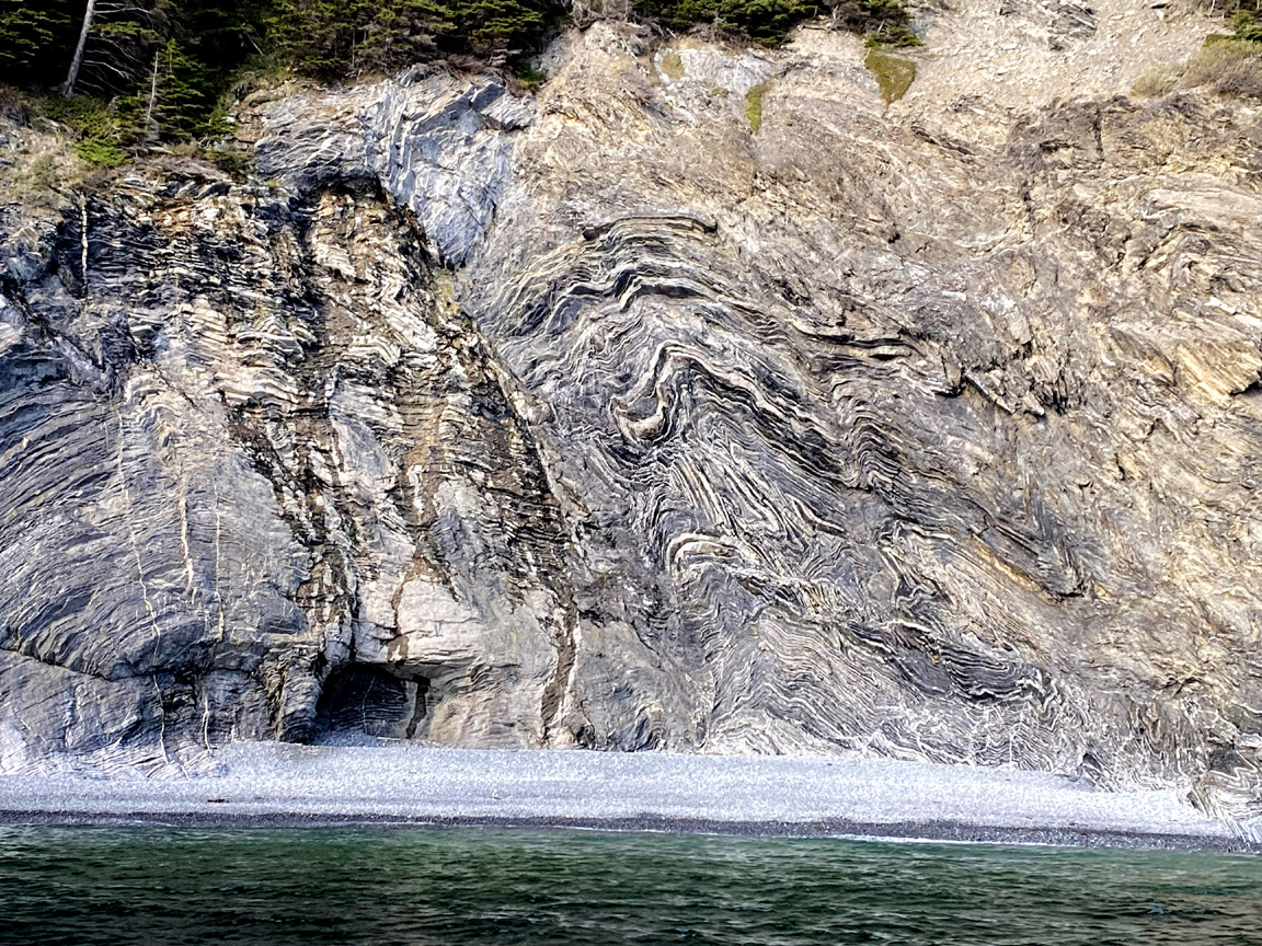
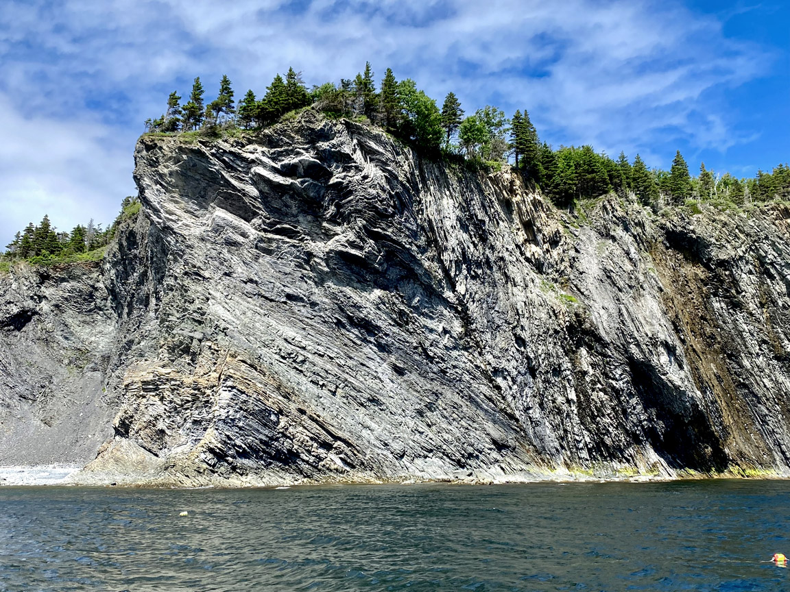
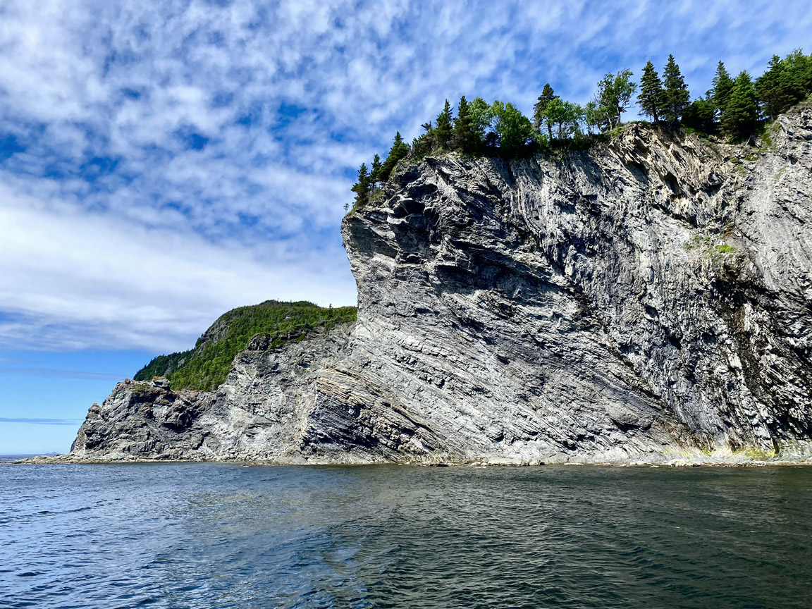
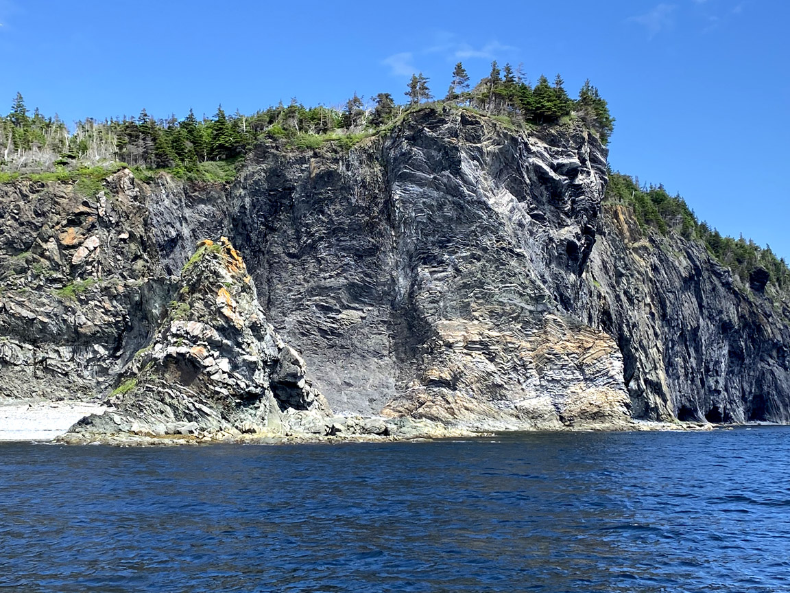
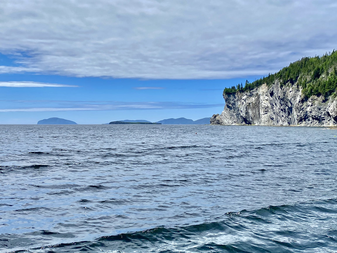
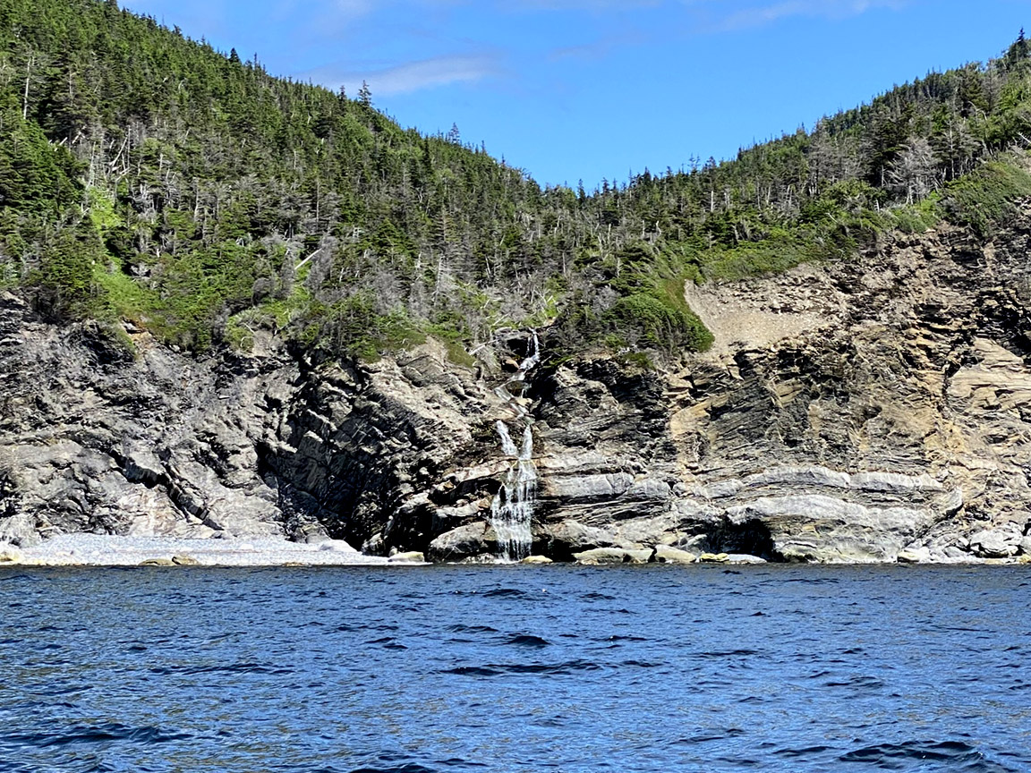
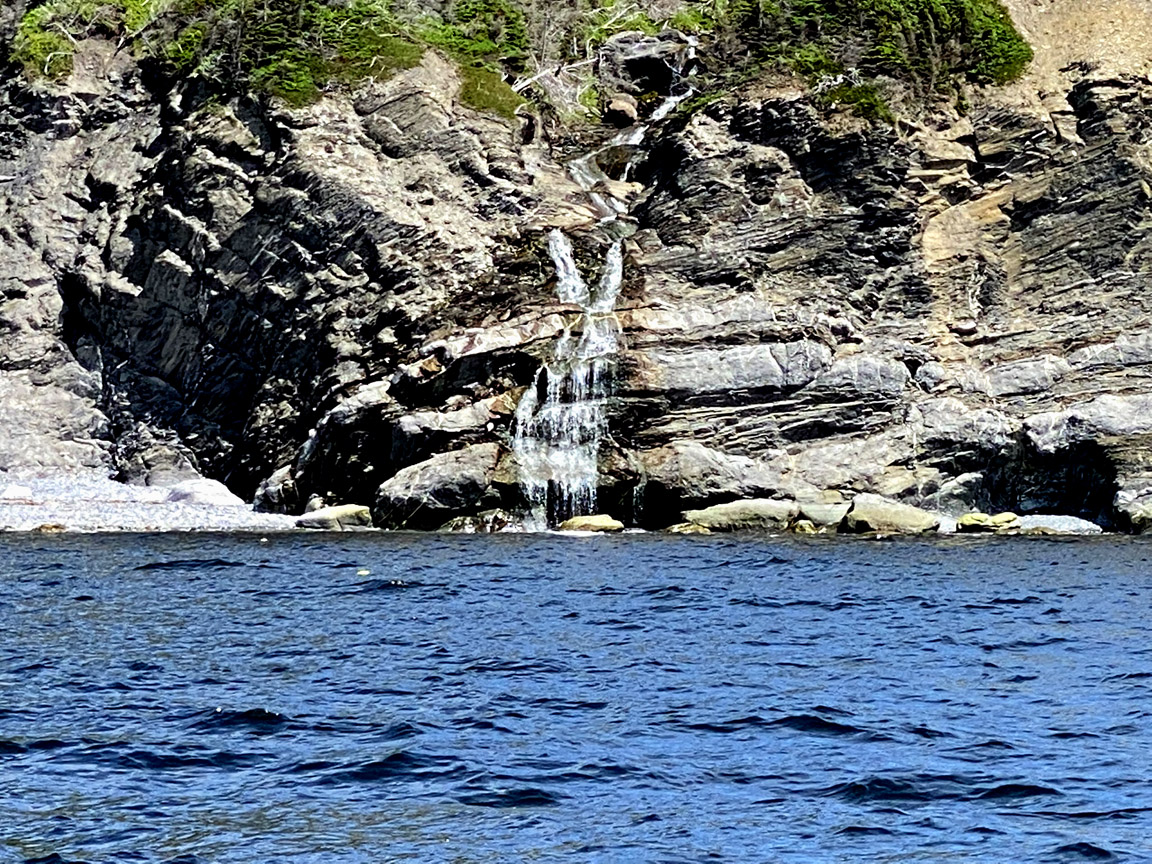
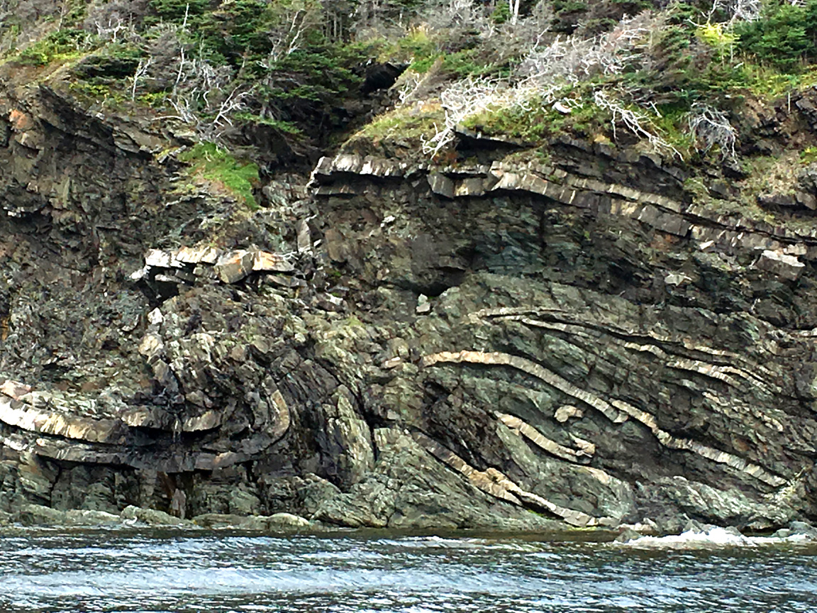
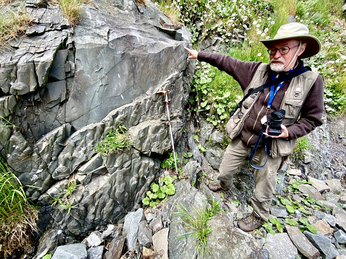
Black Beach (49.12944N / 58.08312W)
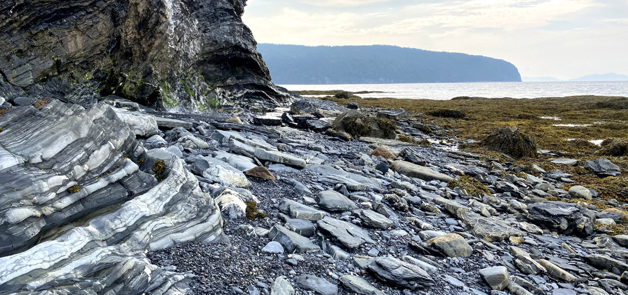
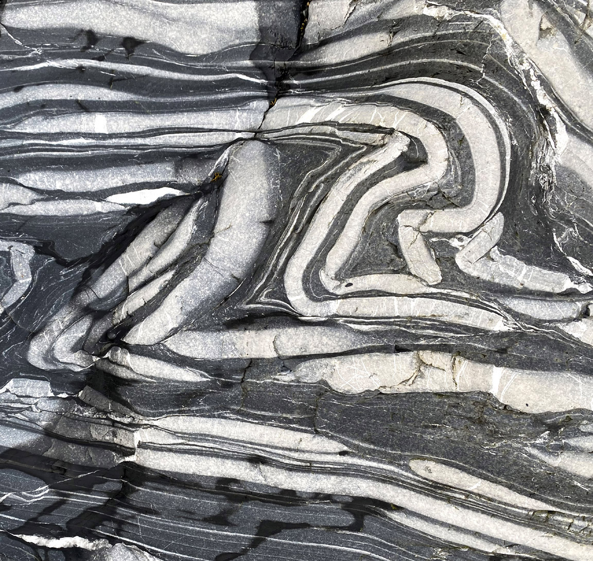
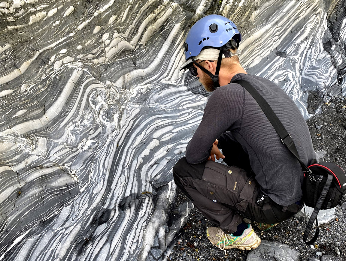
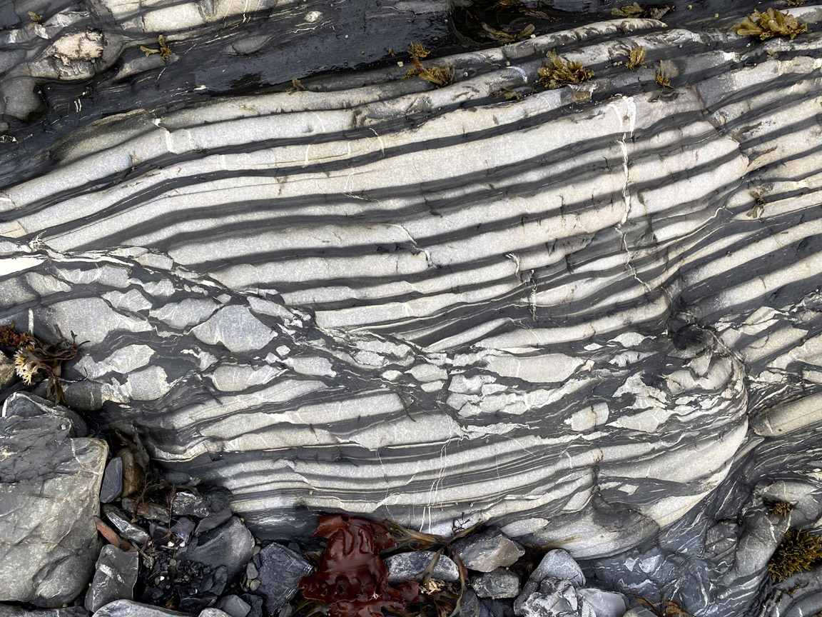
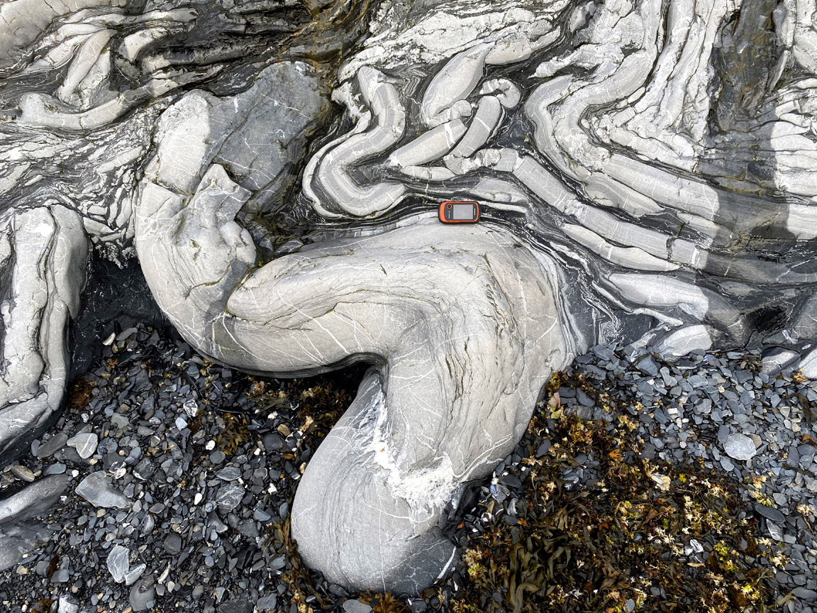
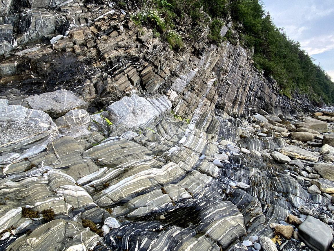
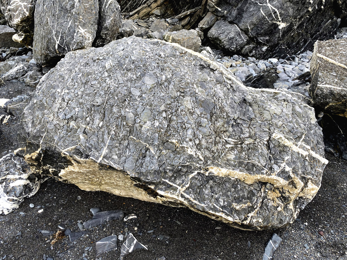
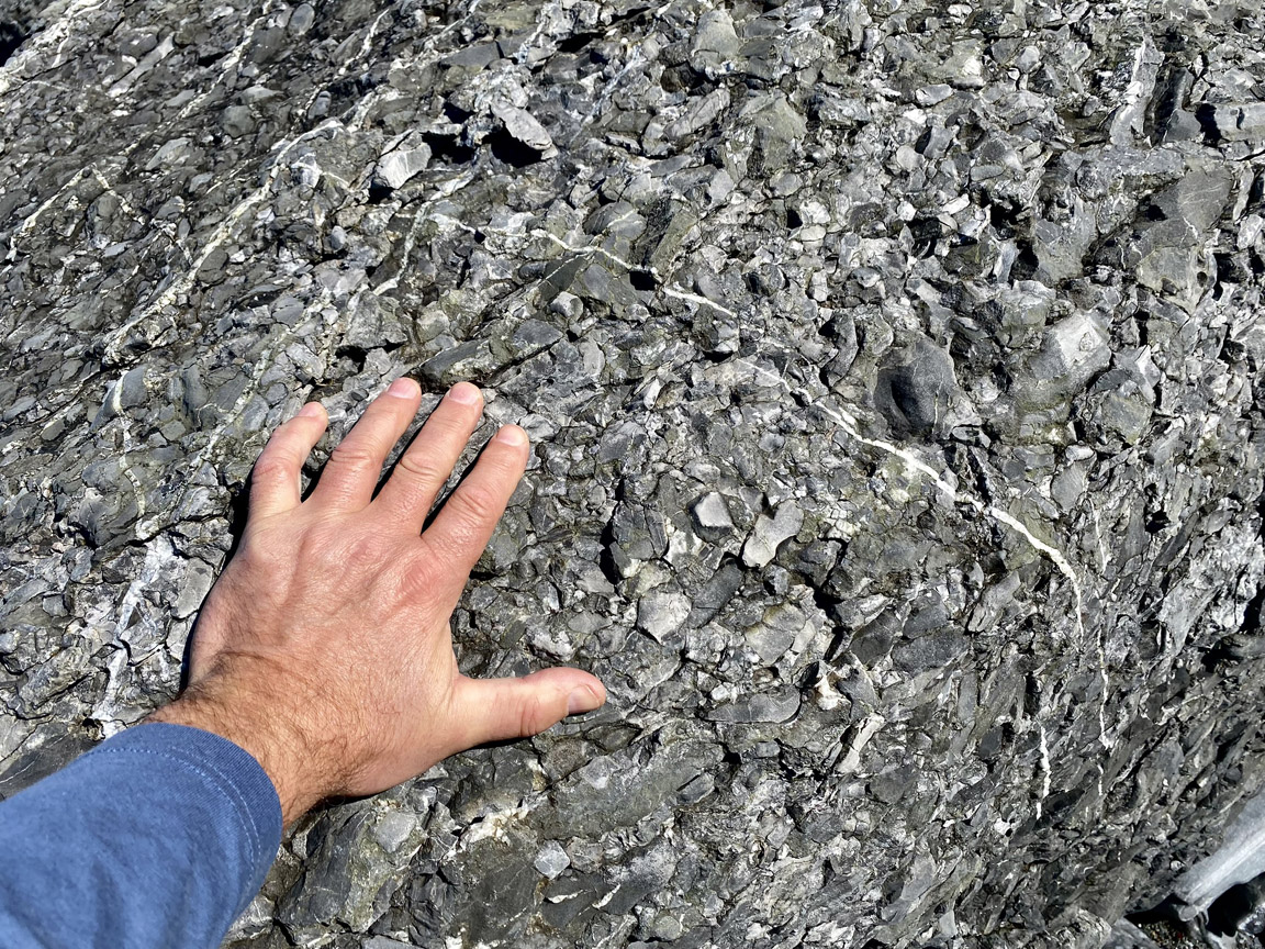
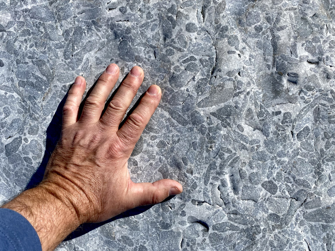
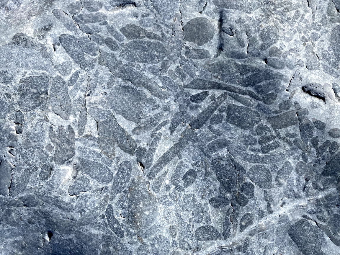
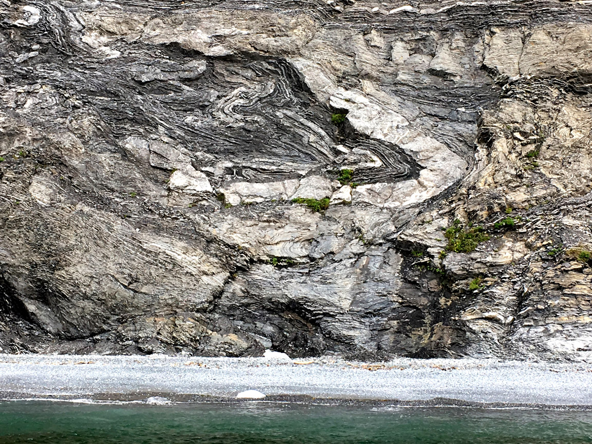
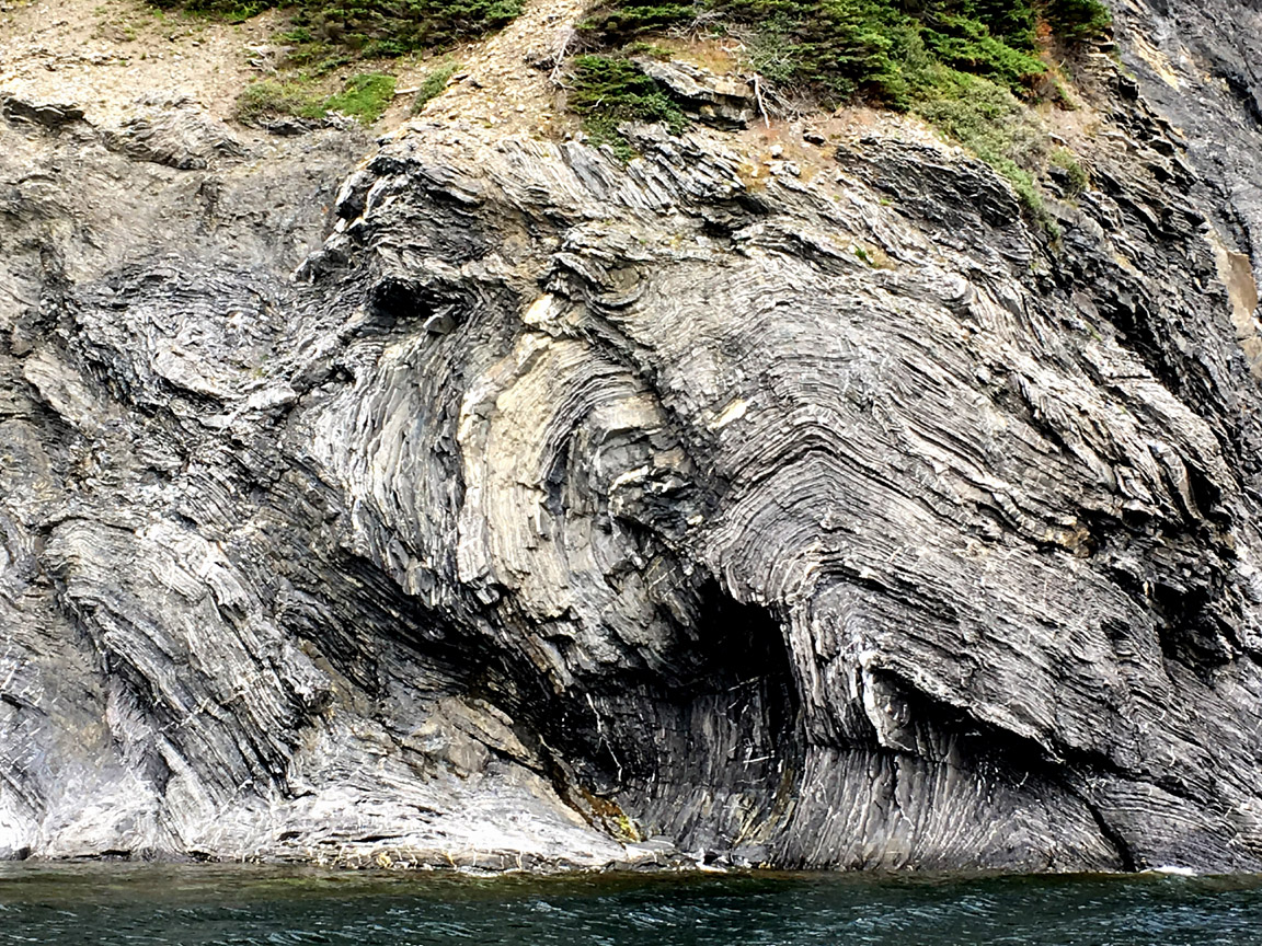
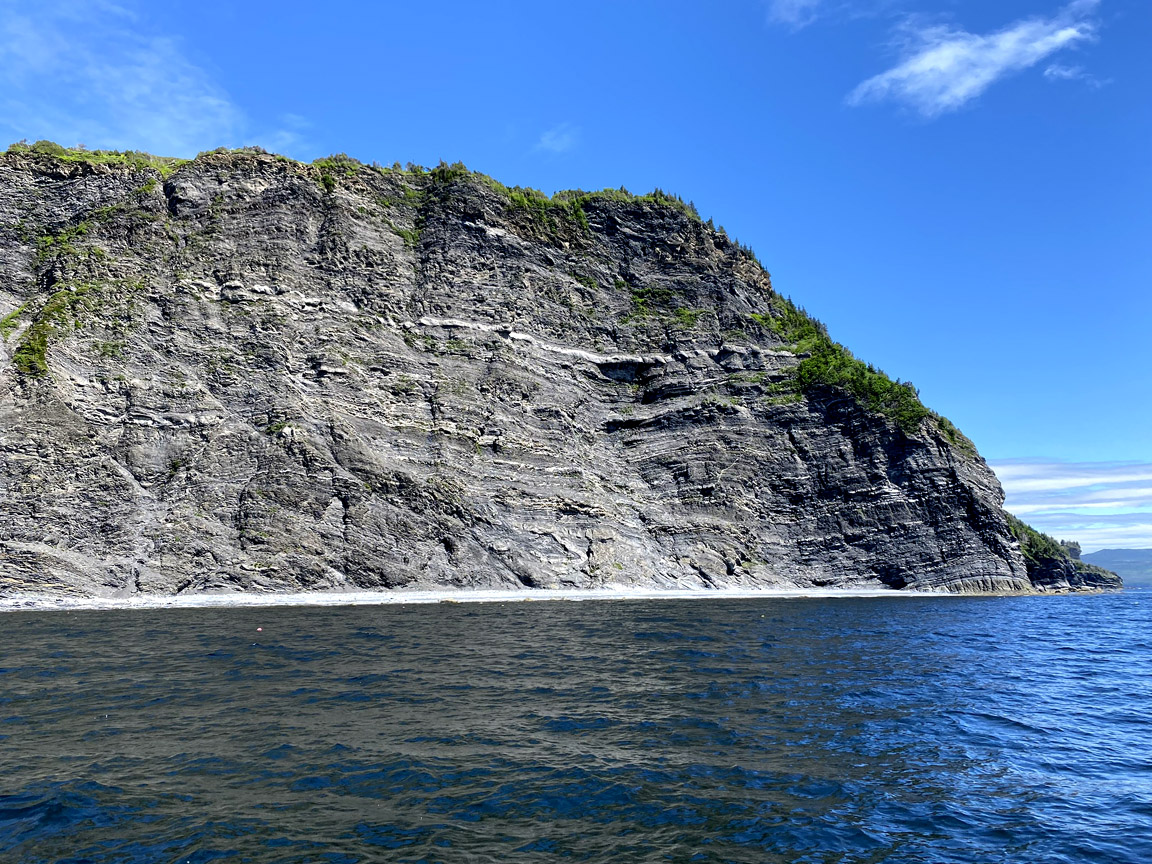
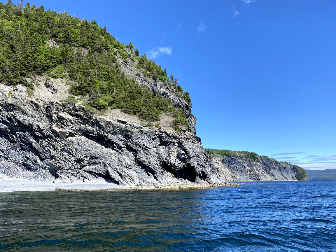
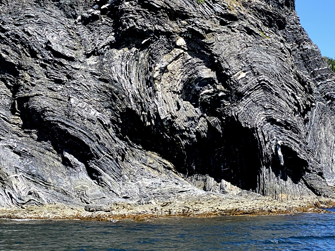
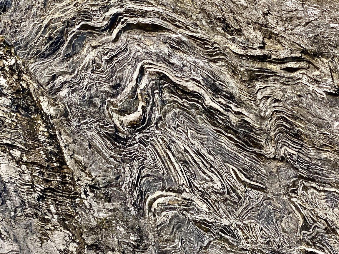
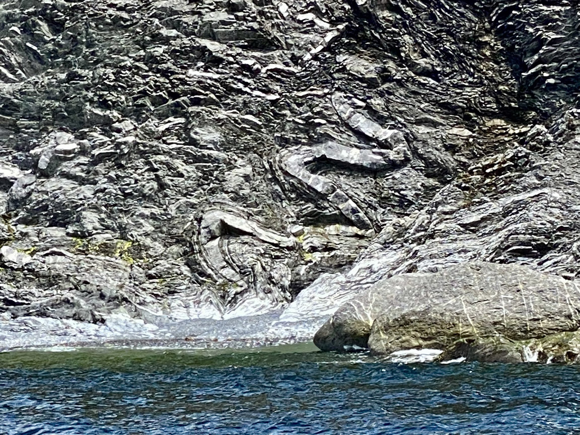
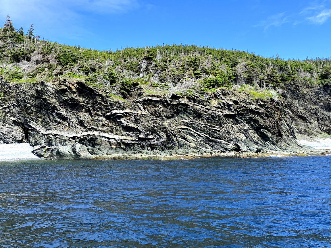
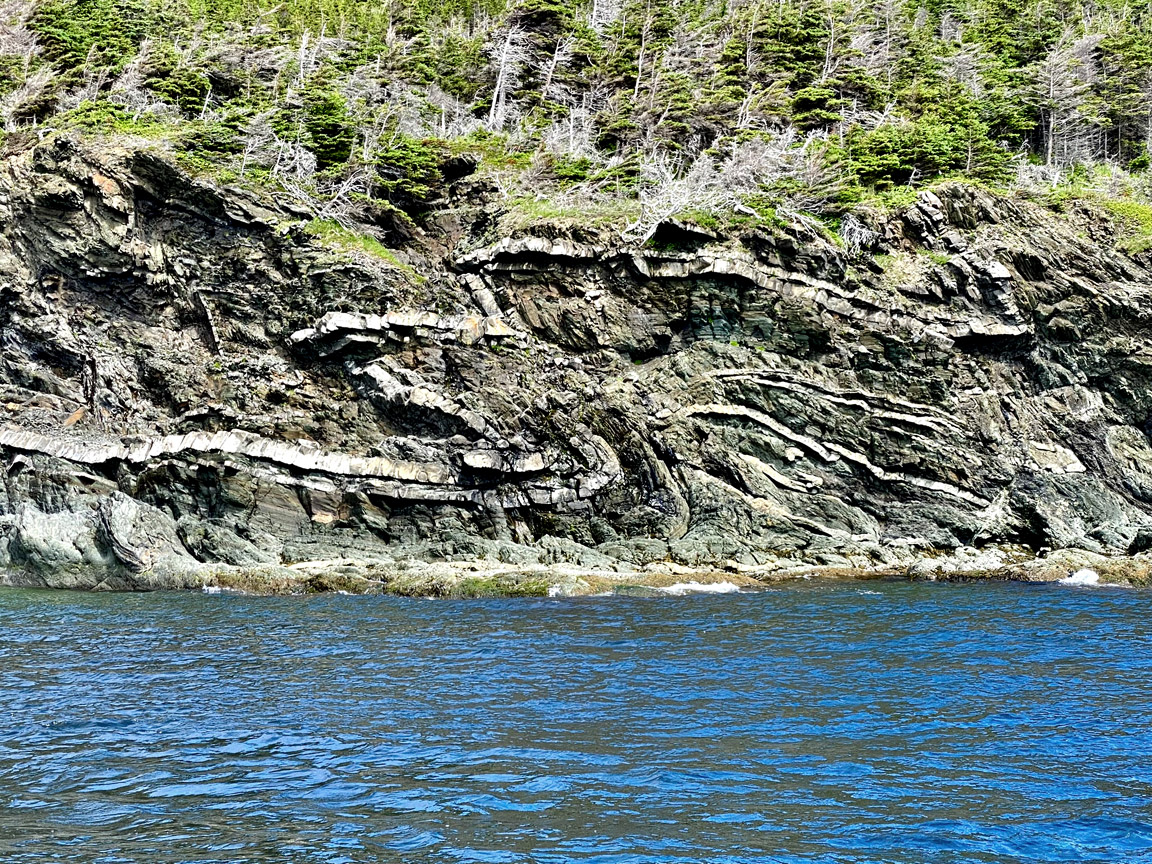
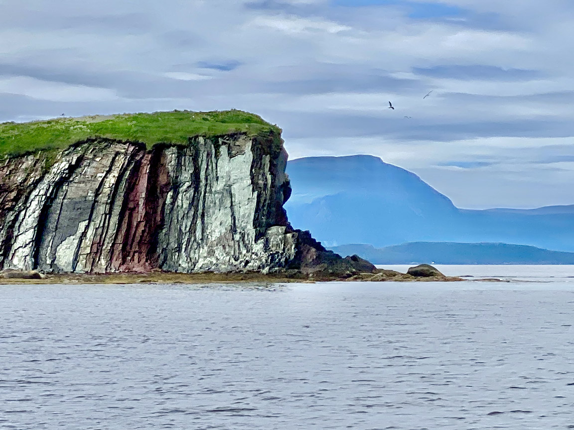
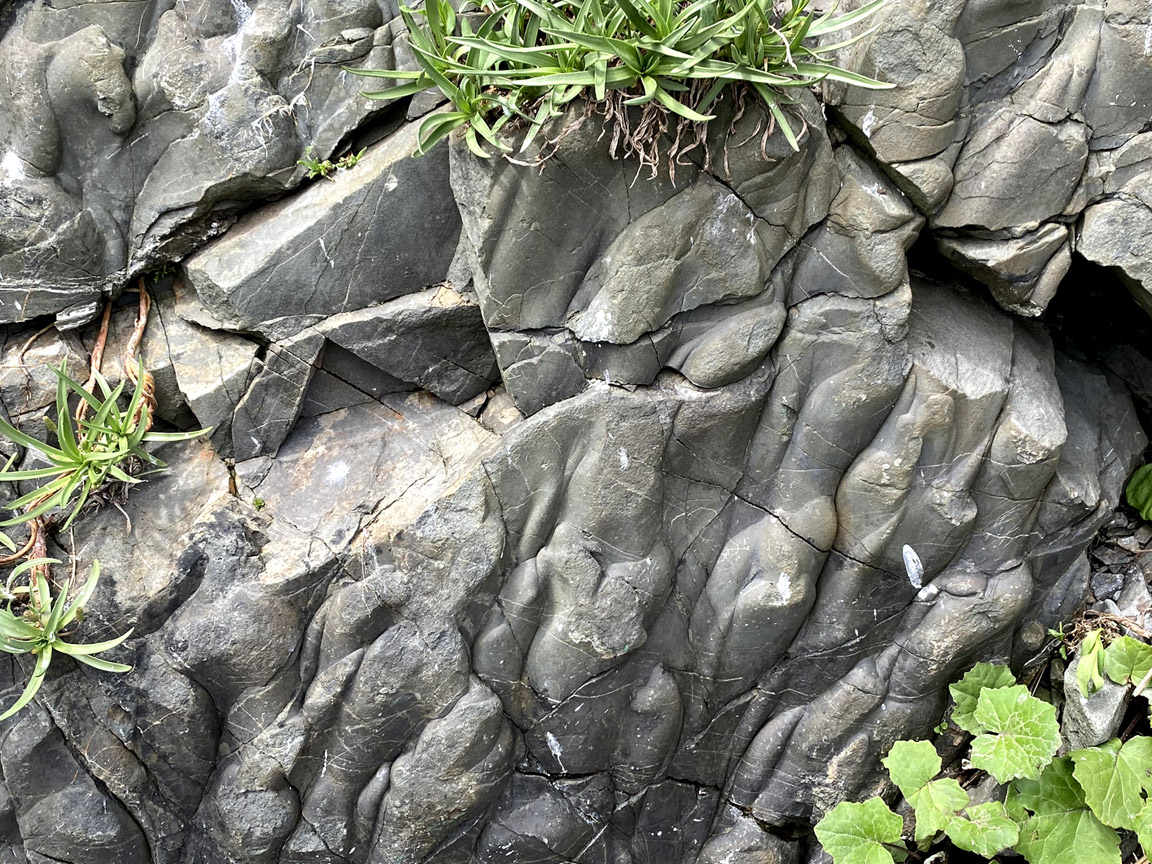
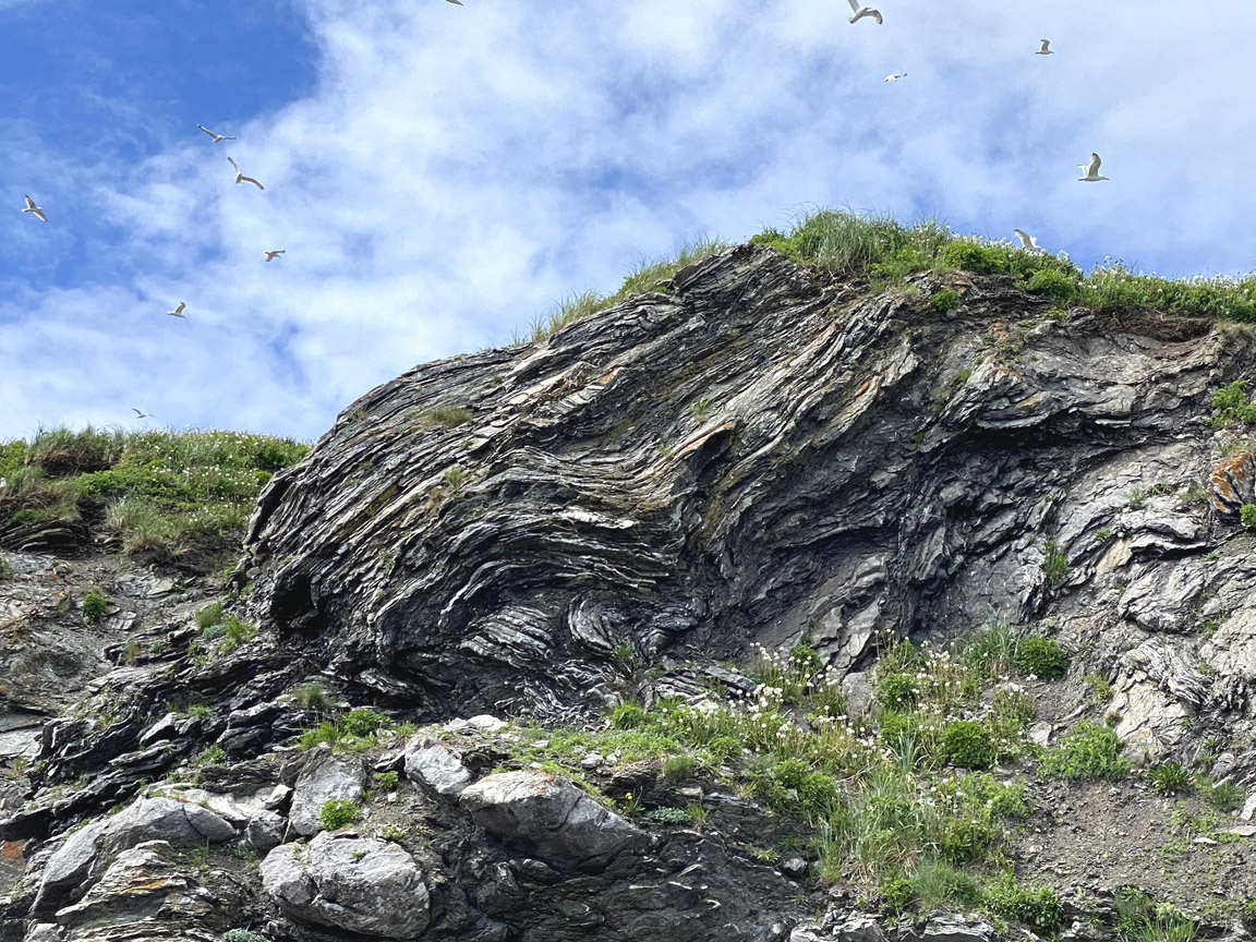
This beach to the west of Cox’s Cove exposes a magnificent section of limestone and mudstone of the Cook’s Brook Formation, deposited in deep water in the later Cambrian and Early Ordovician Periods between about 510 and 480 million years ago. During this time, the eastern margin of ancient North America (Laurentia) featured a warm, shallow, tropical environment teeming with life, leading to the deposition of thick beds of limestone. Farther offshore in deep water, mud full of dark organic matter from decaying microscopic organisms was deposited, with clouds and avalanches of pale limey sediment periodically rushing down the continental slope to deposit layers of limestone. The result was the stripy cliffs seen here, with alternating layers of pale limestone and dark mudstone. From time to time, an avalanche of coarser pebbles would come down the slope and deposit a layer of limestone conglomerate, which is best seen at the far end of the cliff, towards Brakes Cove.
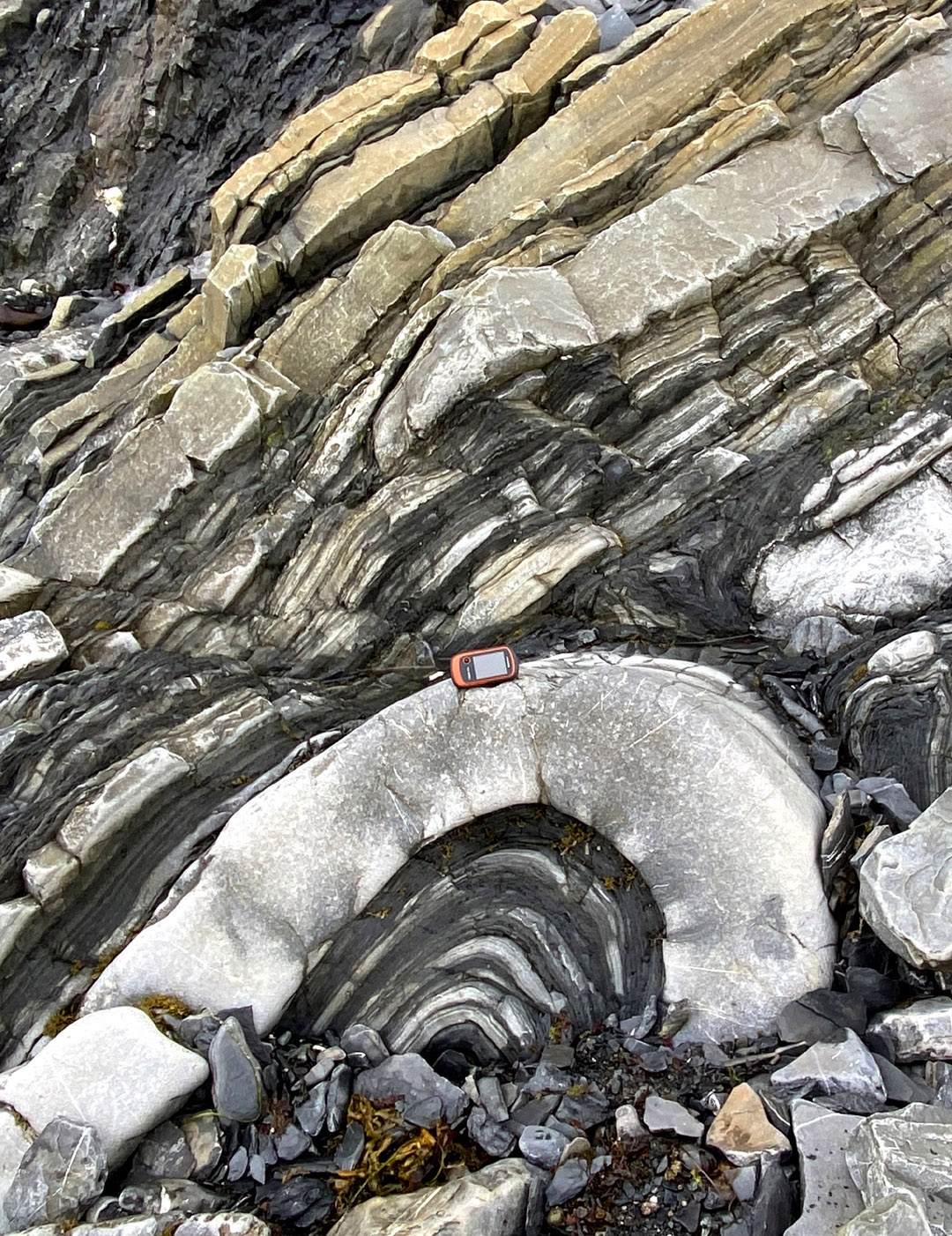
Originally, these deep water sediments were deposited far to the east of Cox’s Cove. Then, about 465 million years ago, the continental margin started to collide with an island arc, which pushed the deep-water rocks up onto the continental shelf above a thrust fault. The layers in the slope rocks were crumpled into folds, some of which can be seen in the rocks on the beach. During deformation of the thicker layers, cracks opened up. Initially the cracks were filled with water carrying dissolved lime, from which calcite crystals were in the cracks to make veins. However, in some cases, oil formed from the decaying organic matter in the mudstone, filled the cracks instead, or as well as water. Later heating converted the oil to solid bitumen, which remains in the cracks to this day.
Access
From Trans-Canada Highway exit 7, take Route 440 west for ~39 km to Cox’s Cove. Turn left at the stop sign in Cox’s Cove and take Main Street to the lookoff at end of the road. Park and descend the stairs to Black Beach. Take care on the stairs and heed any warning notices. Beware of loose rocks falling from the cliffs and slippery rocks from wave action and falling tide. Also, be aware that high tide will prevent access along the beach and may strand visitors to Brakes Cove. Visit the beach at falling or low tide and return to the stairs well before high tide.
Note: There are two high and two low tides every 24 hours and 50 minutes (i.e., the length of a lunar day) and each occurs at approximately the same time around the Bay of Islands.
Tide predictions for the bay can be found at: https://tides.gc.ca/en/stations/02685
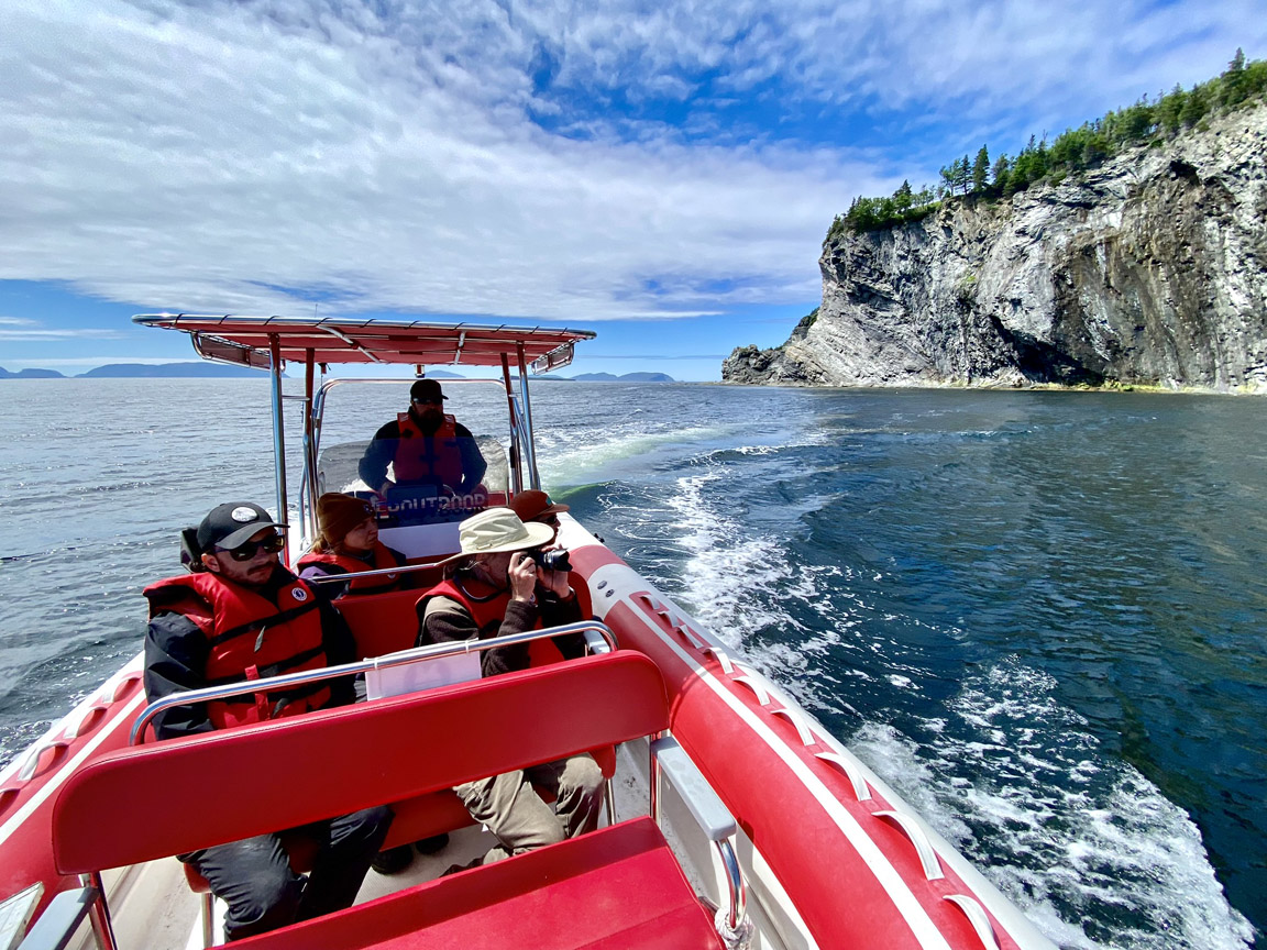
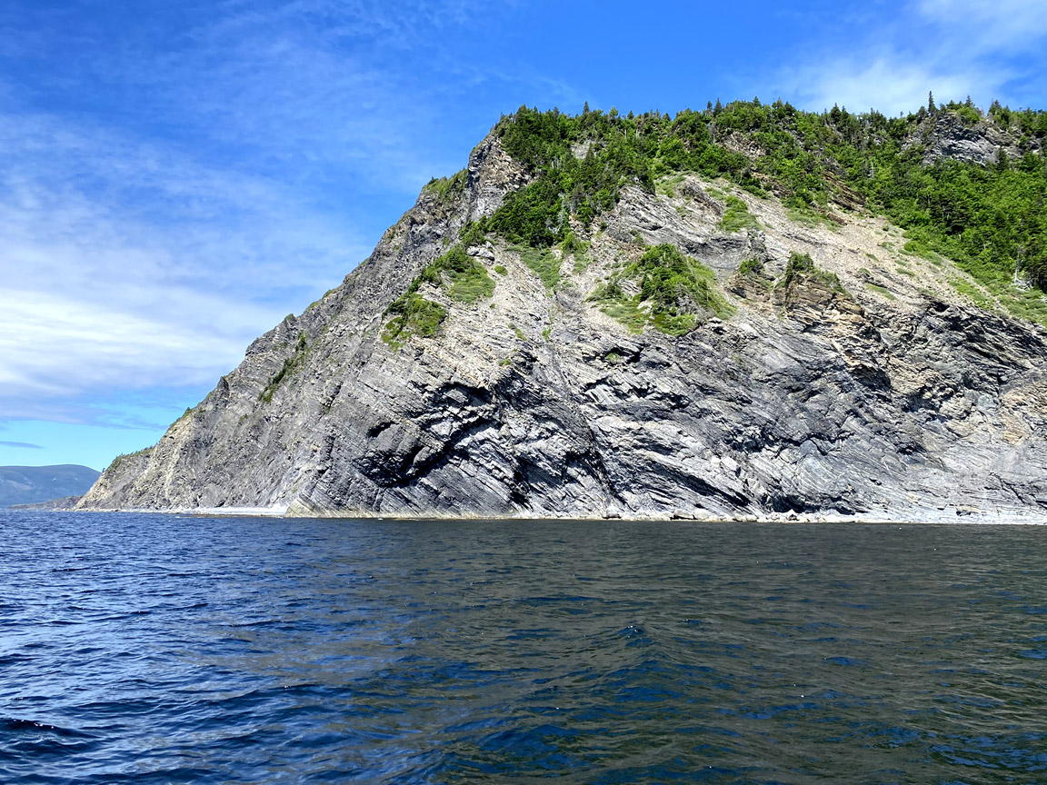
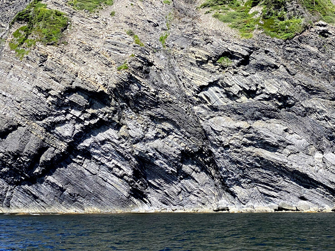
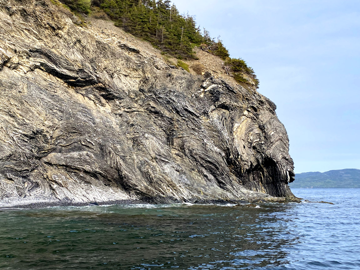
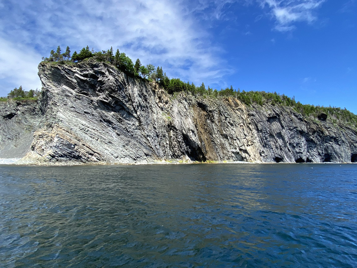
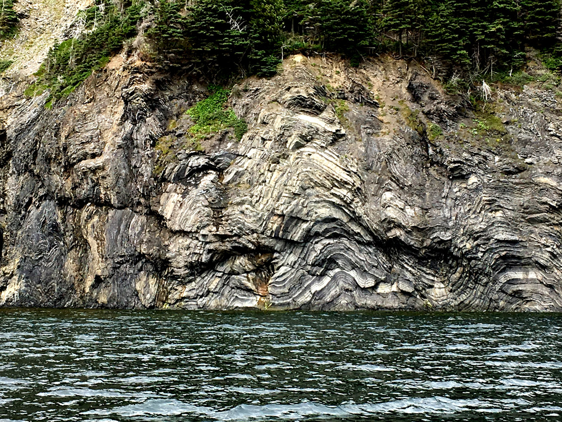
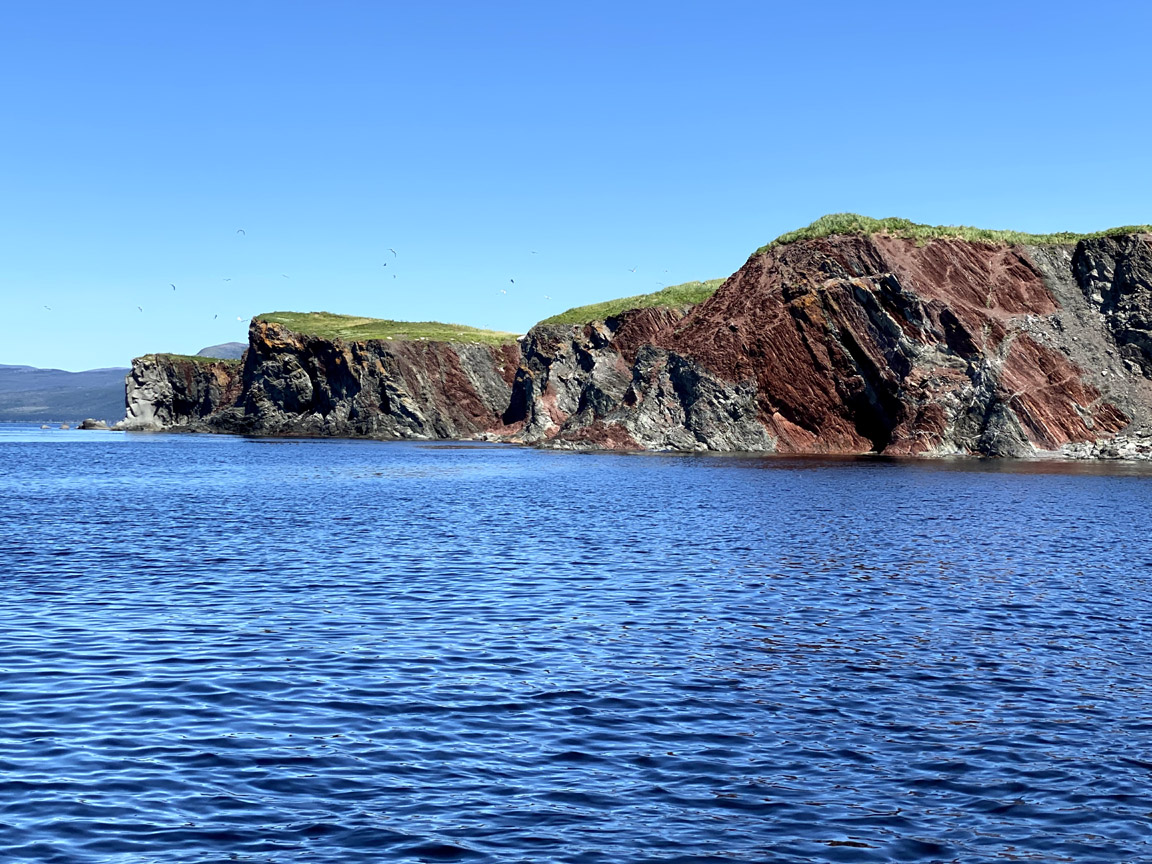
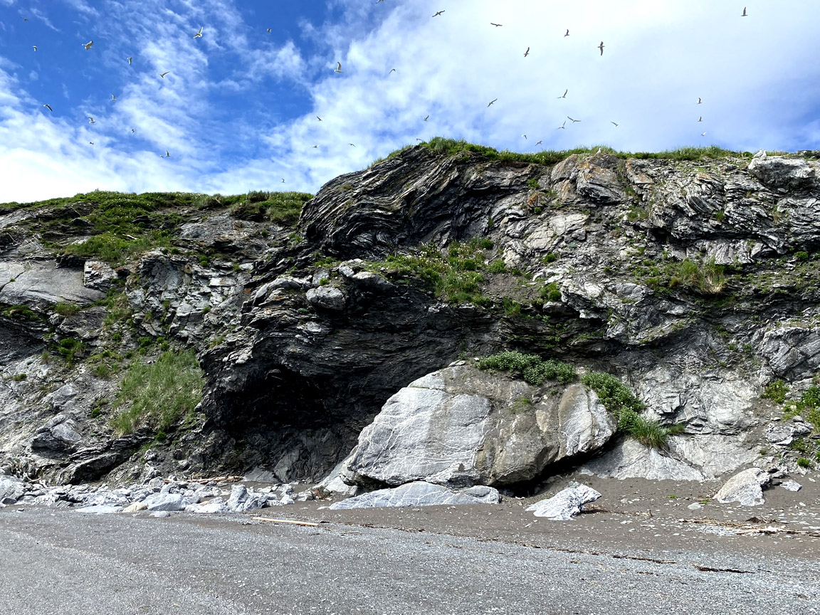
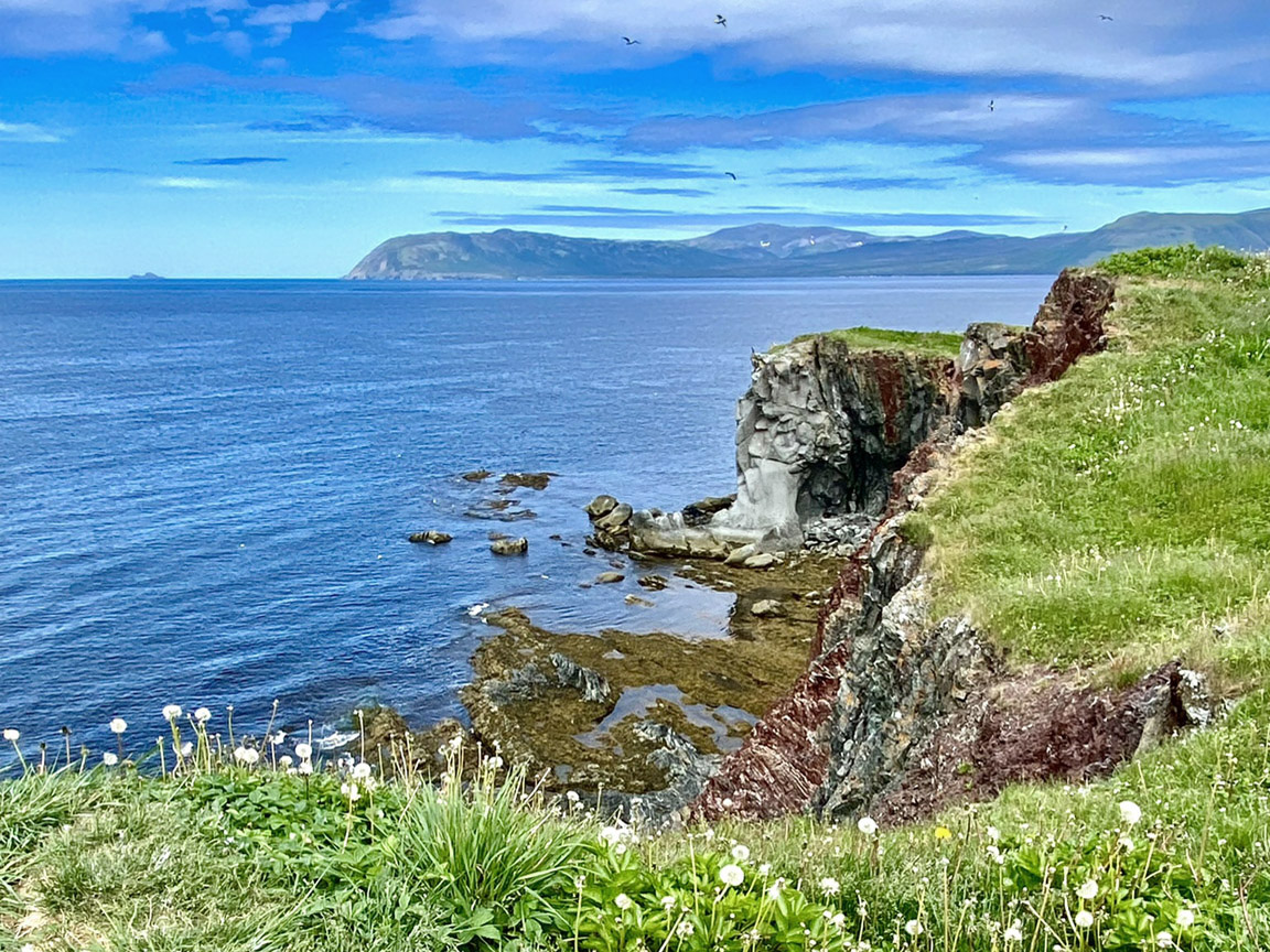
Northern (aka Big) Head (49.16023N / 58.11479W)
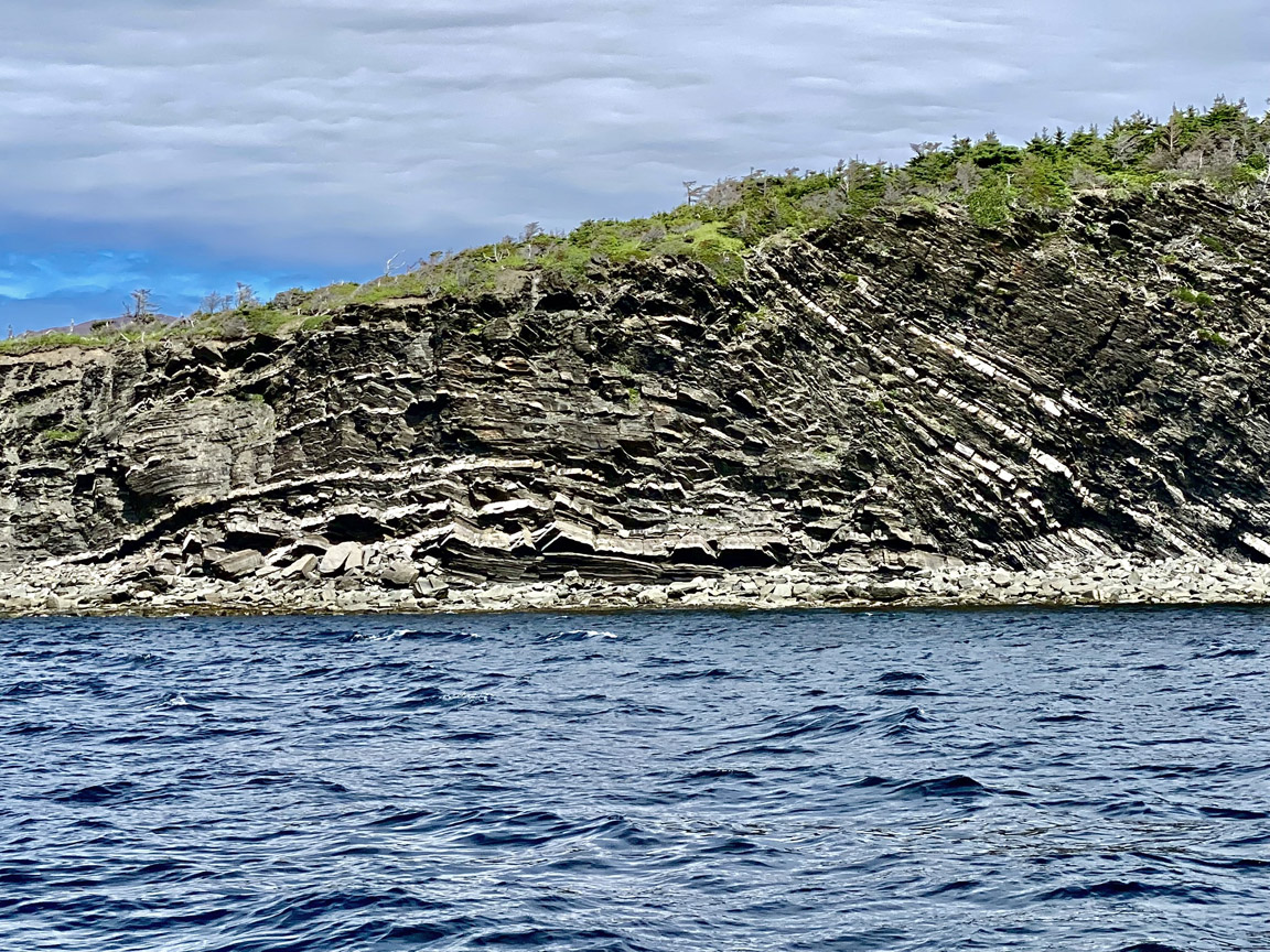
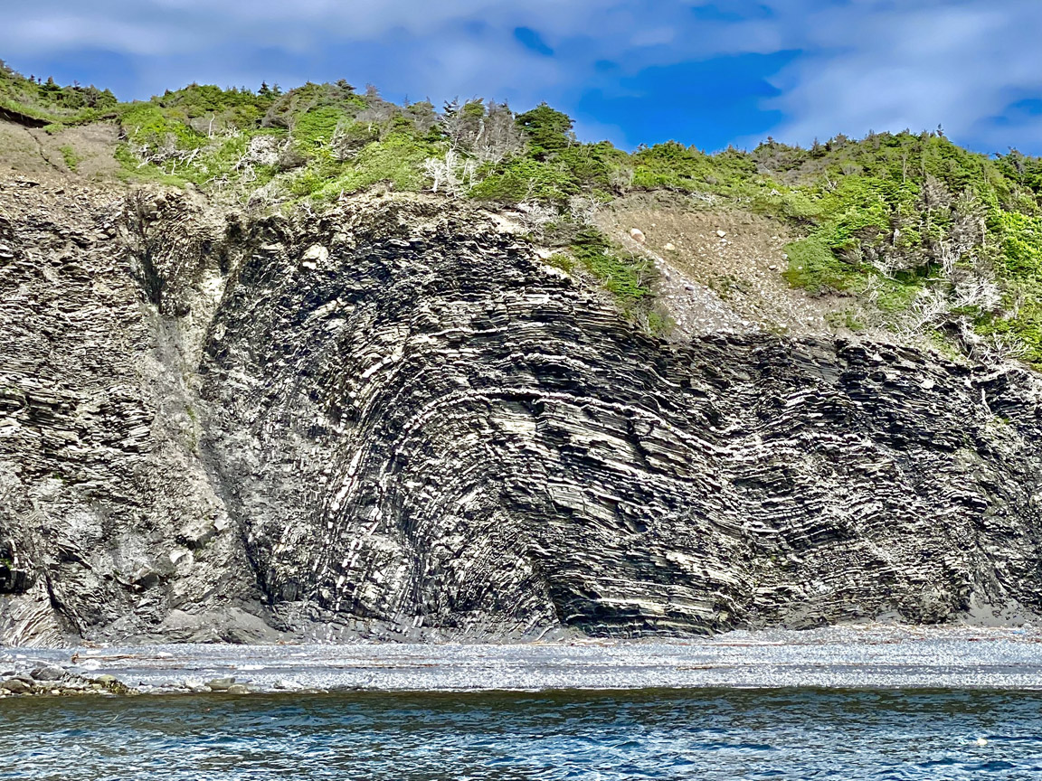
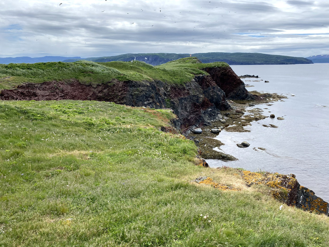
More examples of folded limestone can be seen across Middle Arm at Northern Head (aka Big Head). There, it’s possible to deduce that early folds formed as the rocks were thrust westward and re-folded between approximately 450 and 430 million years ago as other plates collided with Laurentia from the east, producing wildly contorted patterns of layers in the cliffs.
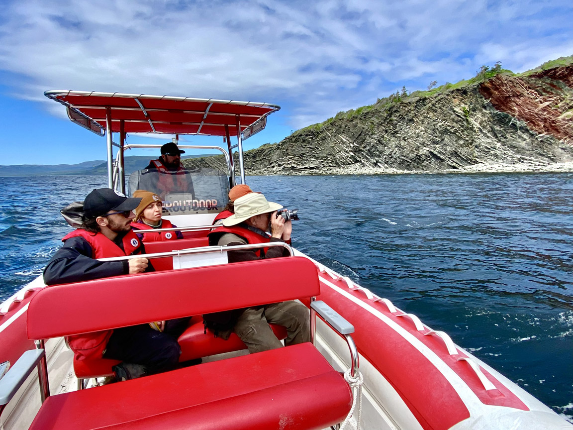
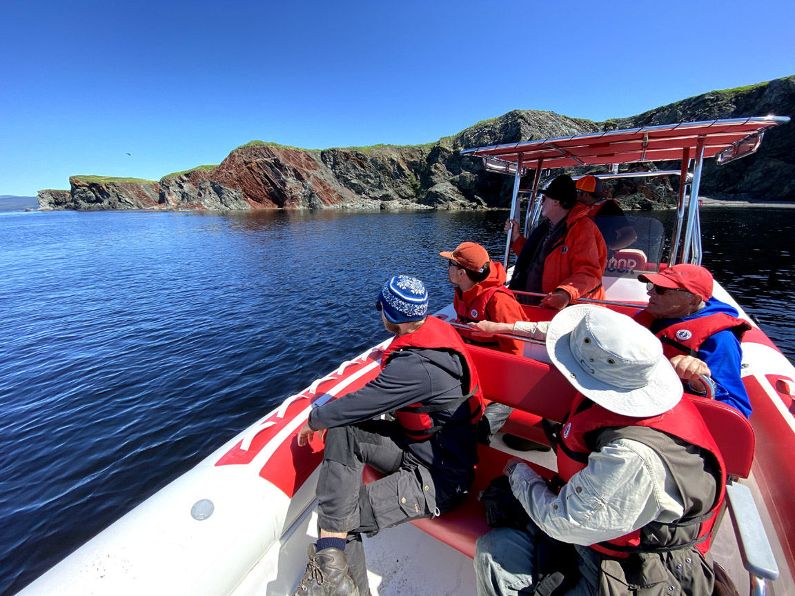
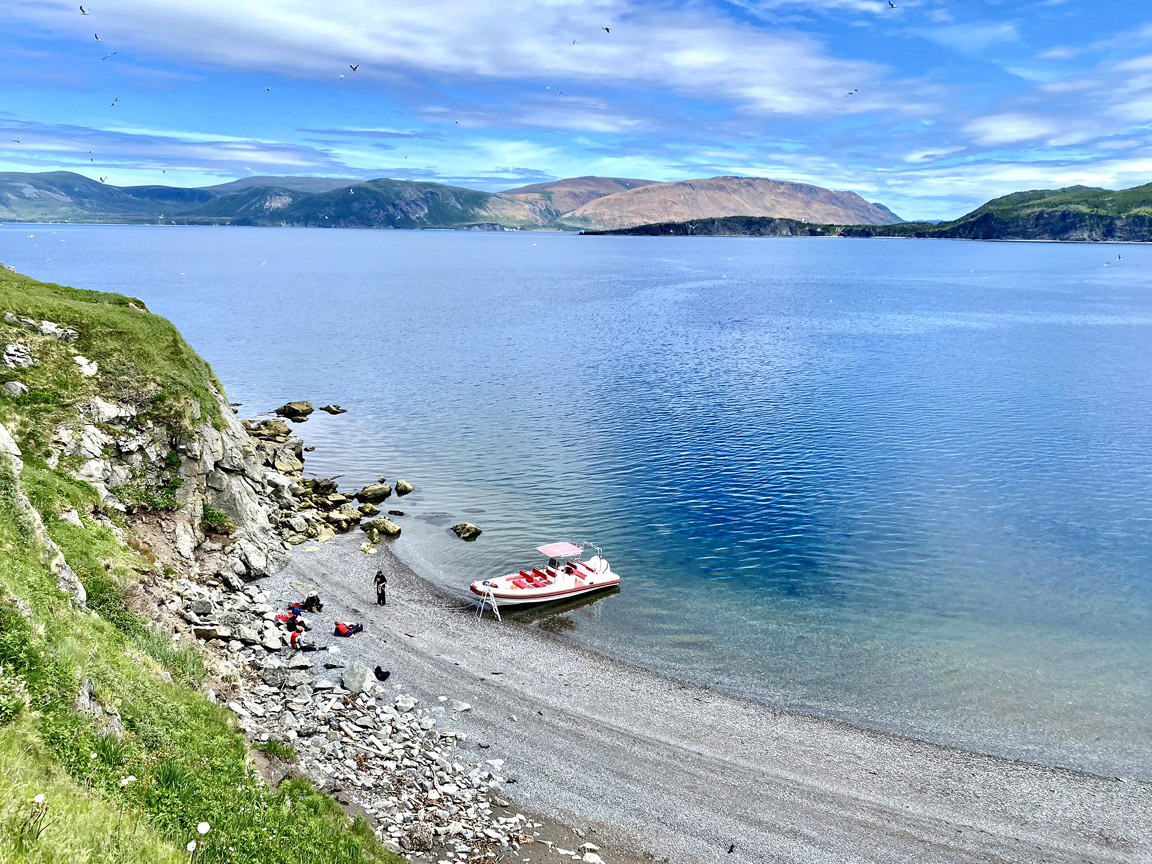
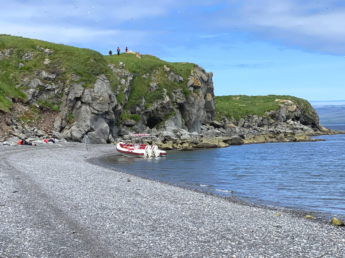
The 7 km stretch of coastline surrounding Big Head is only accessible by boat. Group zodiac tours can be arranged through Everoutdoor Adventures.
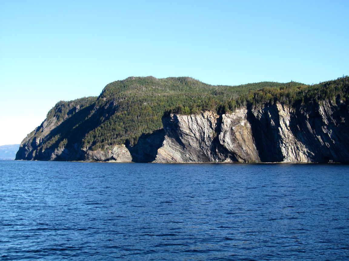
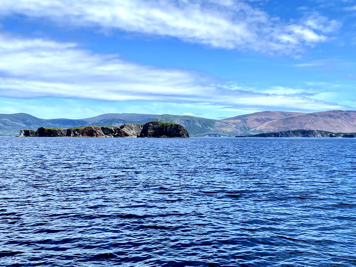
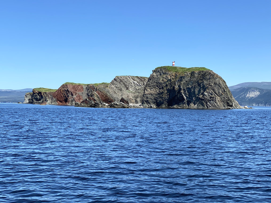
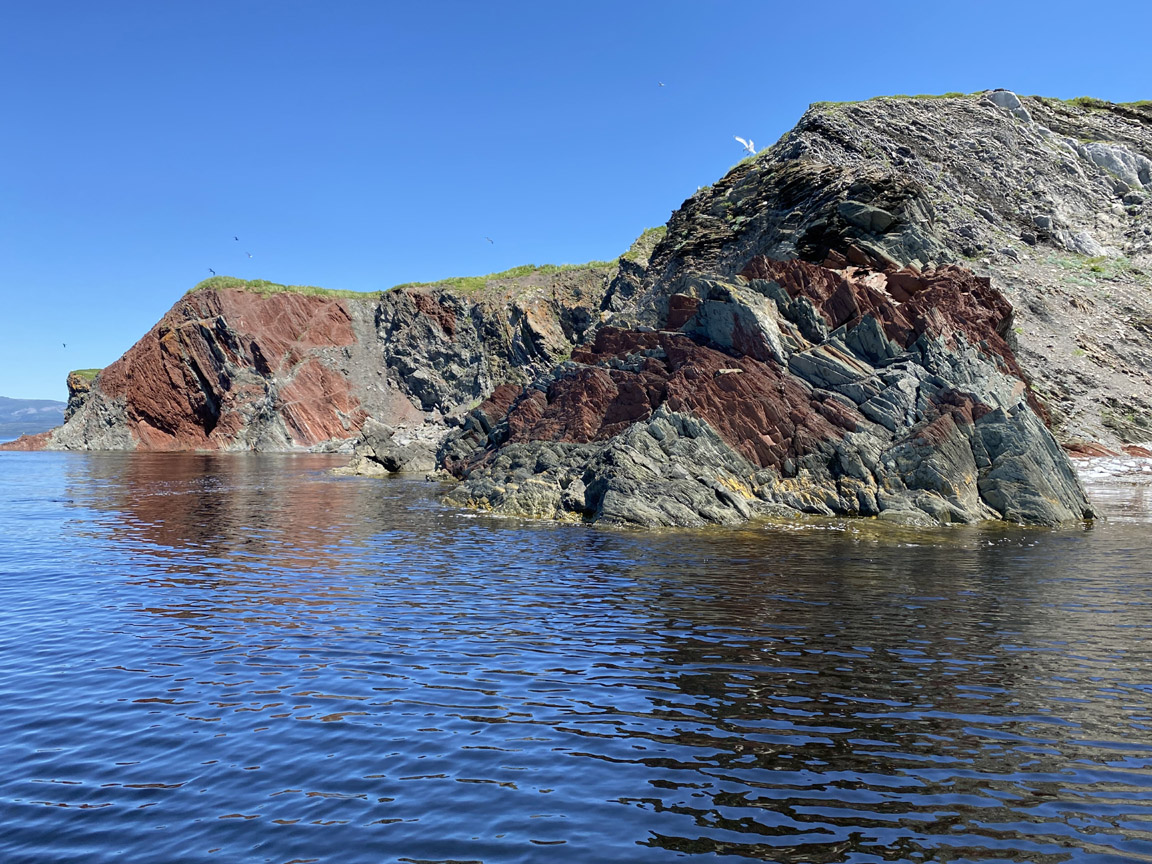
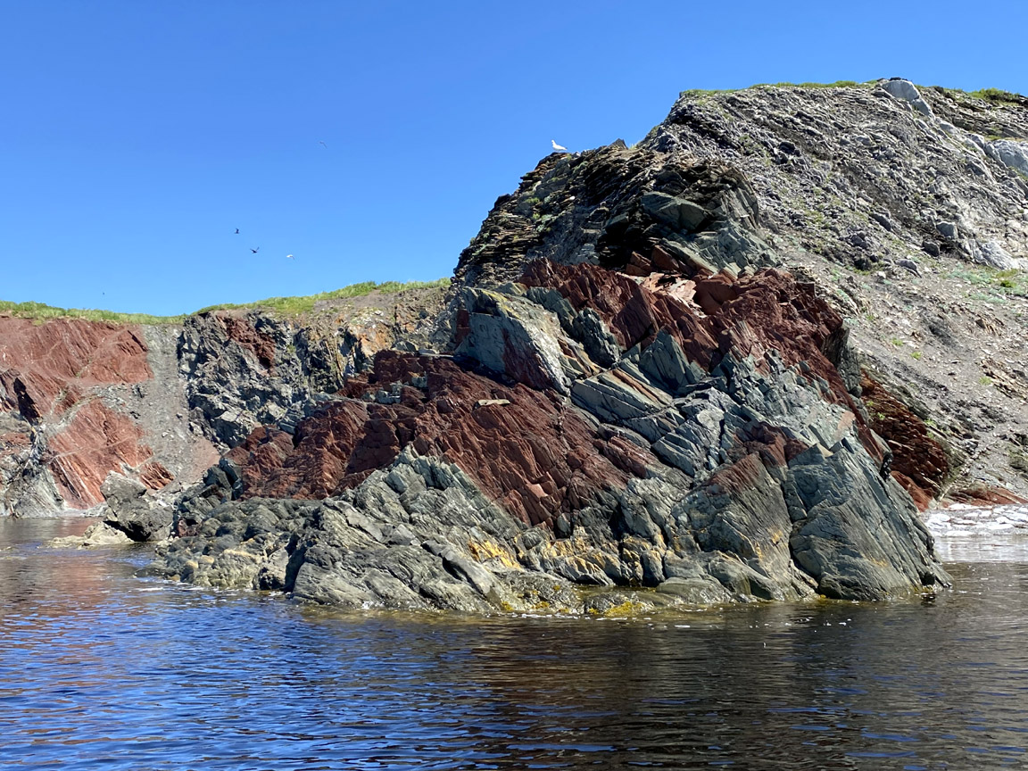
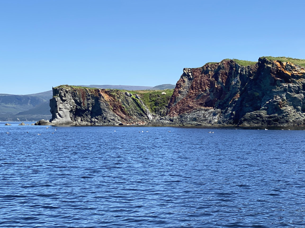
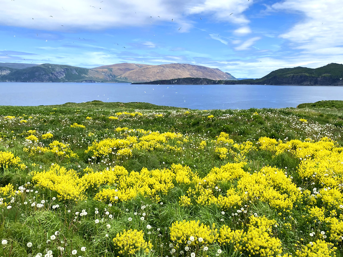
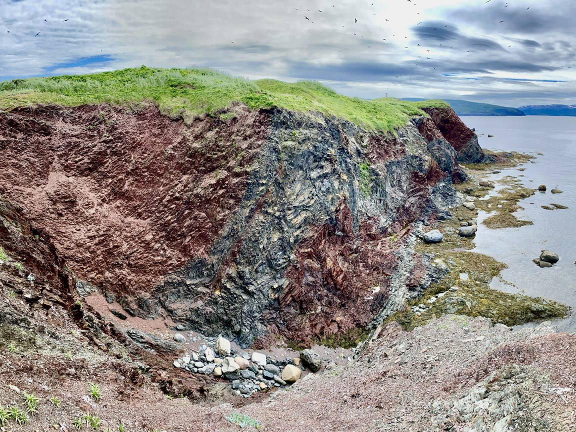
Eagle (aka Green) Island (49.16388N / W58.14789W)
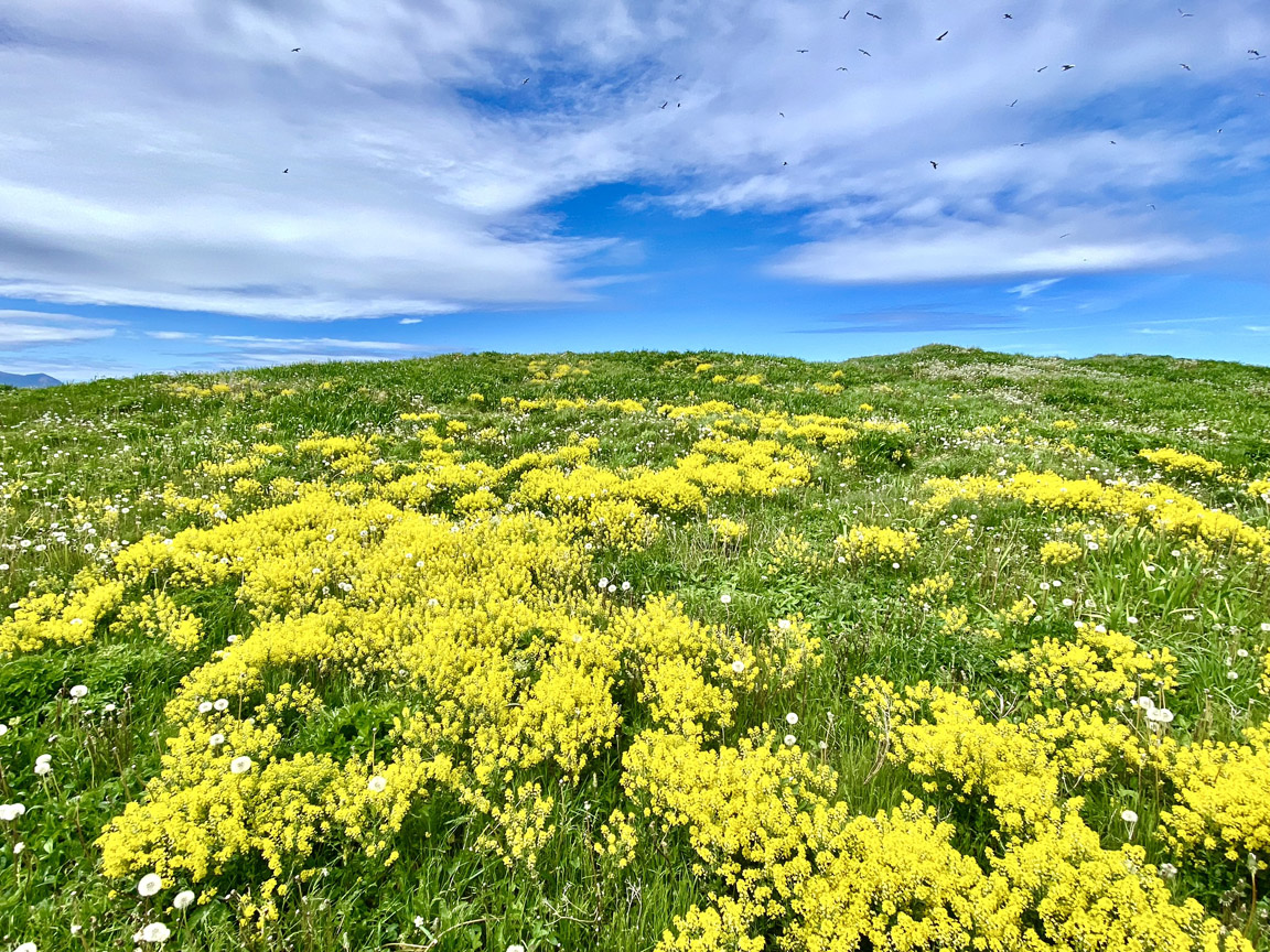
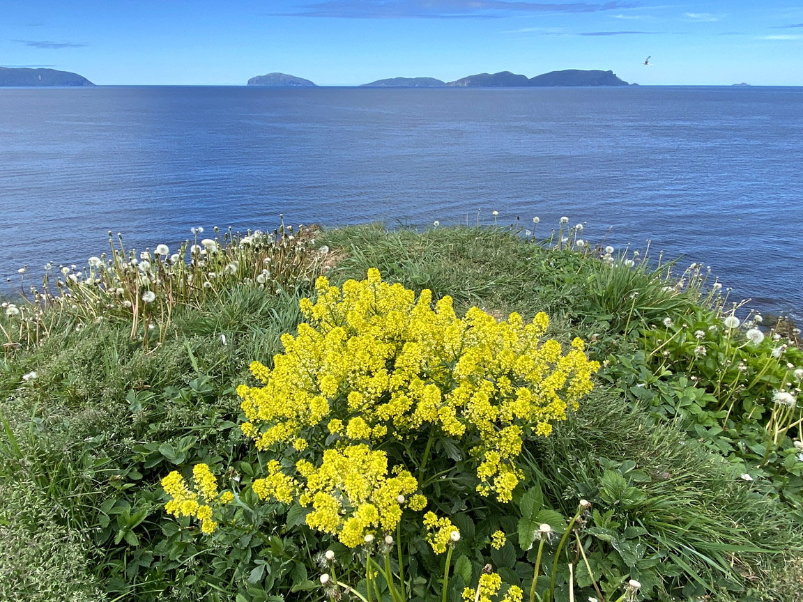
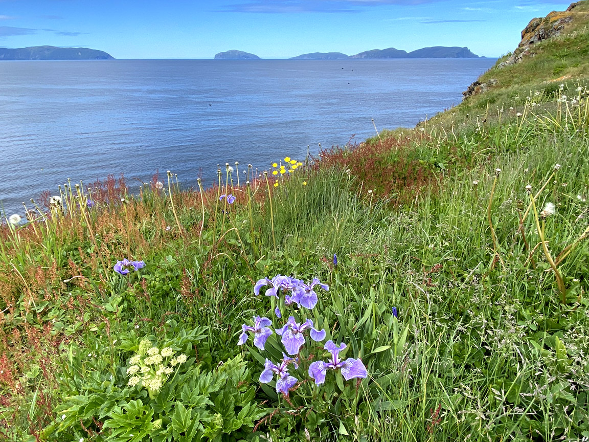
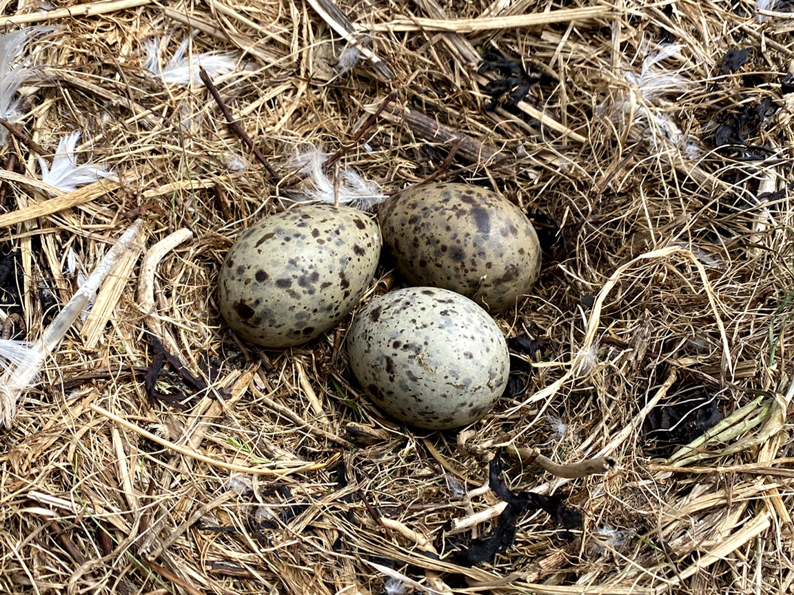
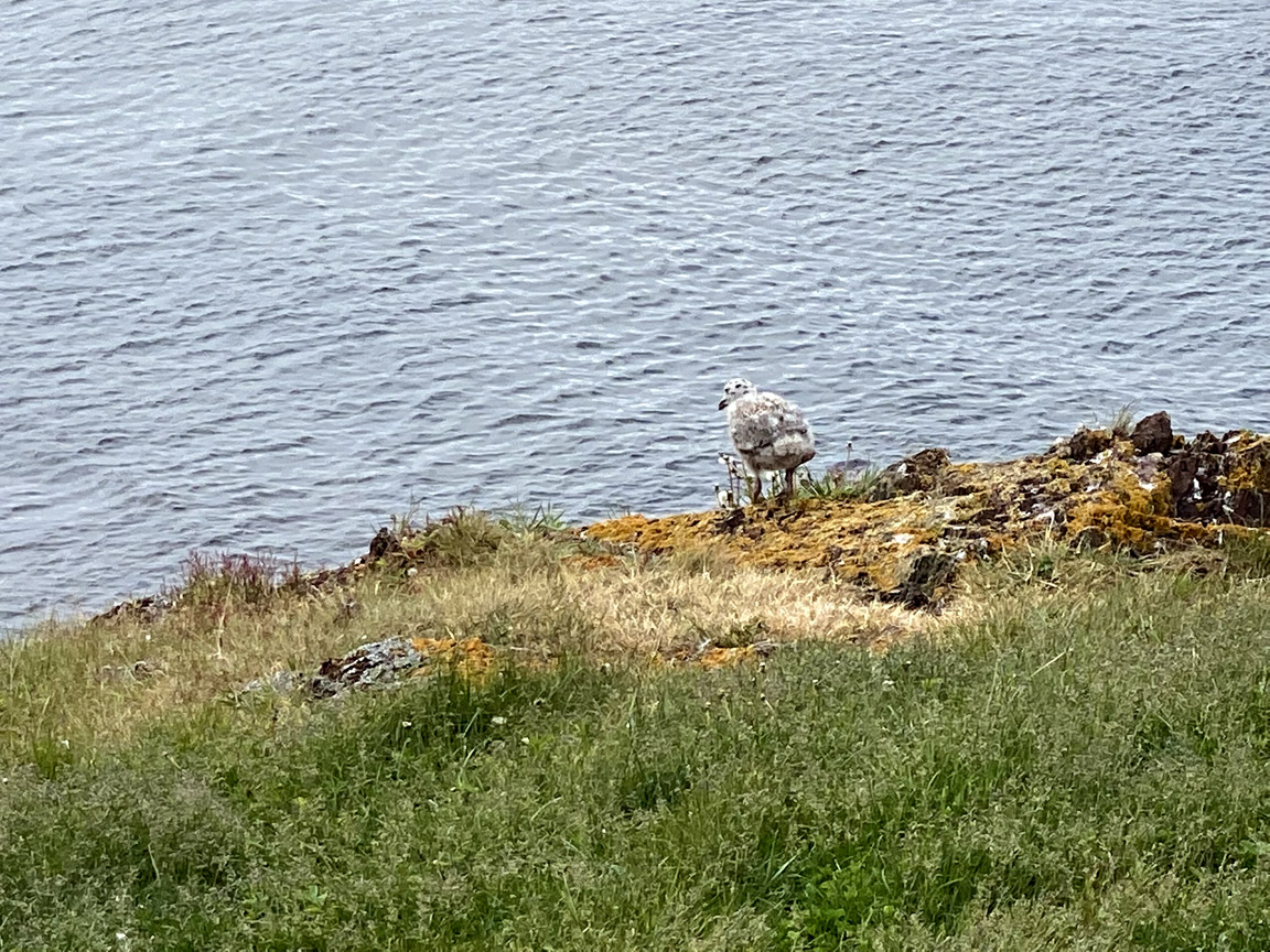
As its name suggests, this small 1/2 km long island 2 km west of Northern (Big) Head is composed primarily of sedimentary rocks belonging to the Eagle Island Formation (part of the Western Brook Pond Group) and Cooks Brook/Middle Arm Point Formations (part of the Cow Group). It is characterized by folded, steeply dipping strata displaying a combination of sedimentary rock sequences and marine deposits. Rock types include grey and green lithic sandstones, red sandstones, and gray shale. In summer, the flat island is covered in grass and a profusion of wild flowers and is a breeding ground for seagulls that is only accessible by boat.
Other Attractions
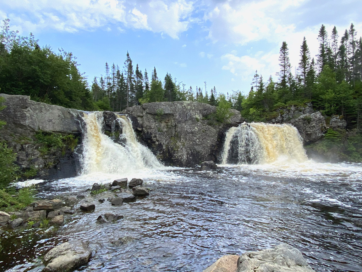
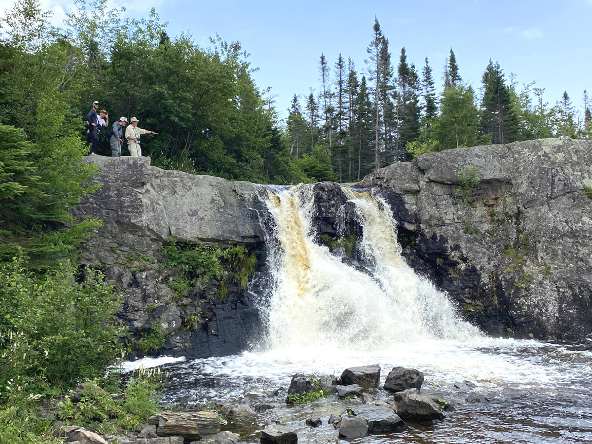
Cox’s Cove (aka Twin) Waterfalls (49.10981N / 58.06154W)
These twin waterfalls drop approximately 6 meters (19ft) into a large pool popular among swimmers in summer. A short trail leads to the top of the falls, but beware of the slippery rocks, as there are no guardrails!
Access
To reach Twin Falls, turn right at the stop sign when entering town and drive approximately 400 meters until you reach a Y intersection. Turn right onto Country Road and drive 1.5 kms until you come to a gravel road that turns off to the right. Follow that road for 400 meters to the waterfalls.
- The beach west of Cox’s Cove known as Parkes Beach has one of the oldest records of human habitation in the area. The site on a low raised beach includes remains from both the Dorset/Groswater culture (between about 2400 BCE* and 950 CE) and later. 49.13614N, 58.10563W
- A favourite fishing and nesting site for eagles can be observed at 49.1513N, -58.0898 W.
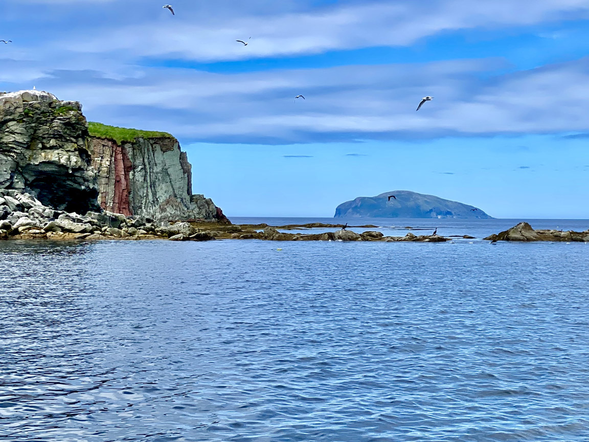
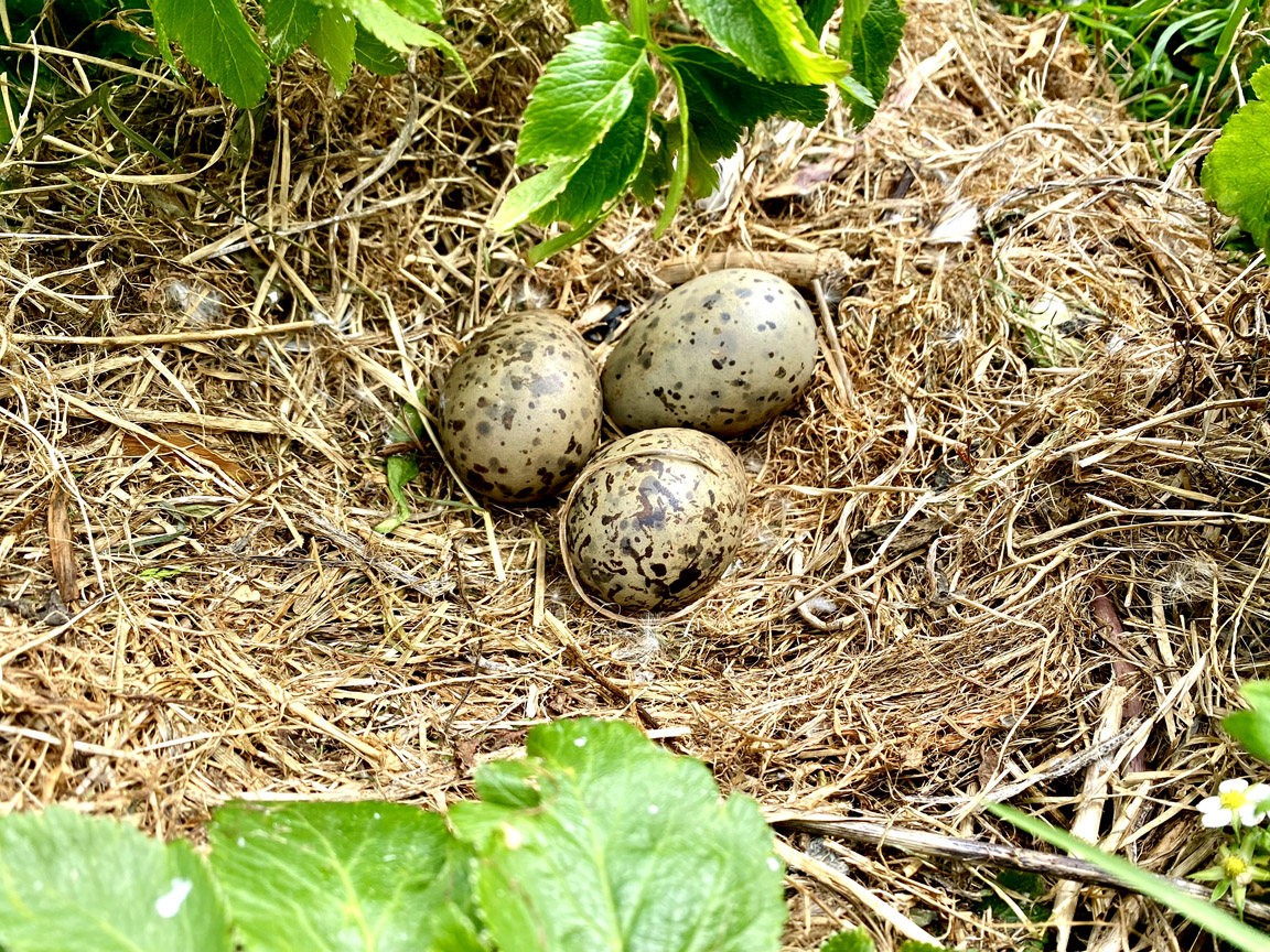
- Seabird nests on the cliffs of these deep water sedimentary rocks can be observed at 49.1657N, -58.1471 W.
* BCE (Before the Common Era) is used here as a culturally neutral equivalent of BC
Geo Finder
|
|
|
Filters
|