Much of the scenic character of the Bay of Islands is the result of Quaternary glaciation and climate change, which produced striking erosional, depositional, and coastal landforms.
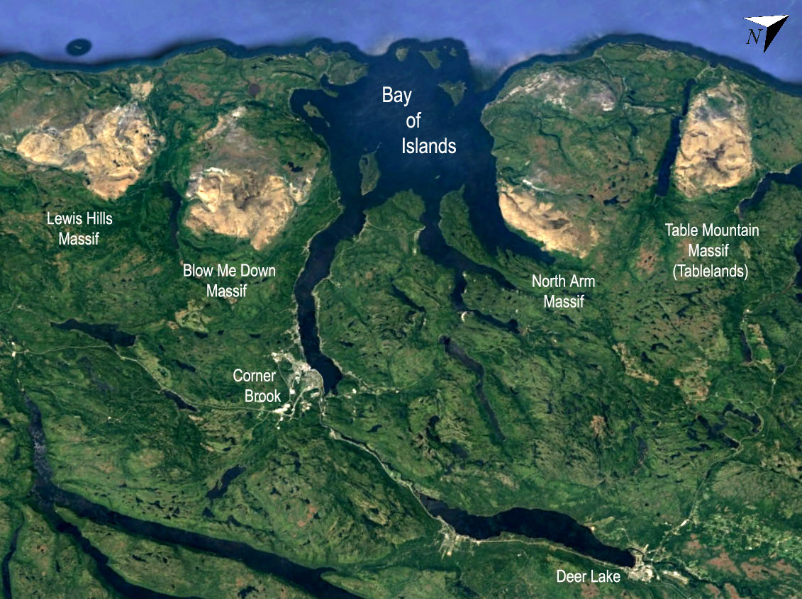
Several magnificent fjords (locally known as “arms”) drain into the Bay, formed by valley glaciers that flowed from an ice cap over the Island of Newfoundland (Batterson and Catto 2003). The weight of ice depressed the lithosphere, leading to pronounced isostatic rebound during deglaciation following the last glacial maximum at ~20 ka. The history of rebound is documented by raised beach deposits that have been recovered up to 50 m above present-day sea level. These deposits show that immediately after deglaciation, an arm of the sea known as “Jukes Arm” after a pioneer of Newfoundland geology, penetrated as far as Deer Lake at the eastern limit of the Geopark (Batterson and Catto 2003). Most of the rebound probably occurred between 13 and 10 ka, while more recent times have seen a slight rise in relative sea level caused by the melting of glacial ice elsewhere (Batterson and Catto 2003, Parang et al. 2024). Marine terraces abound along the coasts, and most communities are built on such platforms, three to 10 m above present-day sea level. A lower terrace is typically occupied by fishing cabins and brightly coloured fishing dories (small flatbottomed boats that are hauled ashore when not in use).
Several larger lakes in the Geopark area are formed behind end moraines composed of glacial till, while glaciofluvial deposits (such as kames and eskers) are quarried for their resources of well-sorted sand and gravel. Most valleys in the area have characteristic U shaped profiles characteristic of glacial erosion, but the Humber Valley, through which the Trans-Canada Highway passes, is V shaped and is believed to have been formed by water, possibly flowing through a cave system, now collapsed. The glacier that formed the Humber Arm, the largest of the Elamastukwek fjords, flowed north of the Humber Gorge, exiting through a U-shaped but largely dry valley at Hughes Brook (Batterson and Catto 2003). Other karstic features include the Lomond Sinkhole and the Corner Brook Stream cave system, both featured in Geosites within the aspiring Geopark.