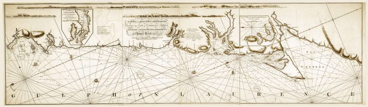
On October 26, 2018, Cabox Geopark in Western Newfoundland commemorated the 250th Anniversary of James Cook’s ‘Chart of the West Coast of Newfoundland’. A large version of the map was installed at the Geopark’s new Saltbox Information Center in Benoit’s Cove on the south side of the Bay of Islands. Other copies of the Chart were (and will be) installed at key locations around the bay, including along the newly designated James Cook Heritage Trail in Blow Me Down Provincial Park in Lark Harbour.
Cabox Geopark Commemorates Cook Chart