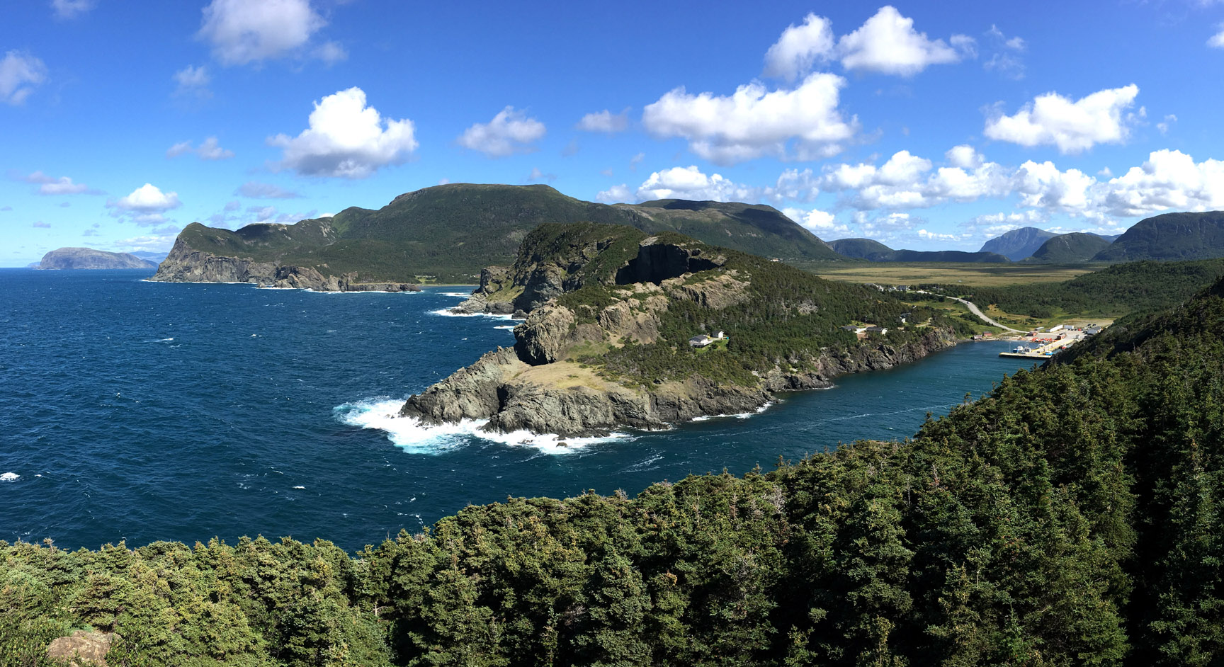
The rocks surrounding Bay of Islands (Elmastukwek) provide a powerful record of the formation and demise of the Iapetus Ocean and the building of the Appalachian Mountains by plate tectonics during the Palezoic Era, when continents collided to form the supercontinent Pangea. The subsequent erosion of the mountains and more recent glaciation over the past 2.6 million years continued to shape the landscape to what we see today.
View of Wheeler's Gulch and Pyramid Peak (right) on the north side of Lewis Hills [Robert Bradbury photo]
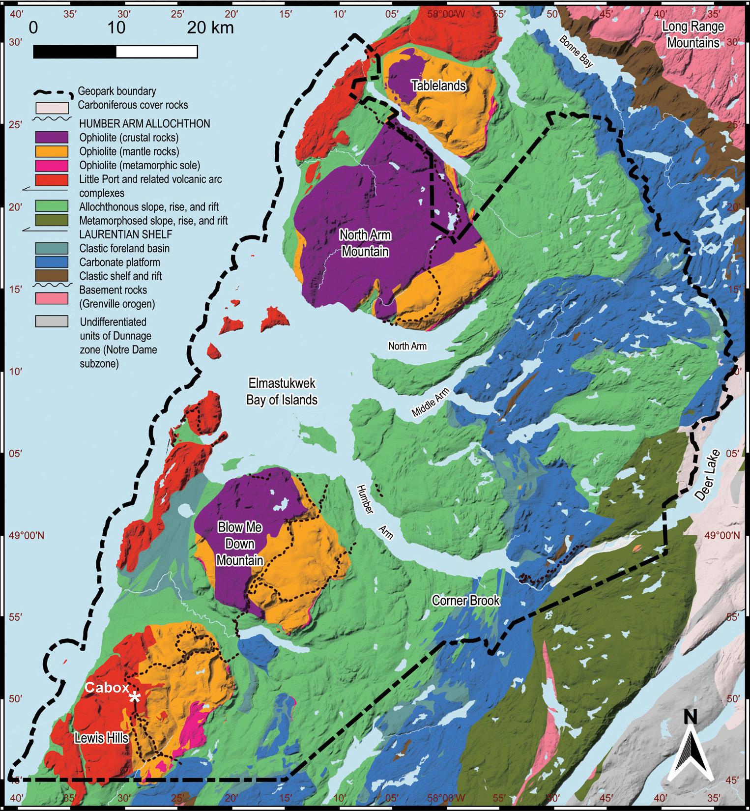
The rocks of Cabox Geopark belong to the following four geological assemblages, which are easily recognizable in the region’s spectacular landscapes:
Shelf Succession
Slope Succession
Ocean Succession
Quaternary Features
Shelf Succession
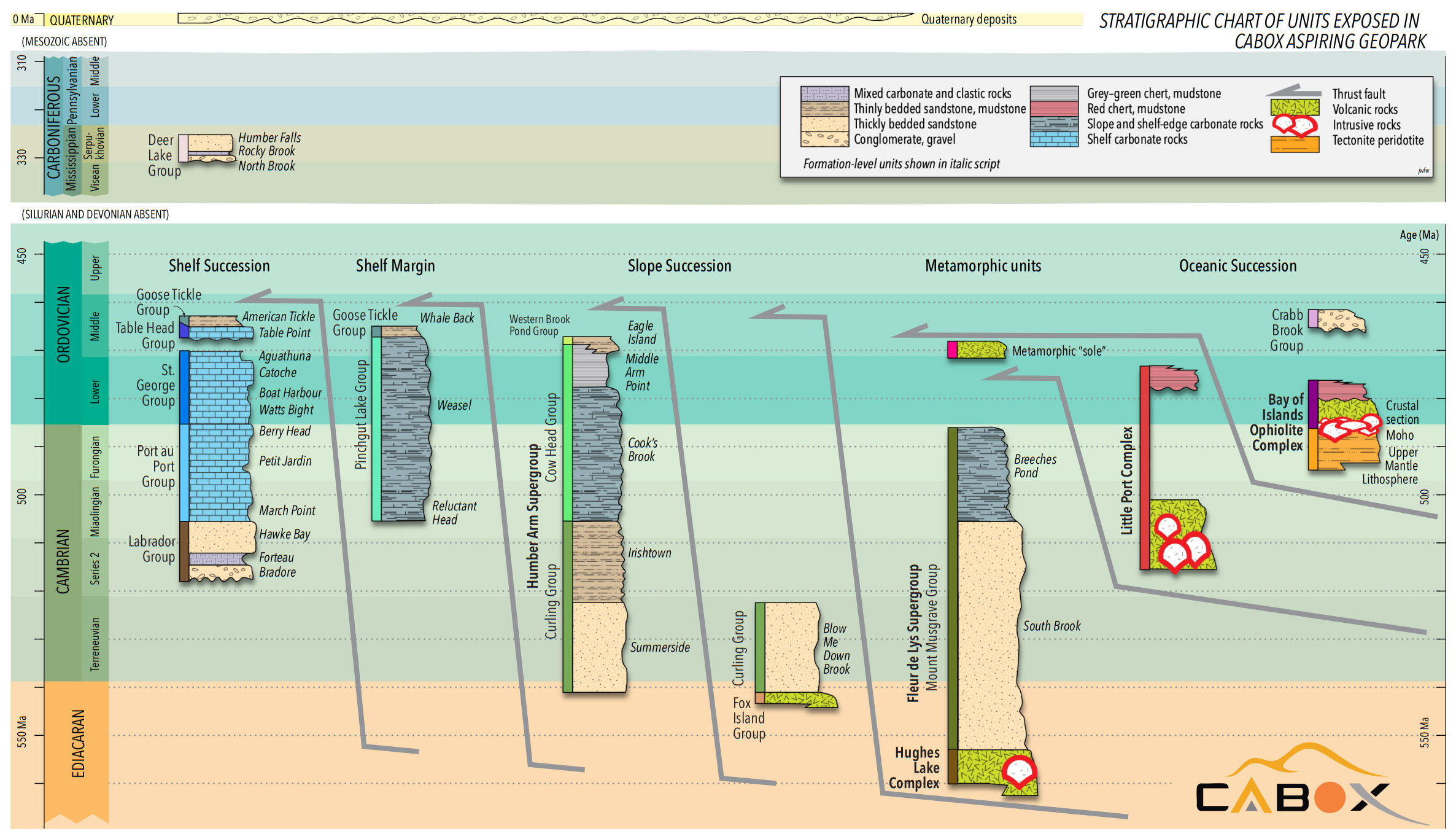
The shelf succession formed during the Cambrian to Ordovician geological periods on the edge of the ancient continent Laurentia, the precursor to North America, that existed before the Appalachian orogen was built. These rocks are primarily sedimentary and were deposited in shallow water on the continental shelf surrounding Laurentia. The earliest units (Labrador Group) are clastic, but because Laurentia lay close to the Equator from mid-Cambrian time onwards, shallow-marine organisms were able to produce thick carbonate deposits keeping pace with subsidence. Fossils of various reef and mound-building organisms are preserved alongside trilobites and other shelly fossils. Bioturbated white limestone and tan weathering dolostone form much of the rugged mountain scenery in the Humber River gorge.
View of Humber River Gorge and Breakfast Head (with Man In The Mountain) from IATNL Bear Head Trail
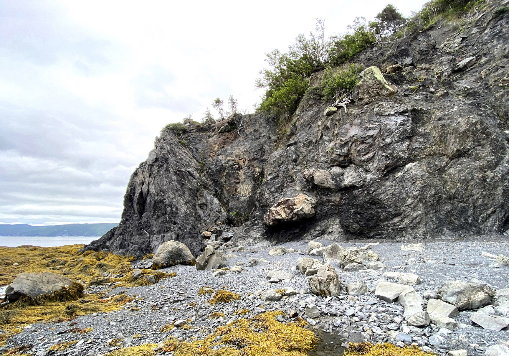
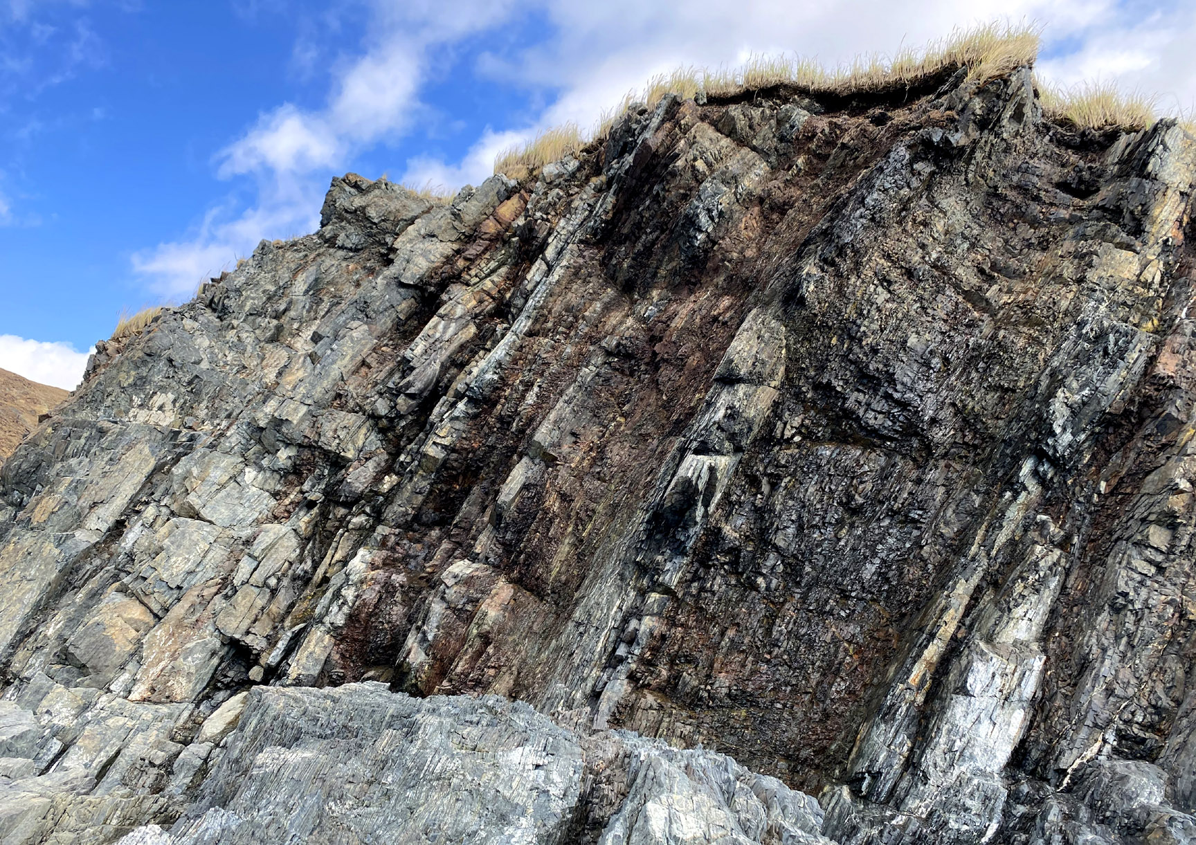
Slope Succession
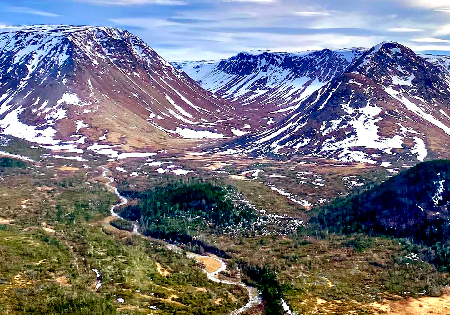
A second large package of rocks, here termed the slope succession, formed in deeper water on the continental slope and rise that surrounded Laurentia. These rocks include abundant mudstone, interbedded coarser turbidite layers, and coarse, structureless cobble to boulder conglomerates deposited by other mechanisms of sediment gravity flow (e.g., debris flow). Many outcrops have a conspicuous striped appearance, allowing visitors to easily distinguish them from the more massive shelf succession. Carbonate turbidites are particularly well developed in the Geopark area and may represent natural climate driven sea-level fluctuations that affected the edge of the continental shelf.
Sedimentary formations near Big Head, North Arm Point, Bay of Islands
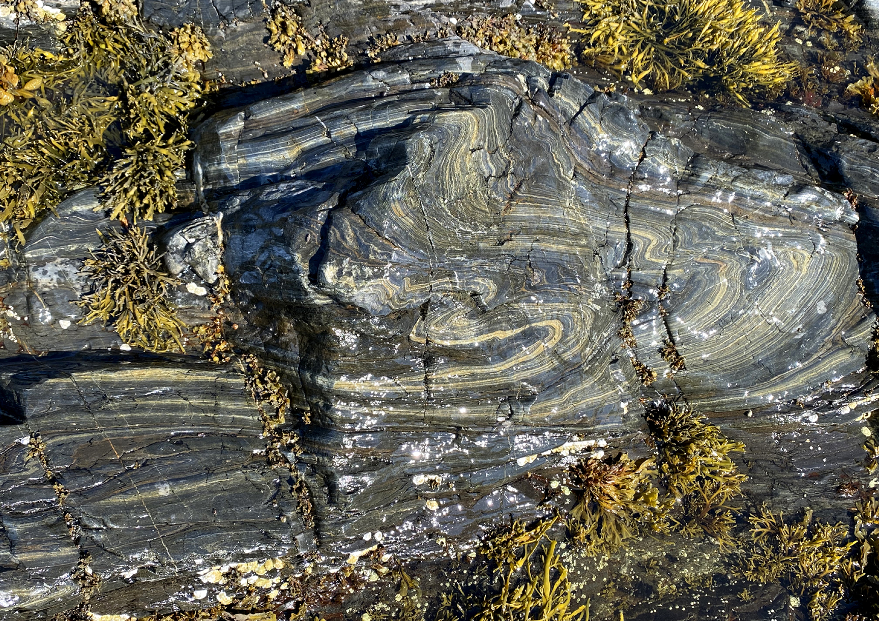
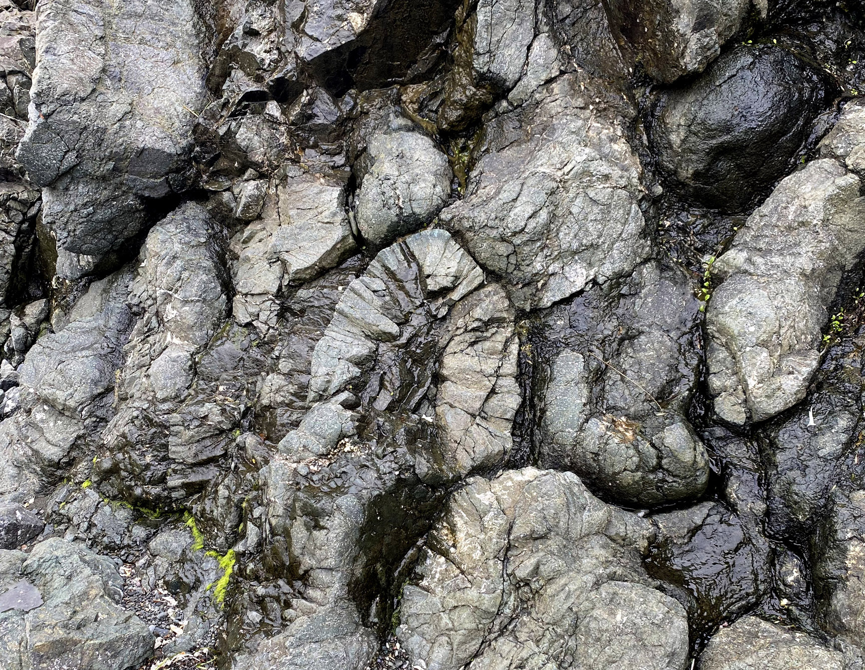
The slope succession rocks were intensely folded and faulted during several orogenic episodes during the building of the Appalachian Mountains, providing spectacular and accessible examples of geologic structures such as folds and faults. In places the rocks of the slope succession were fragmented during deformation to produce block-in-matrix rocks, such as broken formation and tectonic mélange.
Tectonic Mélange at Frencman's Cove near Route 450
Close up of Tectonic Mélange at Frencman's Cove
Oceanic Successions
The third group of rocks in the Bay of Islands area consists of oceanic igneous and metamorphic rocks assigned to two large complexes named for the Bay of Islands and Little Port, both within the Geopark area.
The Bay of Islands Ophiolite Complex preserves oceanic crust and upper mantle and was influential (along with examples in Cyprus and Oman) in the early history of plate tectonics by providing a cross-section of oceanic lithosphere, unobservable beneath the modern oceans. Initially, researchers supposed the Bay of Islands Ophiolite Complex to represent the oceanic lithosphere formed during the spreading of the Iapetus Ocean. However, like most ophiolites in Newfoundland and elsewhere, it has been found to show geochemical traces of subduction. Modern interpretations suggest that it formed in a fore-arc or back-arc environment around 485 Ma (close to the Cambrian Ordovician boundary) during the subduction process that eventually led to ocean closure; the original floor of the Iapetus Ocean, which was formed at a mid-ocean ridge, was entirely subducted.
View of Blow-Me-Down Brook Gulch and Falls, with rust-colored peridotite from Earth's mantle at left and gray gabbro from ocean floor at right
Despite these new interpretations, the four rugged massifs of the Bay of Islands Ophiolite Complex continue to provide visitors to the Geopark with spectacular and accessible examples of ocean-floor pillow basalt, gabbro representing oceanic crust, layered peridotite and gabbro representing the Moho zone, and tectonite ultramafic rock representing the lithospheric upper mantle. The upper crustal section contains scattered occurrences of volcanic massive sulphides; visitors can see the historical record of a mining operation at Blow Me Down Mountain. The tectonite peridotite and serpentinite form distinctive orange-weathering barrens with unusual modern flora adapted to the scant, magnesium-rich soil. At the very base of the ophiolite are foliated rocks of the metamorphic sole: greenschist and amphibolite formed during emplacement in the early stages of Taconian orogenesis in the Ordovician Period.
View of North Arm Ophiolite Massif with Pond Point metamorphic sole in foreground
Metamorphic sole at Pond Point, North Arm, Bay of Islands
Close-up at Pond Point, North Arm, Bay of Islands
The Little Port Complex forms the outer islands and headlands of the Bay of Islands. It consists of igneous and minor sedimentary rocks that more clearly formed in arc environments above the subduction zones that closed the Iapetus Ocean, starting in Cambrian time around 505 Ma, well before the Bay of Islands Complex was formed.
These rocks also include spectacular pillow lavas, together with lava breccias and tuffs recording explosive episodes of arc volcanism. Intrusive diorite and granodiorite, formed by hydrous melting and differentiation in the mantle wedge, are also well represented in accessible places within the Geopark.
View of Little Port, with Bottle Cove, South Head, Weeball (Guernsey Island) and Cape Blow Me Down in background
View of Little Port Harbour
Little Port Pillow Lava
Quaternary Elements
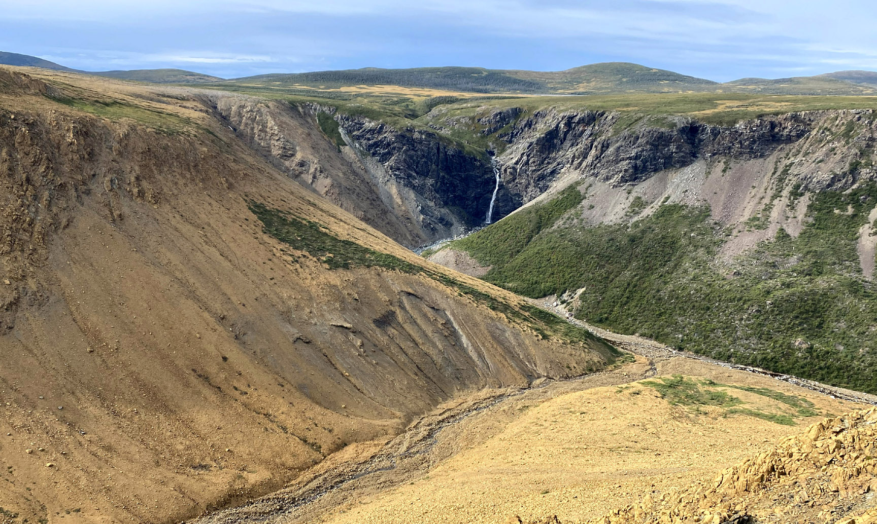
Much of the scenic character of the Bay of Islands is the result of Quaternary glaciation and climate change, which produced striking erosional, depositional, and coastal landforms. Several magnificent fjords (locally known as “arms”) drain into the Bay, formed by valley glaciers that flowed from an ice cap over central Newfoundland. The weight of ice depressed the lithosphere, leading to pronounced isostatic rebound during deglaciation following the last glacial maximum at ~20 ka. The history of rebound is documented by raised beach deposits that have been recovered up to 50 m above present-day sea level.
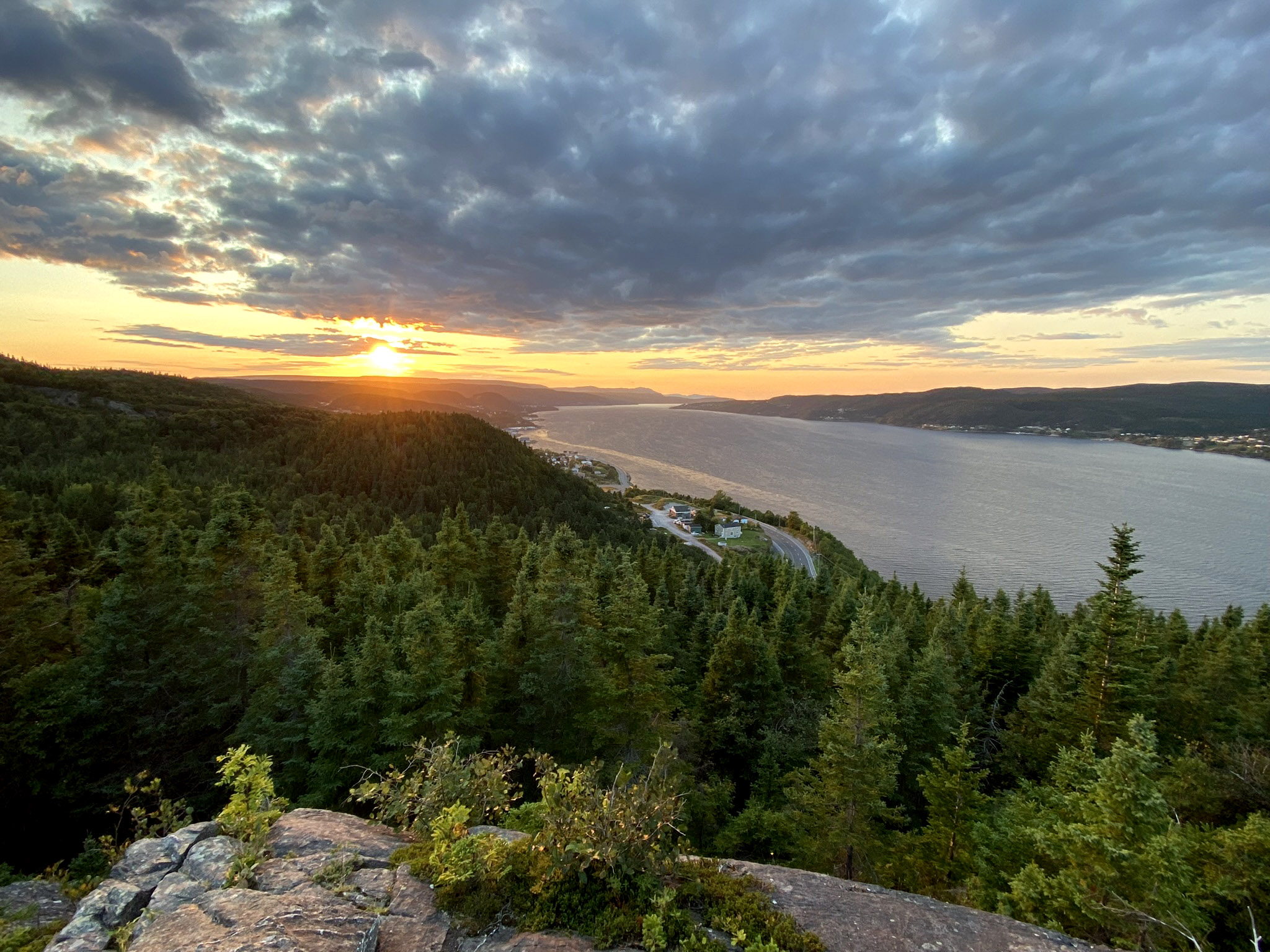
Sunset over Blow Me Down Mountains from Crow Head, Corner Brook
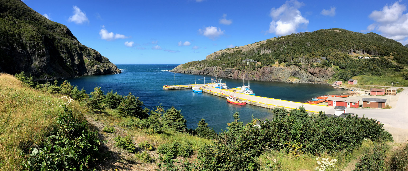
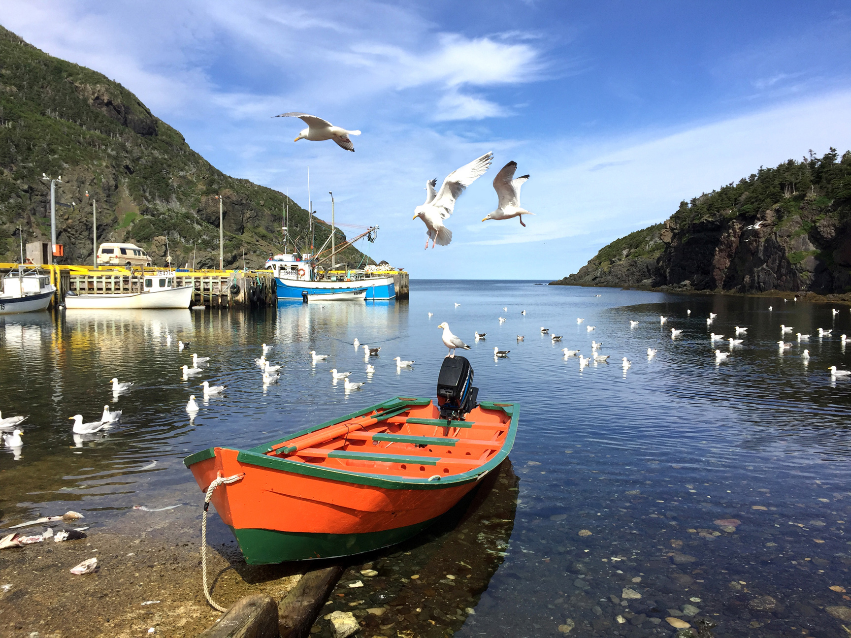
These deposits show that immediately after deglaciation, an arm of the sea known as “Jukes Arm” after a pioneer of Newfoundland geology, penetrated as far as Deer Lake at the eastern limit of the Geopark. Most of the rebound probably occurred between 13 and 10 ka, while more recent times have seen a slight rise in relative sea level caused by the melting of glacial ice elsewhere. Marine terraces abound along the coasts, and most communities are built on such platforms, three to 10 m above present-day sea level. A lower terrace is typically occupied by fishing cabins and brightly coloured fishing dories (small flat bottomed boats that are hauled ashore when not in use).
Bay of Islands Dory at Little Port
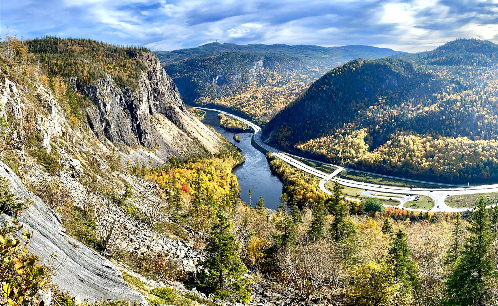
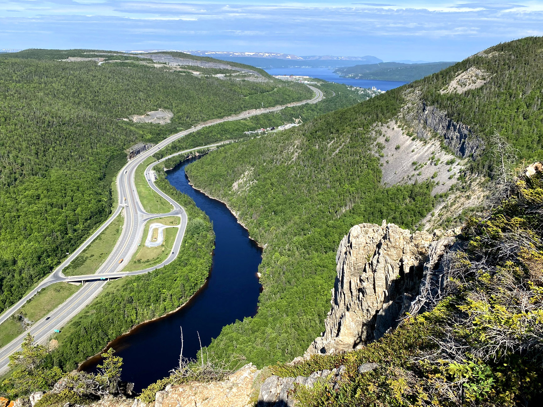
Several larger lakes in the Geopark area are formed behind end-moraines composed of glacial till, while glaciofluvial deposits (such as kames and eskers) are quarried for their resources of well-sorted sand and gravel. Most valleys in the area have characteristic U-shaped profiles characteristic of glacial erosion, but the Humber Valley, through which the Trans Canada Highway passes, is V-shaped and is believed to have been formed by water, possibly flowing through a cave system and now collapsed. The glacier that formed the Humber Arm, the largest of the Elamastukwek fjords, flowed north of the Humber Gorge, exiting through a large U-shaped but largely dry valley at Hughes Brook. Other karstic features include the Lomond Sinkhole and the Corner Brook Stream cave system, both featured in Geosites within the aspiring Geopark.
View of Humber Gorge, Humber Arm and Blow Me Down Ophiolite Massif from top of Man In The Mountain on the IATNL Humber Valley Trail