The name “Cabox” originates from the Spanish, Portuguese, and Galician word Cabos, meaning “capes,” reflecting the area’s dramatic geographical features, including towering peaks and rugged coastal landscapes. Cabox, the highest peak on the island of Newfoundland, holds historical significance as a landmark for early exploration and mapping, known to English-speaking settlers as “New Founde Lande” in the 16th and 17th centuries. It is located in the Lewis Hills, a region thought to have been named after a French King Louis.

Indigenous History
The cultural history of Cabox Aspiring Geopark is deeply rooted in the region’s Indigenous and European legacies that began with the arrival of the migratory Maritime Archaic people between 8600 and 6300 BP. Their tools and projectile points have also been uncovered elsewhere on the west coast, including in the Geopark. Skilled in crafting spear points, ulus, and stone tools, the Maritime Archaic sustained themselves by exploiting the region’s abundant sea and land resources: fish, seals, caribou, and beaver.
The Maritime Archaic were succeeded by the Dorset peoples, also migratory, whose artifacts have also been found in the Bay of Islands. Arriving around 2,000 BP, they settled all along the coastline from the Northern Peninsula to the Codroy Valley. Archaeologists suggest that their way of life may have been disrupted by the Medieval Warm Period (ca. 950 to 1250 CE), when melting ice packs affected migratory seal patterns; perhaps, too, they were the victims of unknown diseases. The Dorset peoples were followed by groups of the Little Passage culture, part of the Algonquin world, who arrived after 1000 CE.
Common throughout much of Atlantic Canada, people of the Little Passage Complex were likely direct ancestors of the Beothuk peoples, Newfoundland’s main Indigenous inhabitants when European fishers began to regularly appear in the early 1500s CE. Living in small bands, they moved with the seasons, primarily hunting, fishing, and gathering eggs. In spring and summer, their families dispersed north along the coast to fish at Cape John and southeast to Cape Freels, in search of salmon and eggs of seabirds; in fall, they hunted, trapped, and congregated for caribou drives. Records indicate that in response to violent encounters with Europeans, they retreated into the interior.
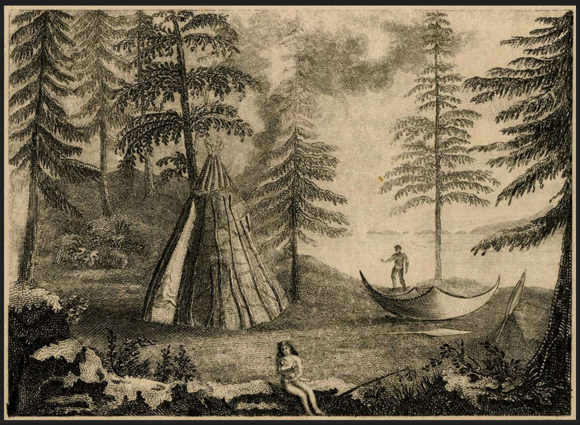
Beothuck Encampment by John Cartright, 1773, showing Beothuck wigwam and canoe
The Beothuk world was described in 1829 by the last known member, Shanadithit, after she was brought by settlers to St. John’s. Archaeological evidence and oral history have further confirmed and expanded her narrative. In the Cabox region, Beothuk artifacts have been uncovered in the Bay of Islands and around Grand Lake. The Beothuk demise has been attributed to their isolation, violent attacks by European fishers and settlers, competition for resources, and disease; contemporary official efforts to protect Indigenous peoples in Newfoundland and Labrador went largely unenforced.
The Mi’kmaq people in Newfoundland can be traced at least back to the 1600s CE. Allied with France against Britain and its American colonies, Mi’kmaq warriors accompanied French forces in a 1696 attack of the Avalon Peninsula during the War of the Spanish Succession. In 1705, the French governor of Plaisance noted the presence of twenty-five Mi’kmaq families from Cape Breton, and a likely Mi’kmaq settlement was later reported in Bay St. George. Southern Newfoundland was well known to the Mi’kmaq of the Maritime region, having historically constituted part of a region of islands beyond Unama’ki (Cape Breton Island). Other Mi’kmaq hunters and trappers came to Newfoundland on a seasonal basis, collecting furs to trade with the French. Mi’kmaw oral history indicates that they and the Beothuk coexisted peacefully, each group establishing their own distinct territories. Descendants of the early Mi’kmaw settlers in the Bay of Islands and neighboring regions now form Qalipu First Nation and other independent Indigenous groups.
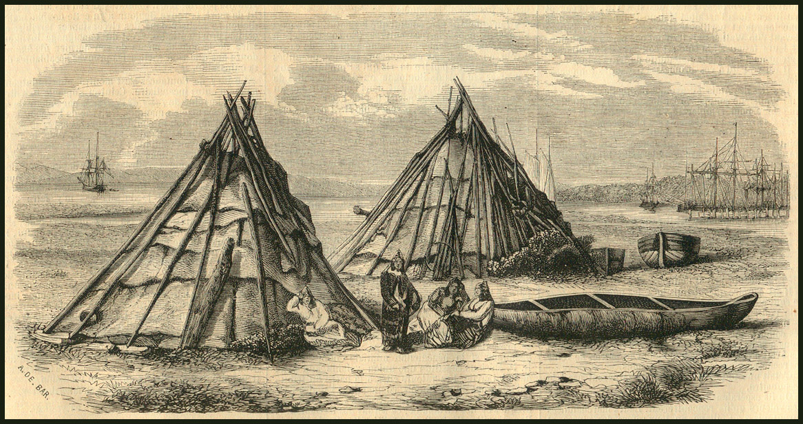
Mi'kmaq Camp, from photograph by Paul-Émile Miot, 1857
Upon signing of the Treaty of Utrecht (1713), Britain placed all Mi’kmaq bands in Unimaki under its sovereignty. Over the next three decades, the Mi’kmaq opposed becoming British “subjects,” resulting in numerous episodes of resistance against British authority and settler encroachment.
Following the expulsion of the Nova Scotia Acadians (with whom they had coexisted), the Mi’kmaq fought alongside French forces at the Battle of Beauséjour (1755) and the Siege of Louisbourg (1758). Their alliance with France only ended after the British victory at Québec, when Mi’kmaq chiefs signed a peace treaty at Montreal (1762).
After the Treaty of Paris (1763), New England settlers began to displace Mi’kmaq communities throughout the Maritime region, pushing several bands into the former French colony of Cape Breton Island. Faced with wildlife depletion, settler encroachment, and denial of their religious requests as Roman Catholics, several bands left for southern Newfoundland to seek out land.
The 1760s were a turning point in Newfoundland Mi’kmaq history. The colonial governors of Nova Scotia and Cape Breton were happy to see bands leave the mainland for the southwest of the island, but, Newfoundland’s governor perceived the growing Mi’kmaq presence as a security threat. However, the British government instructed colonial governors to protect Indigenous peoples, and “to remedy and prevent those Evils (most unprovoked violence and Murthers), which are as contrary to the Rules of good Policy as of Justice and Equity.”
In 1767, James Cook was commissioned to update naval charts of the island and his ship entered the Bay of Islands, anchoring at York Harbour. He collected information from local Mi’kmaq inhabitants and sent a boat up the Humber River to Deer Lake. A map based on Cook’s charts was drawn by John Cartwright in 1773, “laid down by Cook from the authority of the Mickmack Indians”, showing a “lake Mickmack” (Grand Lake) and the Humber River. This map appeared as British imperial authorities began to worry about the spread of American independence and began arranging a series of “friendship treaties” with Mi’kmaq bands; land was set aside in Bay St. Georges for several families, as a reward for loyalty.
The Treaty of Paris (1783) established a new “French Shore” along the west Newfoundland coastline, a region off-limits to permanent French or English settlement, and a comparatively peaceful haven with an abundance of land and sea resources.
A community of at least 30 families and 100 individuals lived at Bay St. George in the 1790s, harvesting the abundant eel stocks between Seal Rocks and Cape Anguille, and trading furs to Europeans in exchange for gunpowder, shot, and blankets at Fortune Bay and Bay d’Espoir. Chief Louis Gougou noted that Americans traded with both the Mi’kmaq and British residents at St. Georges, where the Mi’kmaq community likely also traded with the French migratory fishers, Catholic Newfoundland Mi’kmaq also continued to travel to St. Pierre and Cape Breton Island for religious purposes. Their descendants, widely recognized by the settler population as “Micmac” and “Indians” in the nineteenth and early-twentieth century, are among the present-day Indigenous peoples of Newfoundland, or “Ktaqmkuk,” who live in the Bay of Islands, or “Elmastukwek.”
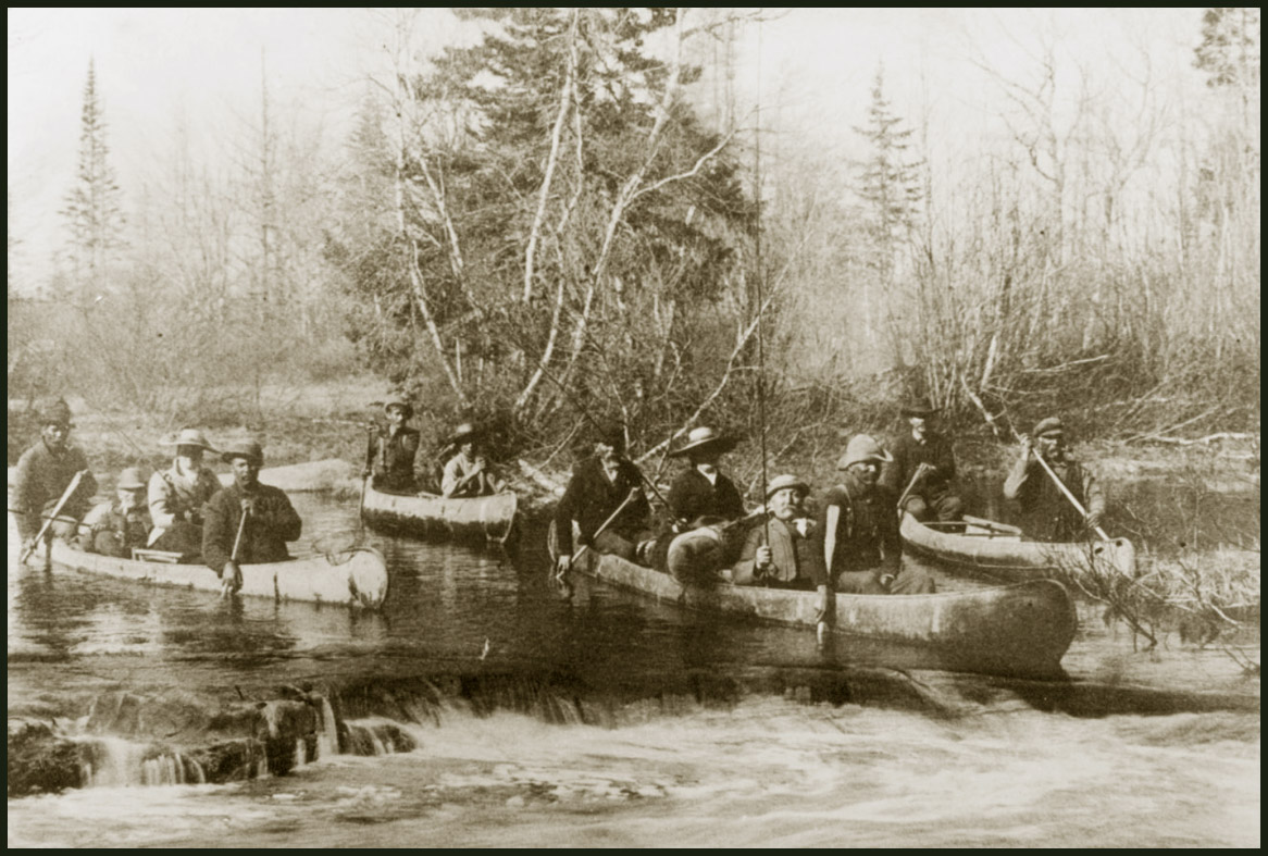
Fishing with Mi'kmaq Guides
European History
European exploration of western Newfoundland began around 1000 CE. According to the Greenland Saga, Norse explorer Leif Eriksson set sail from Greenland in search of lands recently sighted by Bjarni Herjólfsson. After discovering and naming Helluland (“stone-slab land”) and Markland (“wood land”), he found and established an encampment at Vinland (“wine land”). During these voyages, they also frequently encountered Indigenous peoples. In the 1960s, what is thought to be Vinland was excavated by Norwegian archaeologists Helge and Anne Stine Ingstad at L’Anse aux Meadows, located on the tip of Newfoundland’s Great Northern Peninsula, now a UNESCO World Heritage Site.
From Vinland, Leif’s brother Thorvald and other Greenland explorers sailed west into the Gulf of St. Lawrence and east along Newfoundland’s Atlantic coast. The 16th century Skálholt Map, created in Iceland and based on available Norse records, clearly depicts Newfoundland’s Great Northern Peninsula (Promontorium Winlandia), and possibly further south along the west coast to Bonne Bay and the Bay of Islands.
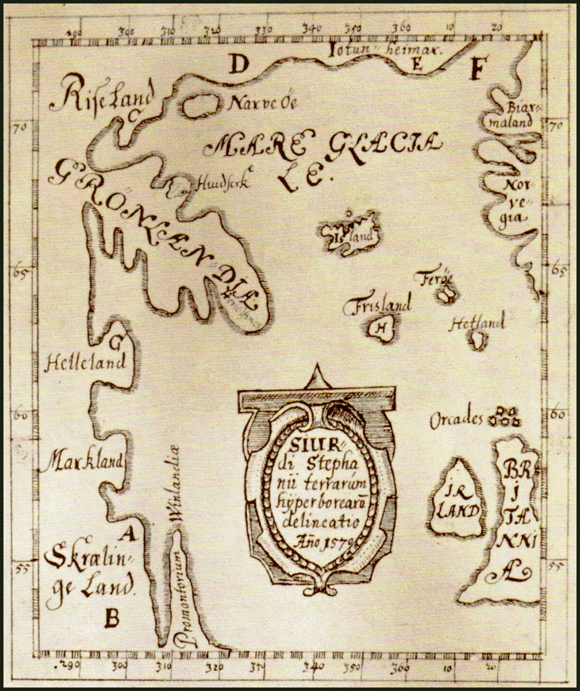
1690 copy of the 1570 Skálholt Map, drawn by Icelandic teacher Sigurd Stefánsson
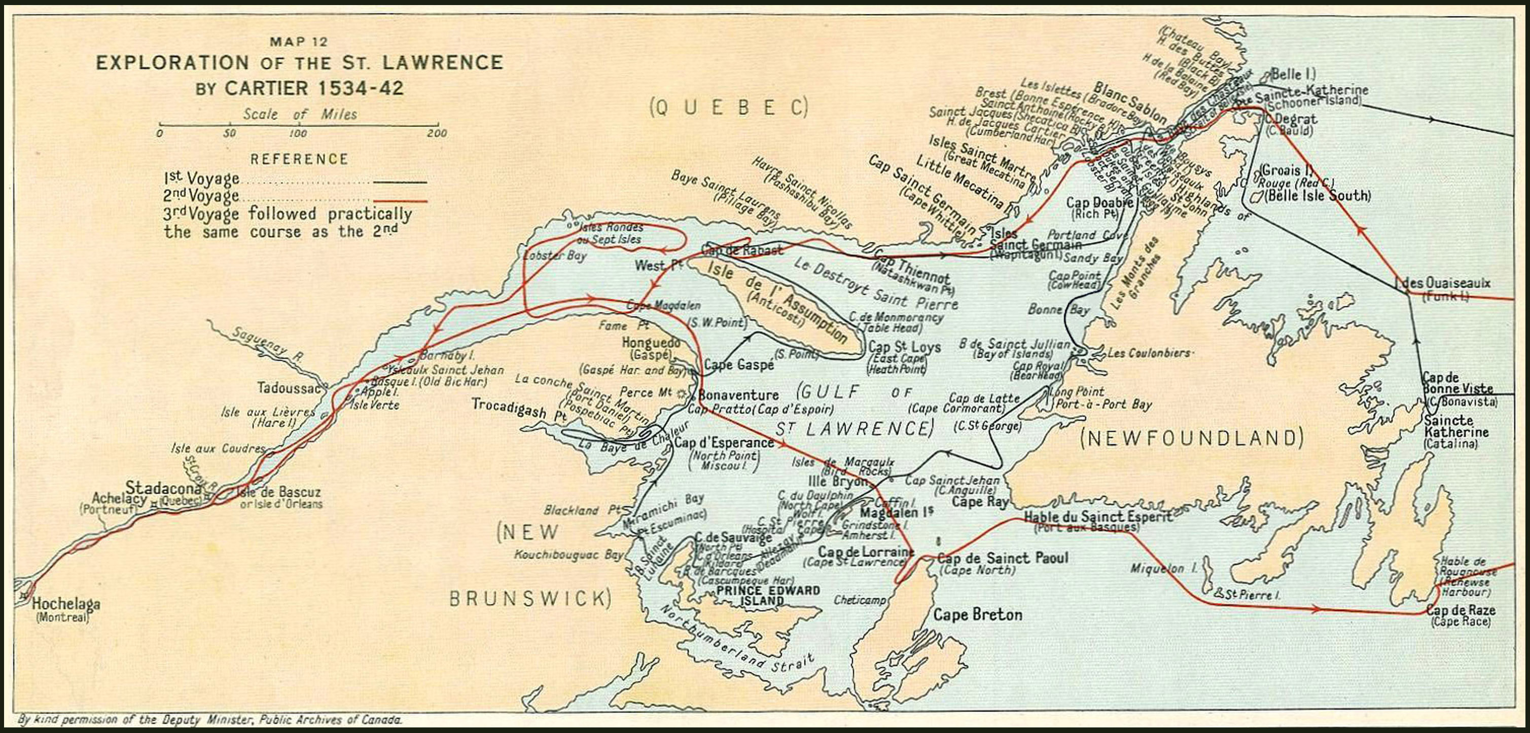
Nearly 500 years passed after the short-lived Norse presence before other European explorers returned. In 1497, Italian born navigator Giovanni Caboto (John Cabot), supported by Italian and Bristol merchants and given a commission by England’s King Henry VII, also “discovered” what was called “New-founde land” while searching for a northeast route to Asia. Gaspar Corte Real and his brother Miguel followed in 1501, seeking out Portuguese possessions in the North Atlantic established by the Treaty of Tordesillas with Spain in 1494, and capturing a group of Indigenous inhabitants to sell as enslaved peoples in Madrid. At this time, maps placed Newfoundland on the eastern (Portuguese) side of the Tordesillas meridian, 370 leagues west of the Cape Verde Islands. It was not until 1534 to 1535 that French explorer Jacques Cartier—who had previously sailed with Portuguese mariners—entered the Strait of Belle Isle and explored western Newfoundland, including the Bay of Islands, to the Cabot Strait. Cartier eventually proved Newfoundland to be one or more islands. He would go on to explore the St. Lawrence River as far as Hochelaga (present-day Montreal), and founding New France.
Cartier was the first recorded European to view the Bay of Islands Ophiolite Complex. In June 1534, after having ‘hove to’ the wind during a storm off Newfoundland’s Great Northern Peninsula, he sighted land again at the Bay of Islands. Before long, Basque fishermen and whalers began plying the waters of the Gulf of St. Lawrence. The highest peak among the surrounding mountains—and the tallest on the island of Newfoundland—became known as “Cabox,” likely derived from the Portuguese and Spanish word Cabo, meaning “cape.”
However, Spanish and French Basque fishers and whalers had been present in the Strait of Belle Isle since the 1520s. Between 1580 and 1630, the Basques established fishing stations throughout the Gulf of St. Lawrence, including the coast of western Newfoundland, among which was Tres Irlac (Three Islands), today’s Bay of Islands. Their legacy includes Red Bay in Labrador, a UNESCO World Heritage site. When the Treaty of Utrecht, (1713) was signed between Britain and France, western Newfoundland was still designated as the Basque Coast. Under the treaty terms, Britain acquired full sovereignty of Newfoundland, while France was given access to the old French Shore (“Côte française de Terre-Neuve”), a littoral extending from Cape Bonavista to Point Riche on the west coast. In 1783, however, the French Shore was renegotiated and redrawn, now extending from Cape St. John along the entire west coast to Cape Ray, including the Bay of Islands, to remain so until 1904. Throughout this entire period, settlement remained sparse and Indigenous peoples inhabited much of this region.
Following the Seven Years’ War in 1763, the old French Shore was reinstated, and the British Admiralty commissioned navigator and cartographer James Cook to survey Newfoundland’s north, south, and west coasts. His five-year project of mapping helped to affirm British sovereignty over the island and consolidate its strategic and commercial importance. Applying innovative hydrographic surveys and geometric triangulation, Cook and his assistants produced the first large scale, highly detailed, and precise maps of eastern Canada, including in 1767, during his final year charting Newfoundland, areas now included in Cabox Aspiring Geopark. Based on his unprecedented accomplishments, Cook was selected in the following year by the British Admiralty and Royal Society to carry out his widely known voyage in the Pacific.
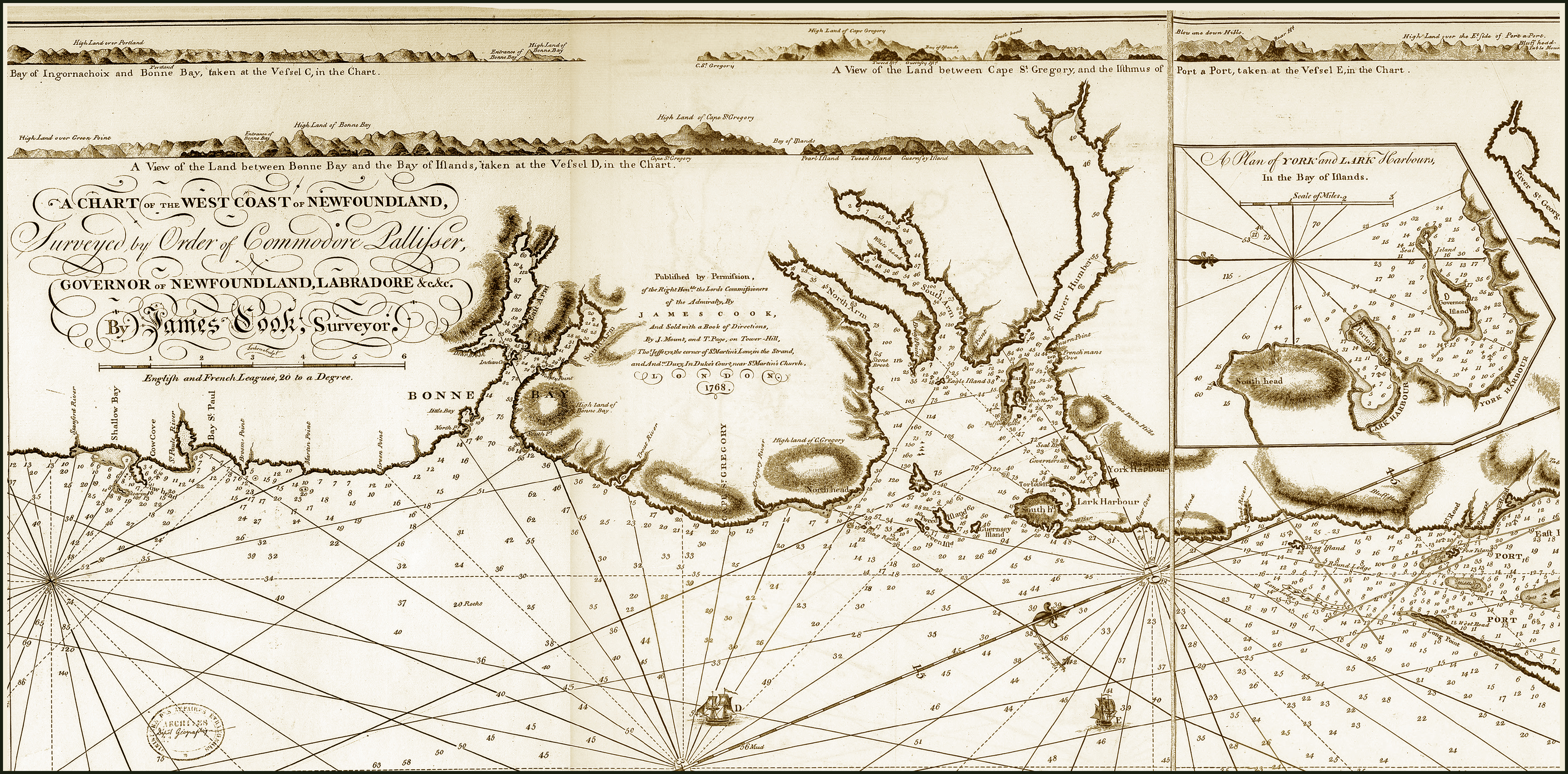
Fragment from James Cook Chart of the West Coast of Newfoundland, 1768
Apart from the Indigenous, French, Basque, and English presence in the Bay of Islands, there was also an ongoing American presence in the Gulf of St. Lawrence after the signing of the Anglo-Convention of 1818 which gave offshore access to American fishers, particularly from Gloucester, Massachusetts. The Bay of Islands, a major centre for herring and part of the American Shore, became a significant source of supply for the American fishery, especially in the early 20th century. Disputes concerning fishing rights involving Newfoundland, Britain, and the United States culminated in the North Atlantic Coast Fisheries Case, adjudicated by the Hague Tribunal of 1910, which established new international rules for foreign fishing.