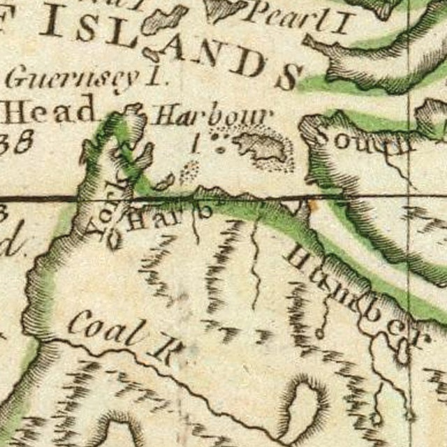
The “Blow Me Down Mountains” appeared on James Cook‘s Chart of the West Coast of Newfoundland published in 1768 after his survey of 1767. They were so named because “WSW and SW winds blow here sometimes with great Violence Occasioned by the nature of the land, there being a Valley of low land between this Harbour and Coal River [Serpentine River] which is bounded on each side with high hills, this causeth these winds to blow very strong over the low land.” York Harbour, at the base of the mountains in Bay of Islands, was identified as a good anchorage and where Cook took on wood, water and other provisions.
Map at left is from James Cook’s A General Chart of the Island of Newfoundland published in 1775, with Serpentine River named Coal River.
The Blow Me Down Mountains are the second of four glacier-carved massifs that together form the Bay of Islands Ophiolite Complex. The mountains rise to a height of 750m (2461ft) at Round Hill and cover approximately 200 sq kms. They are bounded by the outer Bay of Islands to the north, Humber Arm and forested foothills in the east, Serpentine River and Lake in the south, and coastal plain, Little Port Island Arc, and Gulf of St. Lawrence to the west. Road access to the massif is provided by Route 450 on the south side of the Bay of Islands in the north and Logger School gravel logging road in the south, via the Trans Canada Highway or towns of Mount Moriah and Benoit’s Cove in Humber Arm. The OBIEC Cape Blow Me Down Trail, IATNL Blow Me Down Mountain Trail, and Cabox’s UltramaTrex provide access to the plateau from different directions, with cell phone reception only available at higher elevations in the east.
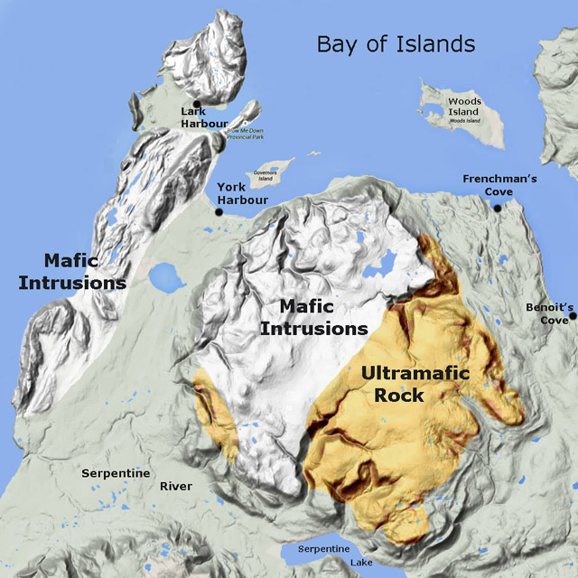
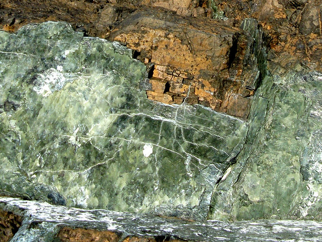
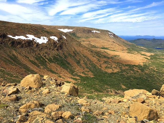
Like the other Bay of Islands Ophiolite Massifs, the Blow Me Down Mountains are “broad, ocean-front mesas with enormous alpine tablelands”¹ composed primarily of two distinct geological formations fused together: ultramafic mantle in the east and mafic oceanic crust to the west. The former is characterized by rust-colored peridotite (oxidized when exposed to the elements) and other silicate rock types, while the latter is characterized by gabbro and other intrusive igneous rocks. These formations were forced to the surface by a process of obduction caused by the movement of the earth’s continental plates in a process called plate tectonics. Like the North Arm Hills, the Blow Me Down Mountains also contain large sections of sheeted dykes and pillow lava, making them more complete ophiolite massifs.
The formation of the Blow Me Down Mountains spans two geological periods: the Cambrian and Ordovician. The former was the first period of the Paleozoic Era (a time of great geological, climatic and evolutionary change) that began c. 541 million years ago (Mya) with the Cambrian Explosion, when life on earth – primarily in the oceans – rapidly diversified to create representatives of all animal phyla. The Ordovician period followed c. 485 Mya and lasted roughly 41 million years. Life continued to diversify in the ocean, and though dominated by invertebrates such as molluscs and arthropods, vertebrate fish continued to evolve. Over millions of years, the abundant life was transformed into major petroleum and gas reserves. However these mountains, having been created by igneous and not sedimentary rock, are devoid of both fossils and oil.
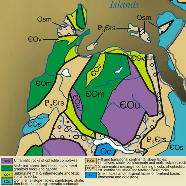
The igneous rocks of the Blow Me Down Mountains are generally either mafic or ultramafic. The latter are composed of intrusive igneous rock known as peridotite, and include serpentinized harzburgite, dunite, pyroxenite, and lherzolite, while the former are composed of a somewhat more viscous intrusive rock called gabbro that includes diorite and minor trondhjemite. Like the other three Bay of Islands Ophiolite Massifs, the Blow Me Down Mountains contain some of the best exposures of ophiolitic rock on earth, made all the more visible by the glacier-carved “gulches” that bisect them.
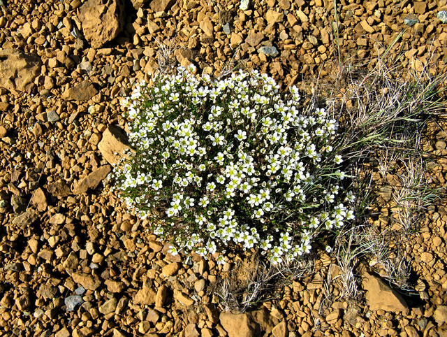
By definition, “ma fic” rocks are high in magnesium and iron (ferrum), while “ultra ma fic” rocks are extremely high in magnesium and iron, to the point they oxidize when exposed to air. As a result, soils composed of these rocks can only support plant species that have adapted to their mineralogical characteristics, including low calcium to magnesium ratio, lack of essential nutrients like nitrogen, potassium and phosphorous, and high concentrations of heavy metals such as iron and chromium. Noteworthy landscapes with endemic species include serpentine barrens at both low and high altitudes, and steep canyon walls with loose scree and low to abundant light.
The Blow Me Down Mountains are separated from the Lewis Hills by the Serpentine Valley. Like the Lewis Hills, the eastern slopes of the BMDM are primarily ultramafic rock from the earth’s mantle, while the central mass and western slopes are composed of mafic rock from the ocean floor, such as gabbro. On the south face, Simms Gulch and Red Gulch drain into Serpentine Lake, while in the north Blow Me Down Brook plunges over a series of waterfalls – including the 45 meter (150 ft) Blow Me Down Brook Falls – before flowing east through a deeply incised cirque-like canyon then turning north to empty into the Bay of Islands approx 3 kms (2 miles) west of Frenchman’s Cove.
Simms Gulch and Blow Me Down Brook Gulch, like Rope Cove Canyon and Travertine Canyon in the Lewis Hills, straddle the discontinuity between mafic gabbro (which is typically a light grey color) and ultramafic peridotite (which is an orange brown rust color). The Blow Me Down Mountains, like the other three Bay of Islands Ophiolite Massifs, straddle the realms of geological wonderland and hiking playground, as the essentially treeless canyons and barren mountaintop plateaus provide relatively easy access with full view of the geological composition. Though strong hikers can cross the mountains in one day in June and July, for most it is a two-day hike.
In the north, hikers can access the Blow Me Down Mountains from the OBIEC Cape Blow Me Down Trail on the eastern side of York Harbour and the IATNL Hummock Trail above Frenchman’s Cove. New or improved routes are being developed from Clark’s Brook near Benoit’s Cove and Blow Me Down Brook Trail near the mouth of Blow Me Down Brook. In the south, hikers can access the mountains by way of the tree-lined IATNL to the entrance of Simms Gulch after wading across the western end of Serpentine Lake. The UltramaTrex route between Simms Gulch and Frenchman’s Cove provides the best views of the ultramafic sections of the ophiolite massif.
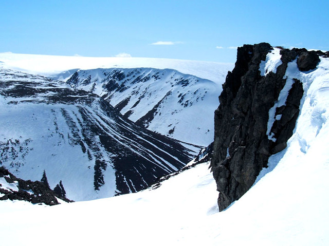
The coming of snow in late autumn changes the character of the Blow Me Down Mountains dramatically. With the exception of the occasional rock outcrop, the white blanket covers the rust-colored peridotite and grey gabbro, making the unique mineral composition hidden from view. Before long, eager snowmobilers head to the foothills to ride the abundant snow. By late winter, the cycles of rain and snow, mild and cold produces a sufficient base for riders to head into the mountains to explore the valleys and plateaus. For out of town visitors, rentals and/or tours can be arranged.
¹ Beyond Ktaadn, Eastern Alpine Guide, ©2012, p. 183

