After 6 months of cutting trees, grubbing sod and spreading … Read More
Cabox Installs Interpretive Panels
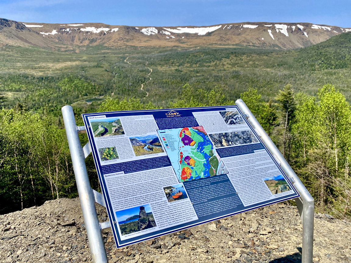
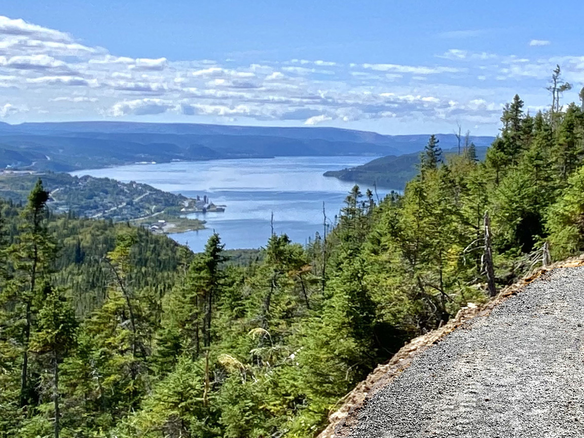
In spring and summer of 2025, Cabox Aspiring Geopark installed numerous interpretive panels at various geosites and points of interest in and around the city of Corner Brook, lower Humber Valley and Bay of Islands. Cabox Overview Panel at Cruise Ship Terminal in Corner Brook Geosite panels designed for particular geosites were installed diagonally on aluminum signposts at geosite locations, as were some Geopark overview panels summarizing Cabox Geopark’s storyline. Other overview panels were installed on walls or vertical signposts at key locations, such as trailheads and cruise ship terminal. Geosite and overview panels at Bottle Cove near the…
Unanimous Support for CGN Site Visit
On March 23, Cabox Aspiring Geopark was notified that the … Read More
Cabox Submits Application Dossier
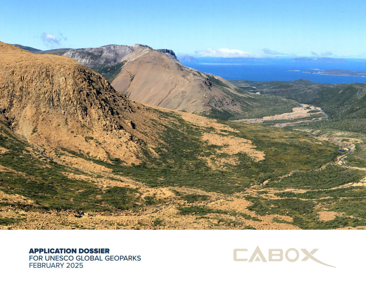
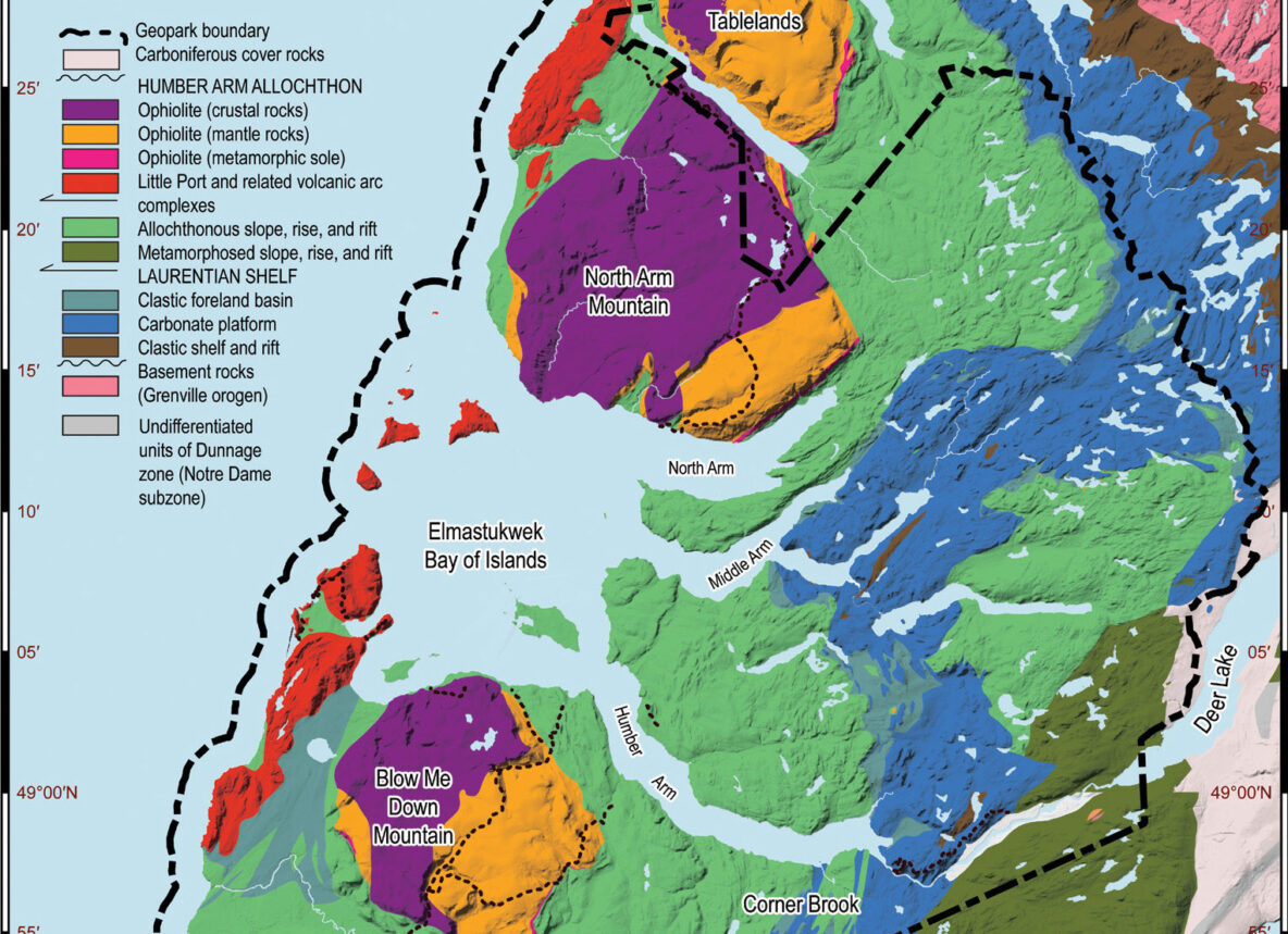
After several months preparing document and annexes, on February 26 Cabox Aspiring Geopark submitted its official application dossier to the Canadian Geopark Network (CGN). Submitting the dossier is the first step in a 2-3 year application process that, if successful, leads to the designation of Cabox as a UNESCO Global Geopark, one of three UNESCO designations. In addition to the 50-page dossier (the limit), the application contained 10 annexes, including a self-evaluation checklist, detailed description of geological heritage and conservation, large scale map showing clearly defined boundary and all geosites, museums and towns, list of endorsements, and one-page general geological description.
Work Completed on First Stage of East Blow-Me-Down Trail

From spring to fall 2024, Cabox Aspiring Geopark in conjunction with the International Appalachian Trail Newfoundland and Labrador (IATNL) developed the first stage of the East Blow-Me-Down Trail off the Forestry Access Road above Benoit’s Cove on Route 450 on the south side of Humber Arm, Bay of Islands. The trail replaces an excavator track to the town’s second water supply that served as the primary hiking route to the East Blow-Me-Down Mountains. It starts near a new parking lot created about halfway down the water supply road, which branches off the Forestry Access Road approximately 2 kms from Route 450.
Cabox Launches “Rock” Video
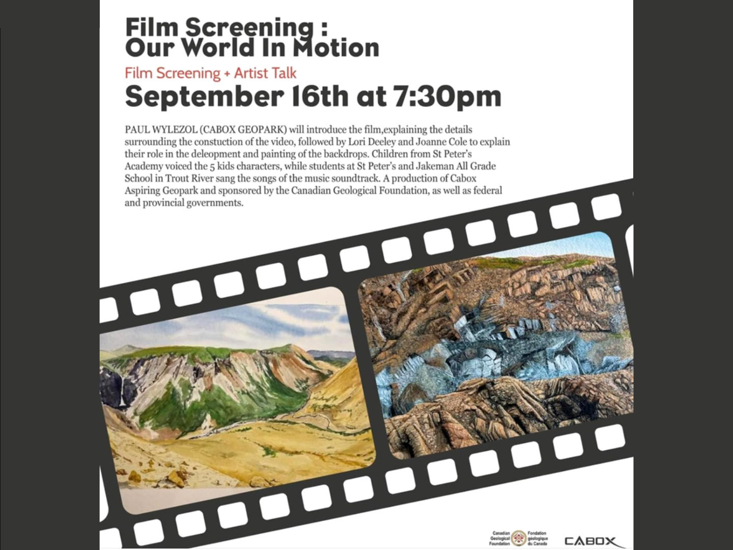
After 2 years of preparation, Cabox Aspiring Geopark launched its animated “rock” video ‘Our World In Motion’ on September 16 at Corner Brook’s Rotary Arts Center. The 12.5 minute video follows the adventures of 5 local school kids as they journey through Cabox Geopark and discover how their lives and environment are characterized by motion. Funded by the Canadian Geological Foundation (CGF), Atlantic Canada Opportunities Agency (ACOA) and provincial department of Industry, Energy and Technology (IET), the video features paintings by artists Lori Deeley and Joanne Cole and animation by Bethany Caldwell. Students from St. Peter’s Academy in Benoit’s Cove …
Gregory River to Shoal Point Traverse
On August 9, 2024, Cabox/IATNL Chairperson Paul Wylezol and Appalachian explorer Lew Coty from Stowe, Vermont made a Gregory Mountains traverse from Gregory River to Shoal Point Cove on the gulf coast south of Chimney Cove. The goal was to identify a one-day hiking route across the oceanic crust on the northwest corner of the North Arm Hills/Gregory Mountains Ophiolite Massif.
The adventure began early in the morning at the intersection of Mogul ATV Trail and Chimney Cove Road 2km south of Trout River Campground where Gros Morne Transportation and Tours picked them up in a side-by-side all terrain vehicle and drove them 10 km to Gregory River.
Cabox Acquires Strategic Land
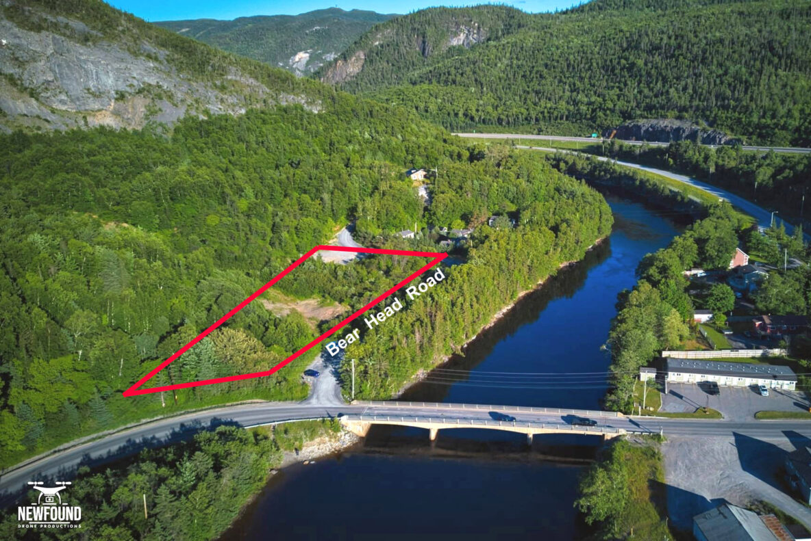
In July 2024, Cabox Geopark Inc. acquired 3 acres of land on the north side of Bear Head Road near Ballam Bridge on Route 440. The strategic parcel of land is located at the intersection of the Trans Canada Highway with Route 440, Route 450, the city of Corner Brook and the trailhead for Humber Valley Trail to Man In The Mountain, which is scheduled for redevelopment in 2025. It is also at the gateway of the proposed Humber Valley National Healing Forest & Trail Park, which would span Humber River Gorge between Corner Brook and Steady Brook. Plans for the land include increased parking area (which would also serve Humber River rafters), Geopark Information Center, Indigenous Heritage Center, Cabox Rock Garden, and a natural outdoor amphitheater.
Work Starting Soon on East Blow Me Down Trail
In Spring 2024, work will begin on the East Blow Me Down Trail, a 4km backcounty hiking route that will connect the Forestry Access Road above Benoit’s Cove on the south shore of Humber Arm to the eastern end of the Blow Me Down Ophiolite Massif. The new IATNL trail will be developed by Cabox Aspiring Geopark, with funding from the Atlantic Canada Opportunities Agency (ACOA), provincial department of Industry, Energy and Technology (IET), and Trans Canada Trail (TCT), of which it will form part of a spur line linked to the Newfoundland T’Railway.
Cabox and Gros Morne National Park Sign MOU
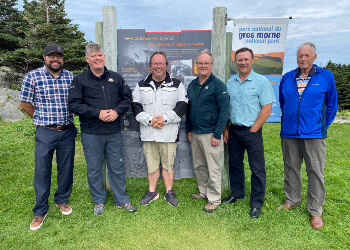
In June 2023, Cabox Aspiring Geopark and Gros Morne National Park (GMNP) signed a Memorandum of Understanding (MOU) to “work cooperatively within and consistent with their respective mandates to identify joint and complimentary opportunities to support the nomination for Cabox Aspiring Geopark to full UNESCO Global Geopark status.” The MOU also identifies areas where Cabox and GMNP “can advance common objectives, achieve common goals, and recognize their cooperation publicly.”