On October 26, 2018, Cabox Geopark and the soon to be Saltbox Restaurant in Benoit’s Cove launched the first Cabox Geopark Information Center. Located approximately halfway along Route 450 on the south side of the Bay of Islands, the center will provide natural heritage and outdoor adventure information to both residents and tourists.
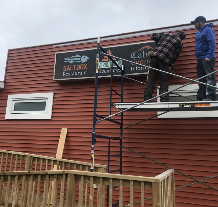
Installing the new sign in preparation for opening day
Opening day included storyboards on renowned surveyor James Cook, who surveyed Newfoundland’s west coast in 1767, and the region’s diverse geology as mapped by a long list of geologists including Newfoundlander Harold “Hank” Williams who colored in Cook’s maps.
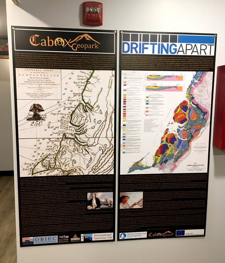
James Cook panel, left, and Drifting Apart geology panel with overlapping maps of the Humber Arm Allochthon
2017 was the 250th Anniversary of Cook charting the west coast, while 2018 is the 250th anniversary of the publication of his Chart of the West Coast of Newfoundland.

Top right, James Cook’s Chart of the West Coast of Newfoundland
Also on display were about a dozen James Cook panels that will be erected along the newly designated James Cook Heritage Trail in Blow Me Down Provincial Park between York Harbour and Lark Harbour.
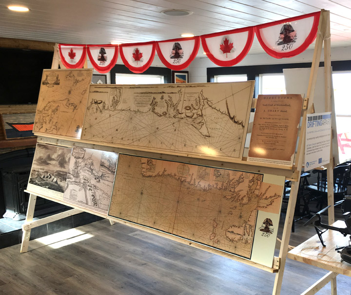
James Cook maps of Newfoundland to be displayed along the newly designated James Cook Heritage Trail
Of course a Geopark wouldn’t be complete without a modern topographical map to locate infrastructure, geosites and recreational services and attractions.
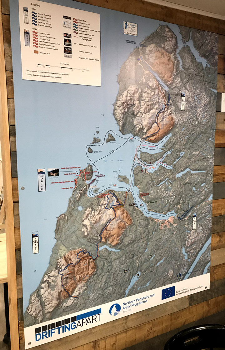
Cabox Geopark topographical map produced with funding acquired through the Drifting Apart project
The map was acquired with funding made available through the Drifting Apart project, as was a professional DJI Inspire 2 drone with Zenmuse X5S camera which was on display.
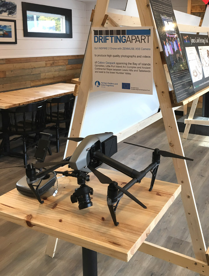
DJI Inspire 2 drone with Zenmuse X5S camera
Drifting Apart project also sponsored a series of interpretative signs erected around the Bay of Island and Trout River, as well as a half million dollar virtual reality (VR) program featuring the natural and cultural heritage of the DA partners, including Cabox.
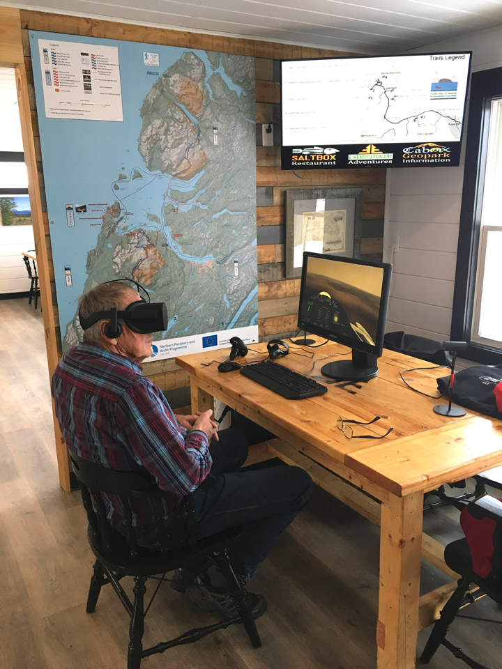
Cabox Geopark’s Arne Helgeland dons an oculus rift headset in preparation for a virtual tour of the Bay of Islands
The Cabox Geopark VR includes 360 video footage from 9 geosites, as well as 5 virtual information panels with audio description.
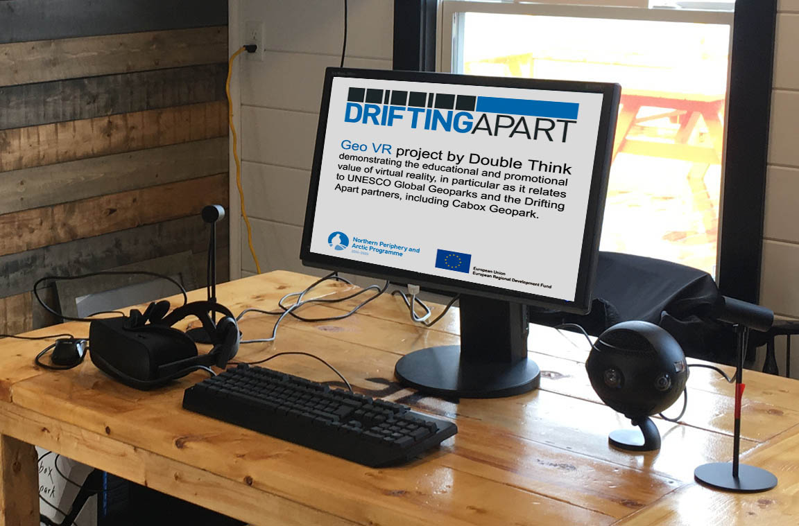
Drifting Apart sponsored Virtual Reality (VR) station, including PC and monitor, Oculus Rift headset, controllers and sensors, and Insta360 3D camera
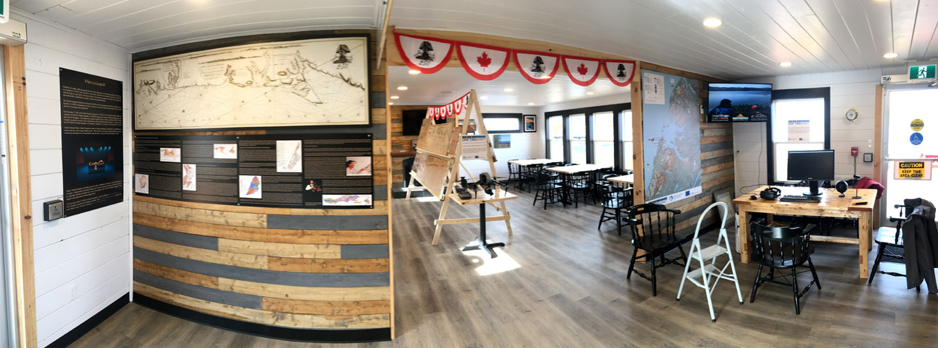
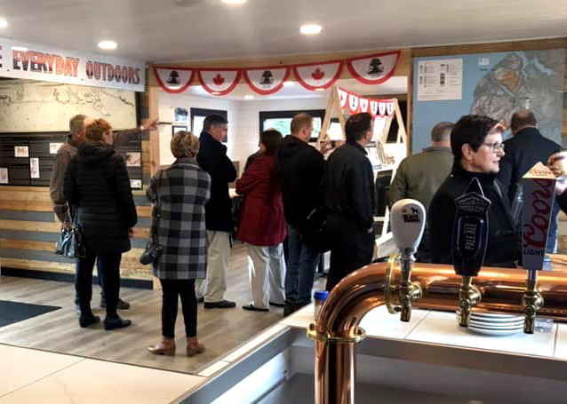
Interior view of the Saltbox on opening day (click to enlarge)
The Saltbox and Cabox Geopark thank everyone who dropped by, including the mayor and councillors of Humber Arm South
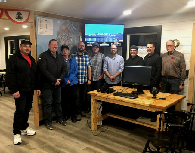
Saltbox Information Center partner reps and Humber Arm South Mayor and Councillors at the Saltbox
and invite anyone who hasn’t yet visited to drop by for some delicious food for both body and mind!
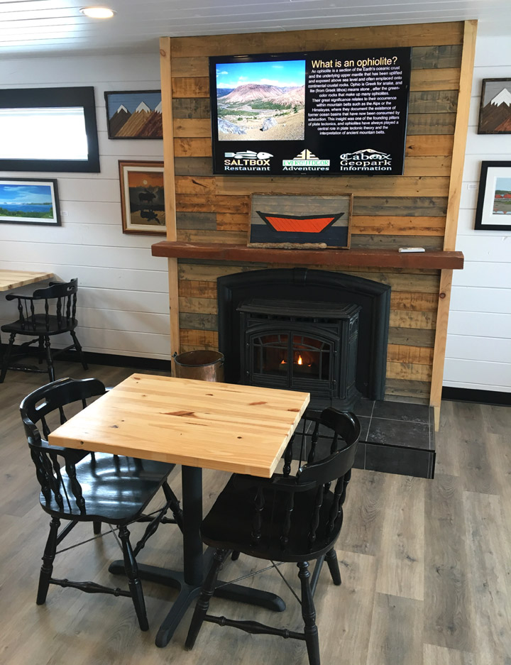
A cozy spot by the fireplace awaits you!
For more on the story, visit the Western Star website.