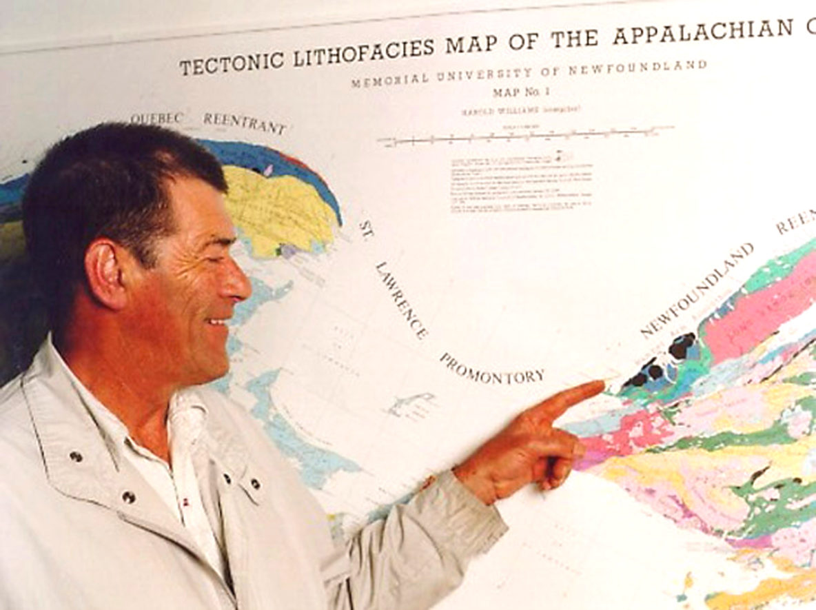
Harold “Hank” Williams points to the Bay of Islands Ophiolite Complex on his Tectonic Lithofacies Map of the Appalachian Orogen
On Saturday, December 15, 2018, Cabox Geopark commemorated the 40th Anniversary of the Tectonic Lithofacies Map of the Appalachian Orogen. The map was compiled by renowned Newfoundland Geologist Harold “Hank” Williams, with assistance from his graduate student Jim Hibbard who continued to update and digitize the map at North Carolina State University where he was Professor Emeritus until his recent retirement.
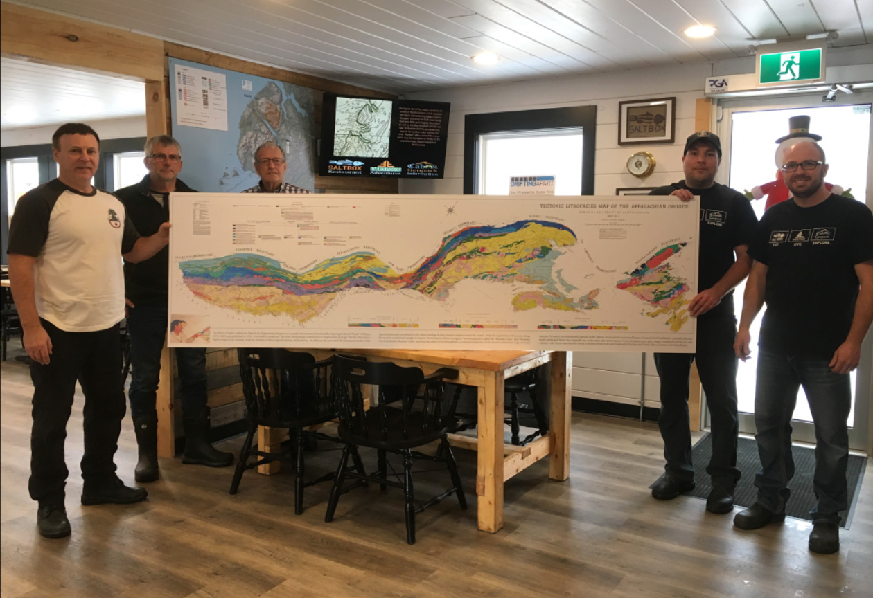
(L-R) Paul Wylezol, Cabox Geopark; Adrian Hulme, OBIEC; Arne Helgeland, IATNL; Rob Thomas and Eric Bourgeois, Saltbox Restaurant
In 2015, Jim joined the International Appalachian Trail (IAT) at the Appalachian Trail Conservancy Biennial at Shenandoah University in Winchester, Virginia, where they presented Tectonic Lithofacies Maps to the Appalachian Trail Museum in Pine Grove State Park, Pennsylvania (where in June 2010 the IAT welcomed Scotland’s West Highland Way as its first European chapter), and the Executive Director and Management of the ATC in Harper’s Ferry, West Virginia.
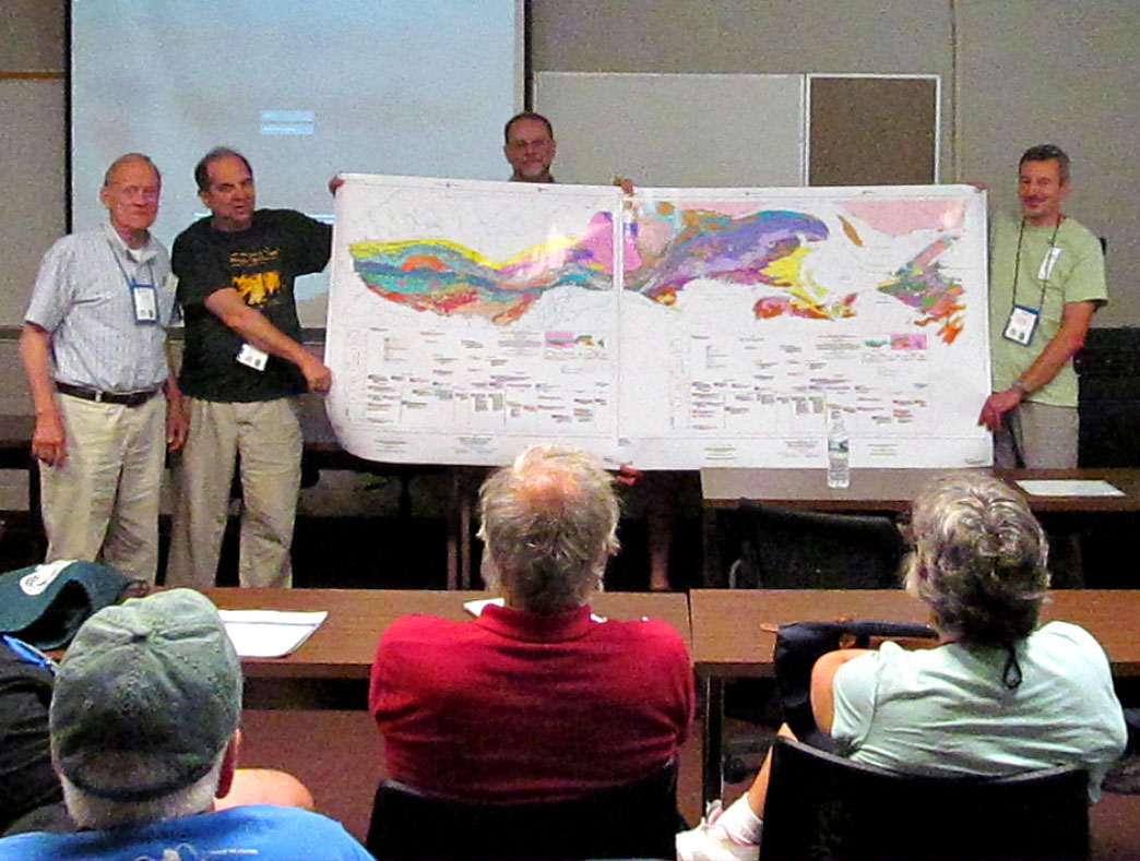
(L-R) Richard “Dick” Anderson, IAT Founder; Larry Luxemberg, AT Museum President; Jim Hibbard; & Hugh Barron, British Geological Survey
Harold “Hank” Williams is generally considered Newfoundland’s best known scientist, who in the 1960s helped confirm the theory of plate tectonics and whose re-mapping of the Humber Arm Allochthon led to UNESCO World Heritage status for Gros Morne National Park. He was the obvious choice to give a visiting Prince Edward a tour of the Park, and when a prominent onlooker asked “Aren’t you lucky to be the one to guide the Prince?”, he replied, “No my son, tis buddy who’s the lucky one, think now he could have been stuck with some political ringer instead of spending his time with me, the guy who knows most about the history of the rocks in this Park.”
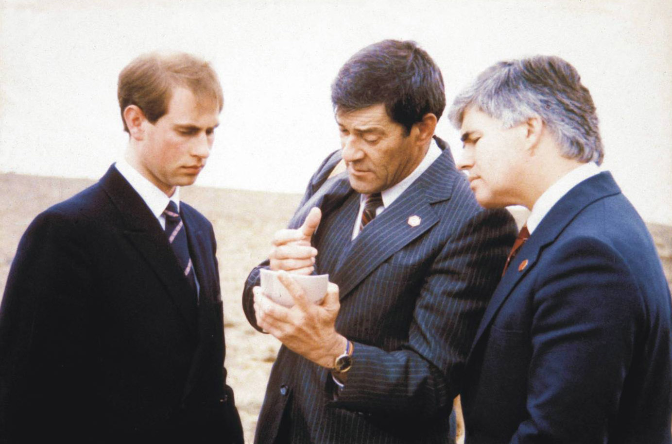
Hank Williams (center) explains the region’s geology to Prince Edward (left) during a tour of Gros Morne National Park
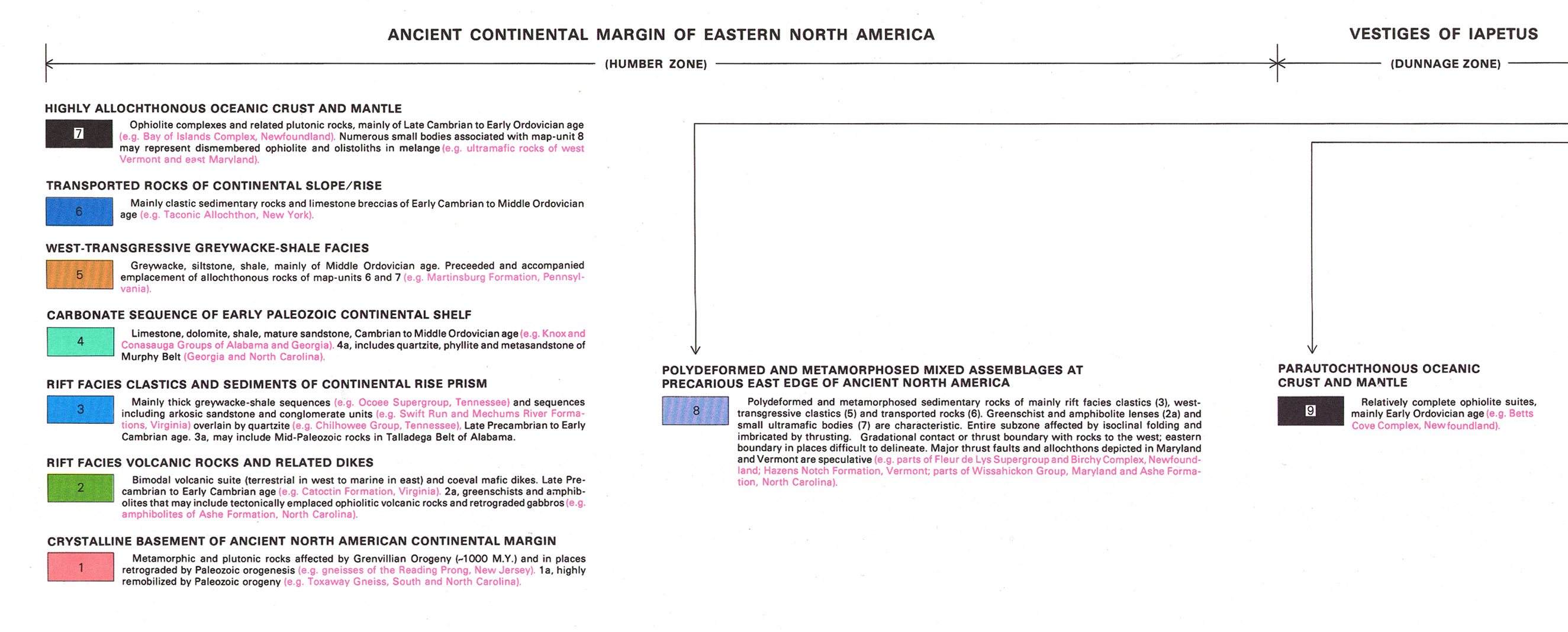
It is said that Hank’s Tectonic Lithofacies Map of the Appalachian Orogen “must be regarded as the most outstanding contribution to Appalachian geology … and few geology departments in the western hemisphere and Europe do not have it hanging on their walls.” It is the first map to depict orogen-scale tectonic elements in terms of their original settings and locations and its influence has pervaded all subsequent studies of the Appalachians and contributed to the understanding of other ancient orogens around the world.
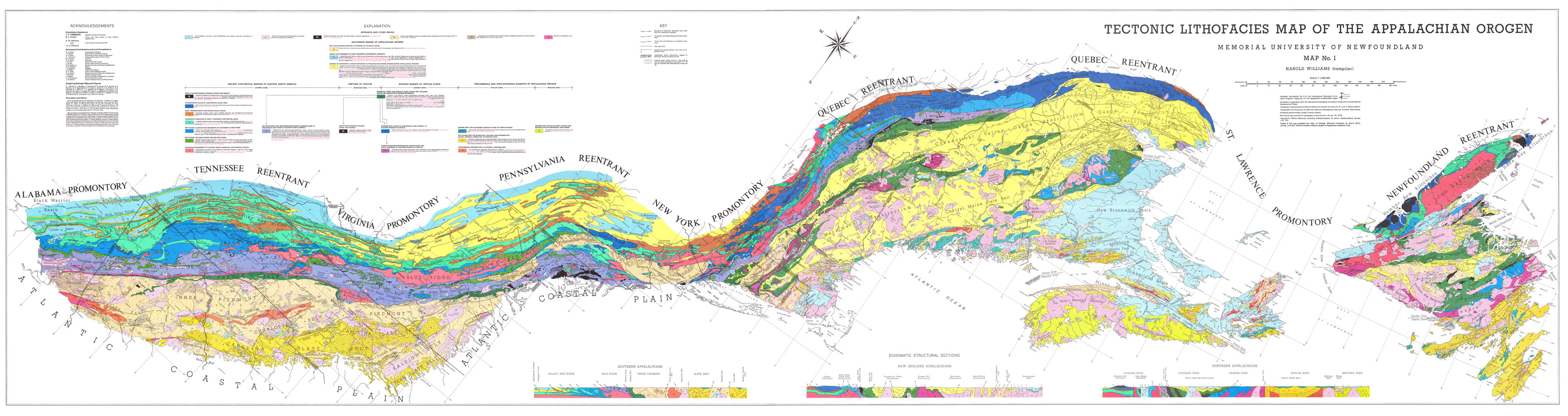
It is noteworthy that on the map, the Appalachian Mountains along the ancient continental margin of eastern North America from Georgia to Newfoundland is called the “Humber Zone” after Western Newfoundland’s Humber Valley. Also of note, the island of Newfoundland is composed primarily of the ancient continental slope of North America (Western Newfoundland), remains of the Iapetus Ocean and its associated basins (Central Newfoundland), a partially discrete small continental block that originally lay on the other side of the Iapetus Ocean (Gander area), and a larger continental block that also collided with North America and closely correlates with rocks now exposed in Europe and North Africa (Eastern Newfoundland).
On Saturday, December 15, a copy of the Tectonic Lithofacies Map was installed at Saltbox Restaurant and Cabox Geopark Information Center in Benoit’s Cove, and will be on permanent display with the other geopark maps and information panels. Drop in for a look … and a delicious home-cooked meal!
