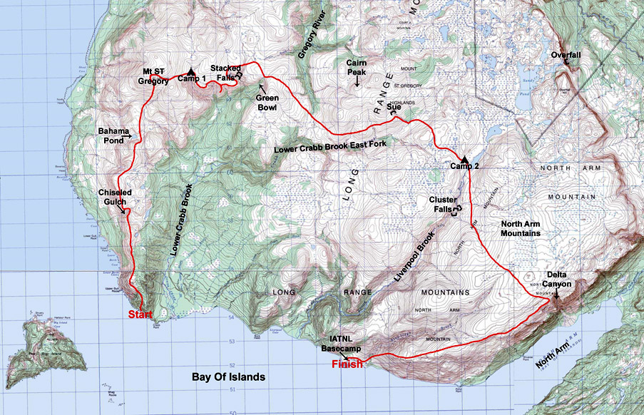
August 6-8, 2019, Appalachian explorer Lew Coty from Vermont, USA undertook a 3-day trek across the Bay of Islands north uplands in search of a St Gregory’s Arc hiking route from the southern end of the Gregory Mountains across the North Arm Hills to the IATNL basecamp at Stowbridges. He was joined during the first half of the trek by IATNL Chairperson Paul Wylezol who broke off midway to explore Lower Crabbs Brook.
In Lew’s own words:
Along the west coast of Newfoundland there is a vast stretch of highland wilderness extending from the Bay of Islands north to the Trout River Pond fjord. The southern end of this plateau is carved by the Lower Crabb Brook on its west side and Liverpool Brook on its east side. Mt St Gregory is the westerly height of land; the east side is dominated by the North Arm Mountains that rise out of the Bay’s North Arm. An International Appalachian Trail route has recently been developed starting from a base camp at Stowbridge Head just east of the mouth of Liverpool Brook, and heading north across the North Arm Mountains to Trout River Pond. The highlands west of this route aren’t so well known and not often explored.

During a previous trip to Mt Gregory I had gazed south down a long barren ridge that ends at the western end of the Bay. It looked like stellar hiking, and I had a bee in my bonnet to give it a go. Speaking with my friend Paul Wylezol, who is the chairperson of the IATNL and has developed much of the Newfoundland sections of the IAT, it didn’t take long for me to convince him that we needed to check out that south shoulder of Gregory.
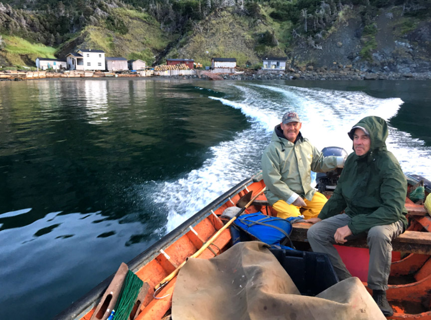
August 6, 2019 After having spent the night at the IAT base camp, Paul arranged a ride with a local fisherman named Kerry Park to deliver us to the base of that shoulder. We rounded the headland west of the Lower Crabb Brook mouth, and were dropped off against a rugged shoreline after spotting a possible route up to the highlands where Kerry said he had seen moose ascending.

The first hundred feet up was a bit of an acrobatic challenge and unfortunately the moose trails above became braided and not well worn. Looking back I waved to our last contact with civilization for several days.

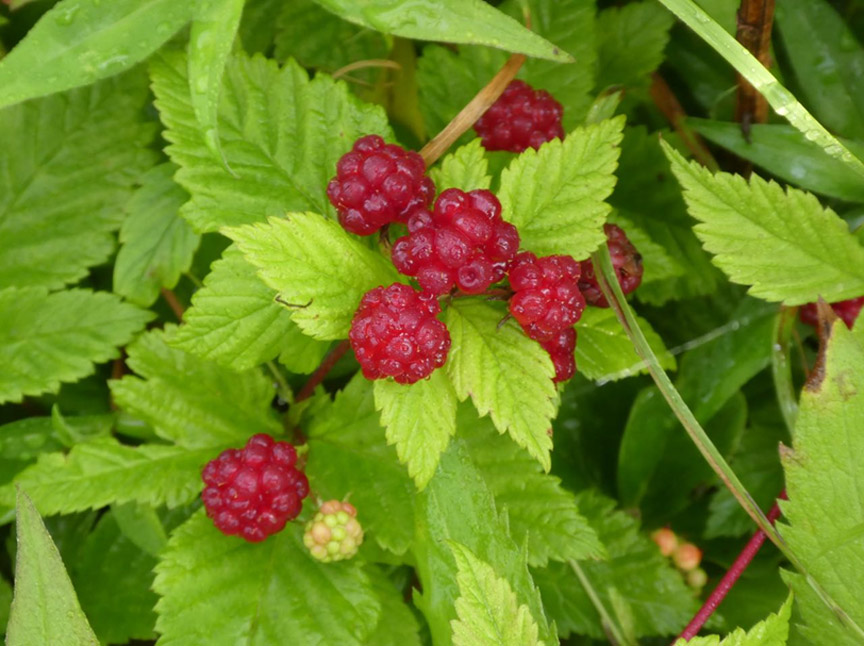
We zigzagged up the initial eight hundred feet, dodging tight growth and seeking out the moose runs wherever we could find them. The miserable hiking terrain was made a little more bearable by the dewberries that kept showing at our feet. It was especially frustrating looking at a barren ridge to the northwest that would have been so much easier to ascend, but was unfortunately separated from us by a deep gnarly valley.
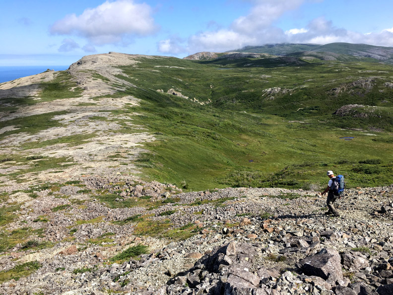
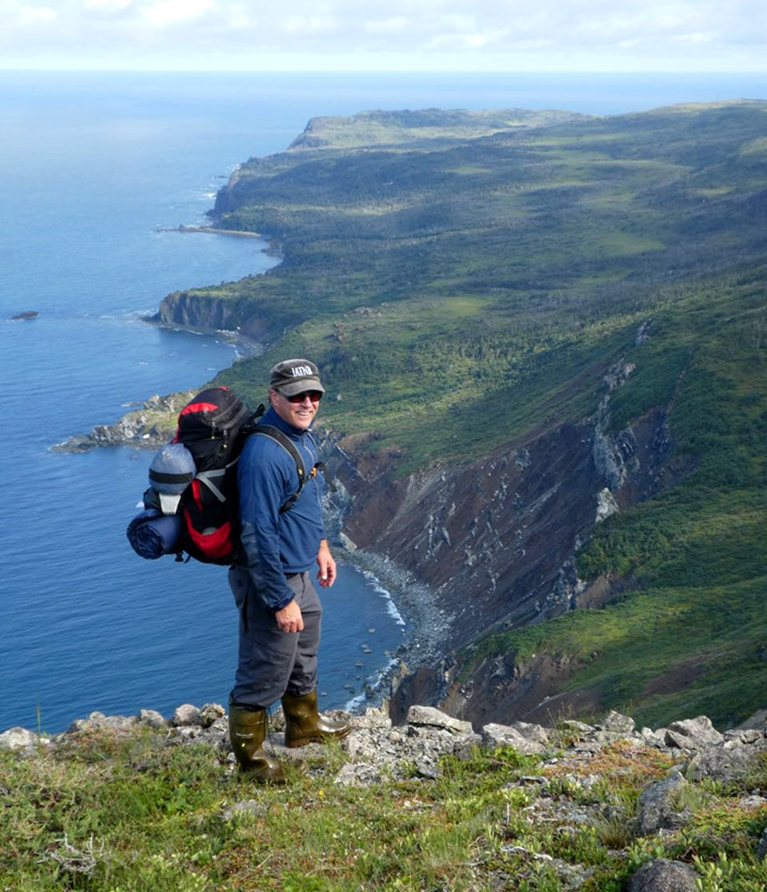
Finally on the ridge top, we proceeded northwest and popped out onto the open barren that pointed the way to Mt Gregory. The views immediately became spectacular as we could look down and across to the islands in the bay below

and up the cliff-lined shore to the north.
Heading up this ridge was a smooth rocky ascent, and the scenery became more detailed and enchanting with alpine ponds and corrugated topography always beckoning ahead.

Read more on the IATNL website…