Though it was a little warm for hiking, the occasional cloud and ocean breeze made for a pleasant 12-hour 23km trek into the remote western Blow Me Down Mountains on August 11.
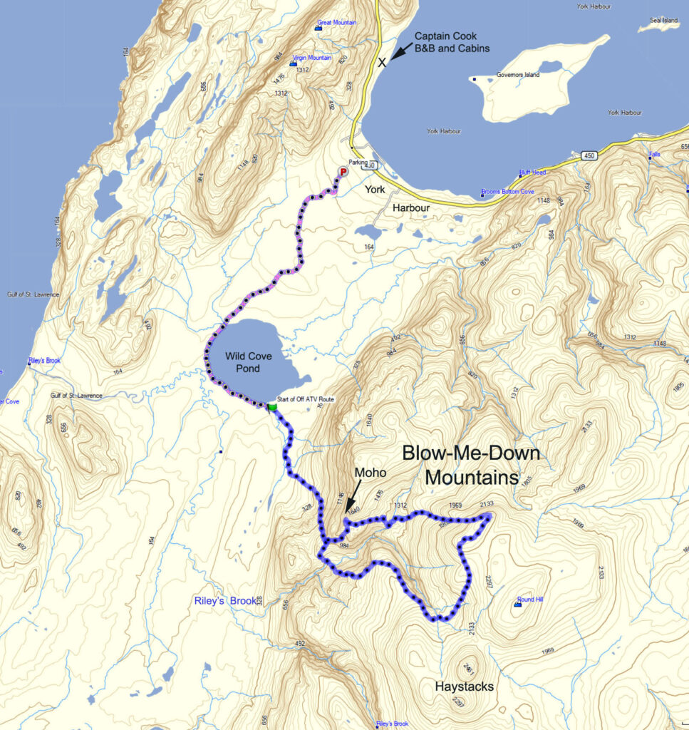
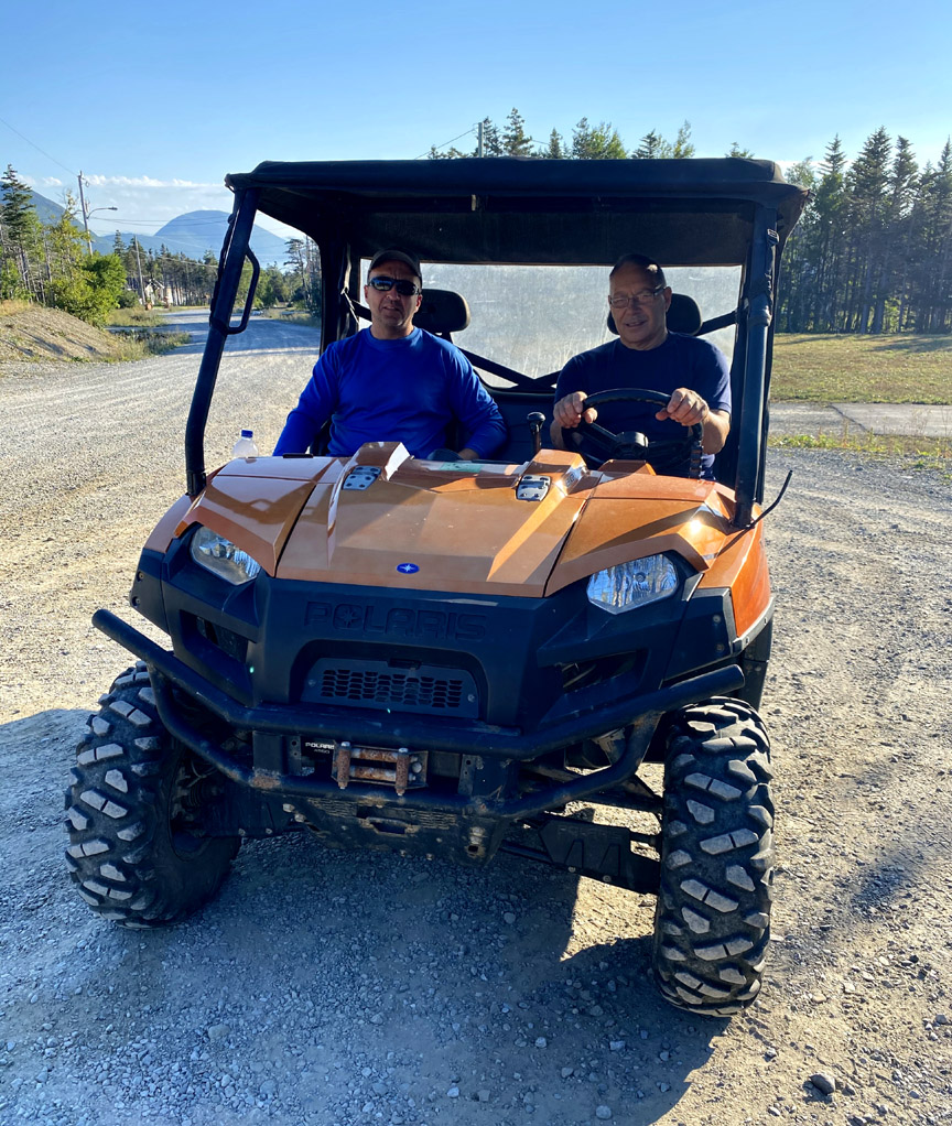
The adventure began with Captain Cook B&B and Cottages’ Alan Shepherd giving IATNL directors Paul Wylezol and Delano Pittman a side-by-side ride from York Harbour on the southern side of the outer Bay of Islands to the southeast corner of Wild Cove Pond, where the York Harbour/Lark Harbour network of ATV trails ends near the base of the Blow-Me-Down Mountains.
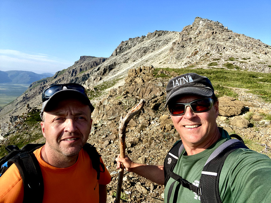
The goal of the trek was to find an access to/from the mountains below Round Hill and The Haystacks (the highest peaks on the Blow Me Downs) that would provide a 2-day east-west traverse of the hills from Benoit’s Cove via the back end of Simms Gulch.
The route as is requires a small amount of to-the-knee bushwhacking and a little scree hopping, but with a few improvements it will provide an intermediate level trek with great new views of and from the Bay of Islands Ophiolite Massif, and more examples of its stunning geology.
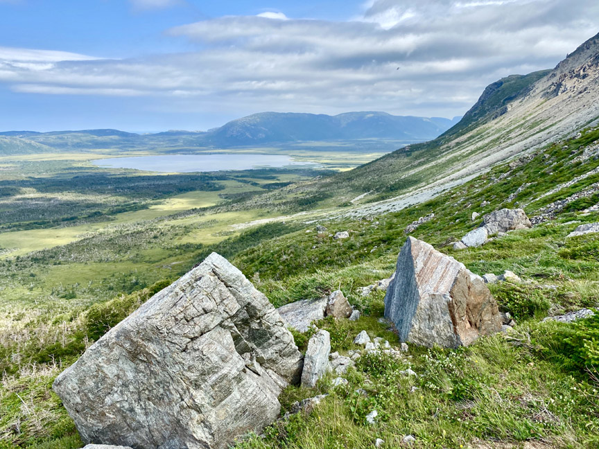
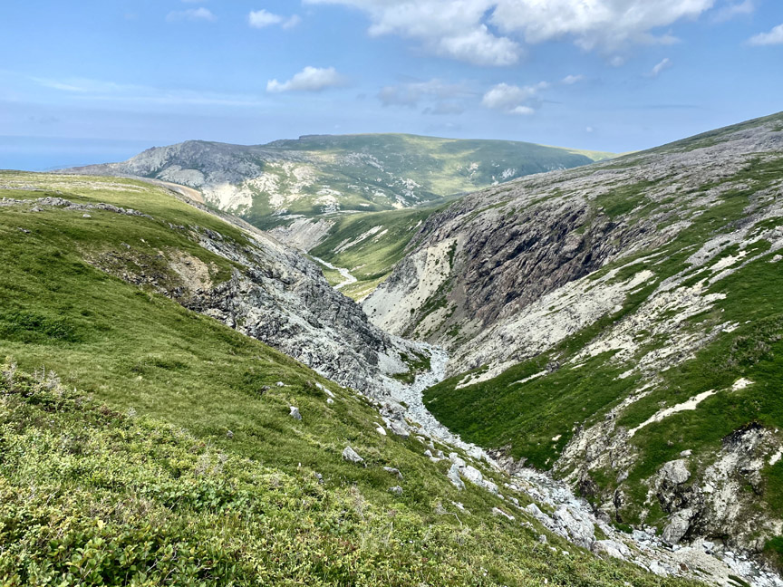
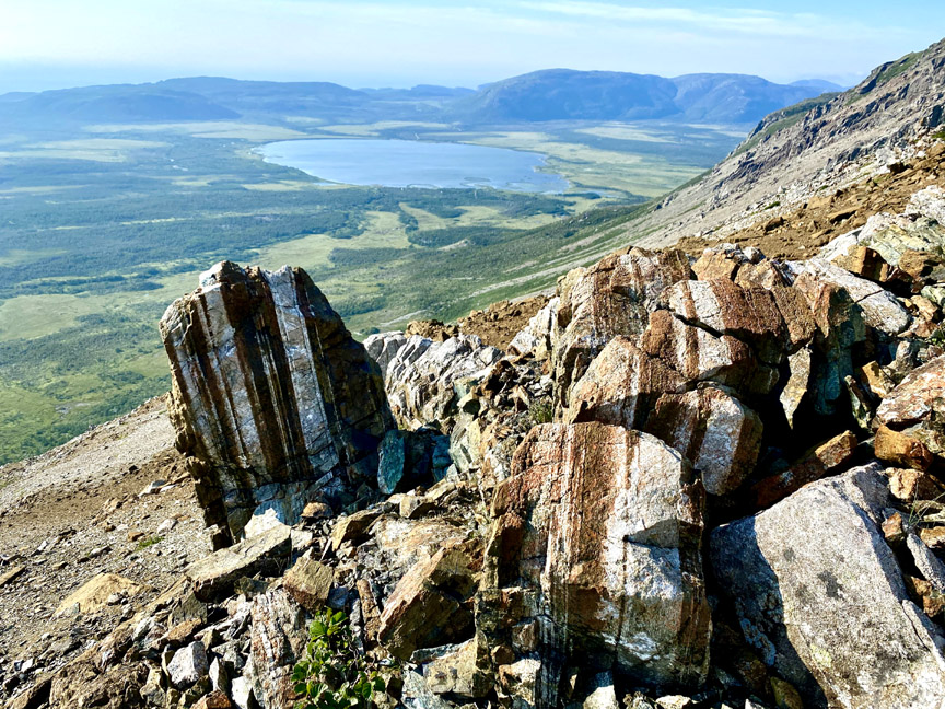
Once past the base of the mountains and into the north branch canyon of Riley’s Brook, the massif reveals a landscape of rust-colored peridotite from the earth’s mantle and light gray gabbro from the ocean crust.
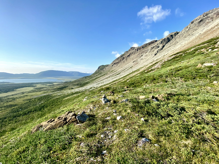
The south bank of the canyon is characterized by a long, barren, rocky slope with occasional patches of low shrubs, which makes for an easy climb or descent with great views of the brook and opposing hillside.
Once above the fork in the brook, the peridotite disappears and the canyon transforms into a strictly gabbroic viewscape.
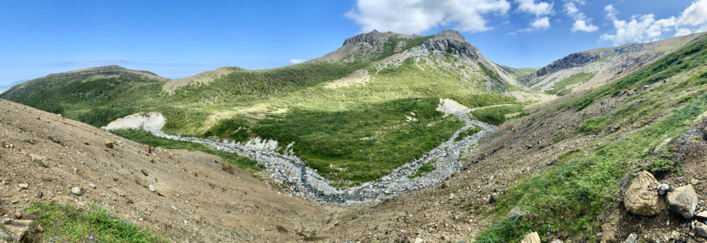
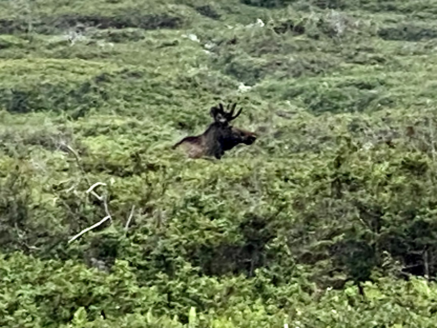
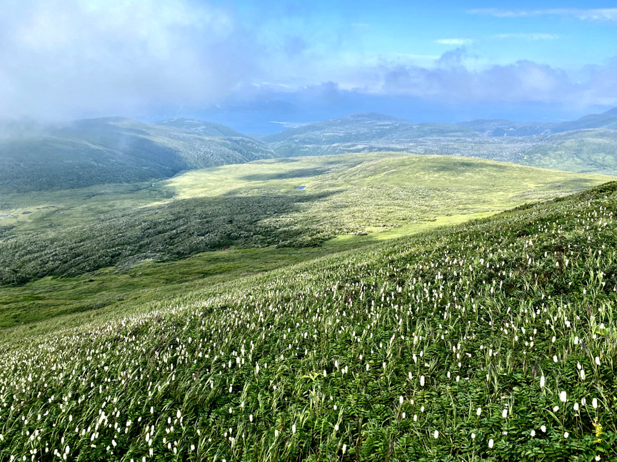
This mid-level plateau contains interconnected patches of 4-6ft scrub, where several moose graze in relative obscurity.
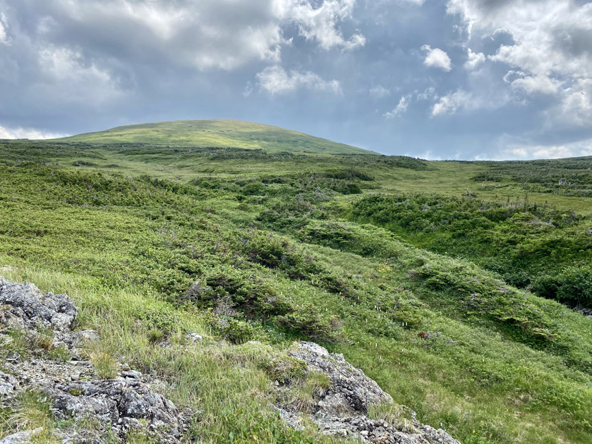
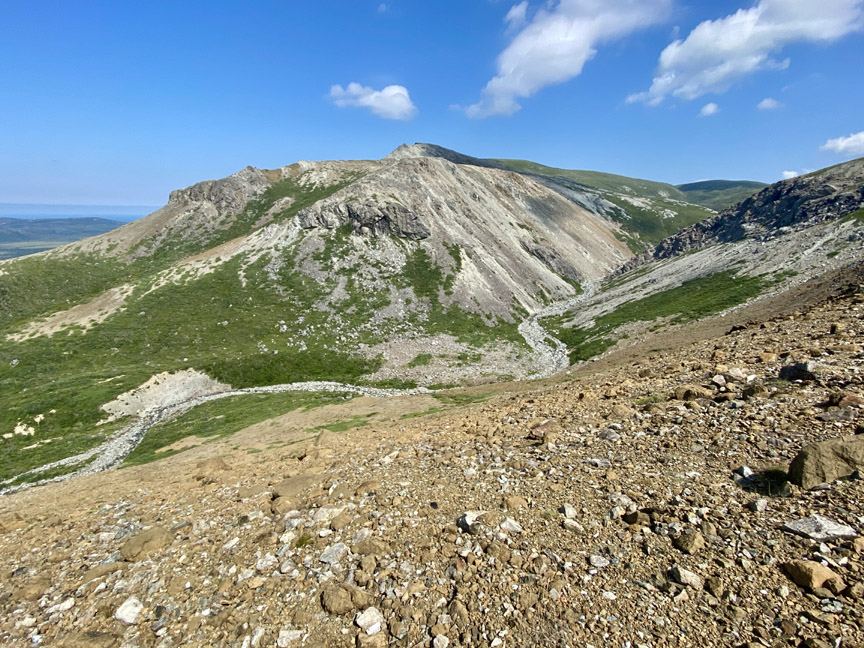
Looming above at approximately 800 meters (approx 2,500ft) are the dual peaks of the Haystacks and Round Hill, the highest peaks on the Blow-Me-Down Massif.
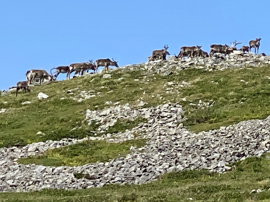
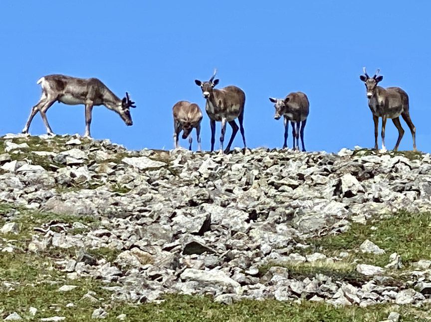
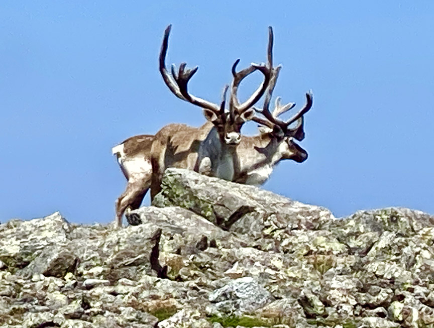
These large round hilltops are ideal feeding grounds for caribou, and Paul and Delano were lucky enough to see a small herd of about 2 dozen animals.
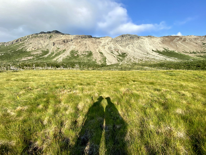
When not blocked with low-lying clouds, the views from the top are expansive, particularly to the east across the grass and lichen-covered mountains.
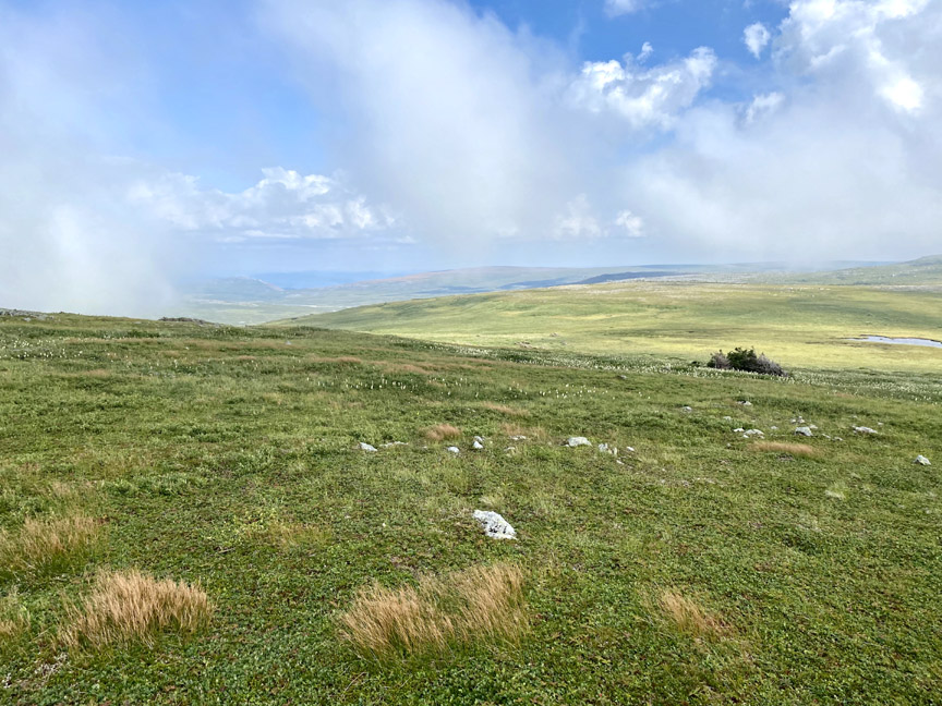
Descending the hilltops in a wide arc reveals views to the northwest, with the outer Bay of Islands visible in the background.
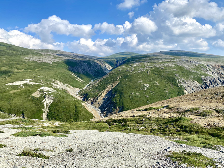
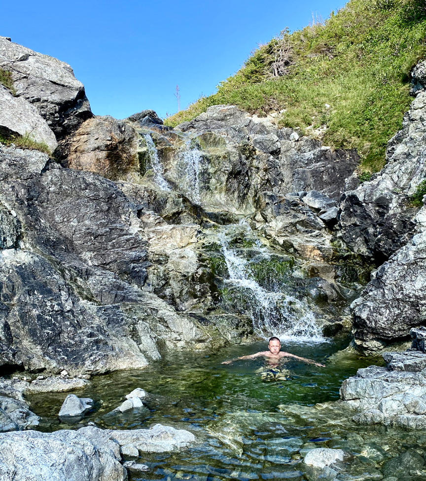
Far below it is necessary to cross the north fork of the north branch of Riley’s Brook, where a pretty little waterfalls and pool provides an ideal opportunity to cool off in the crystal clear water.
From there a relatively short climb uphill and Paul and Delano were at the edge of the Blow Me Downs’ western escarpment.
The southern end of the escarpment marks the boundary between the earth’s mantle and ocean crust, both pushed to the surface by plate tectonics during the closing of the Iapetus Ocean approximately 500 million years ago. Here one can see a section of the Mohorovičić Discontinuity (aka Moho) where the ocean crust emerges from the mantle, generally characterized by various interconnected and overlapping layers of gabbro and peridotite.
As the escarpment faces west, it is best viewed in late afternoon when the sun shines directly on the mountains.
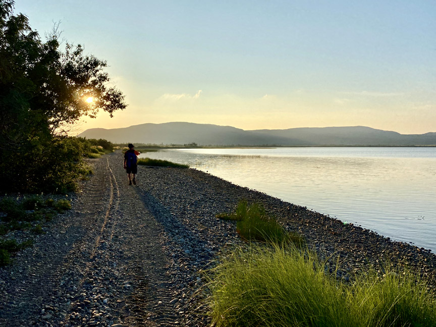
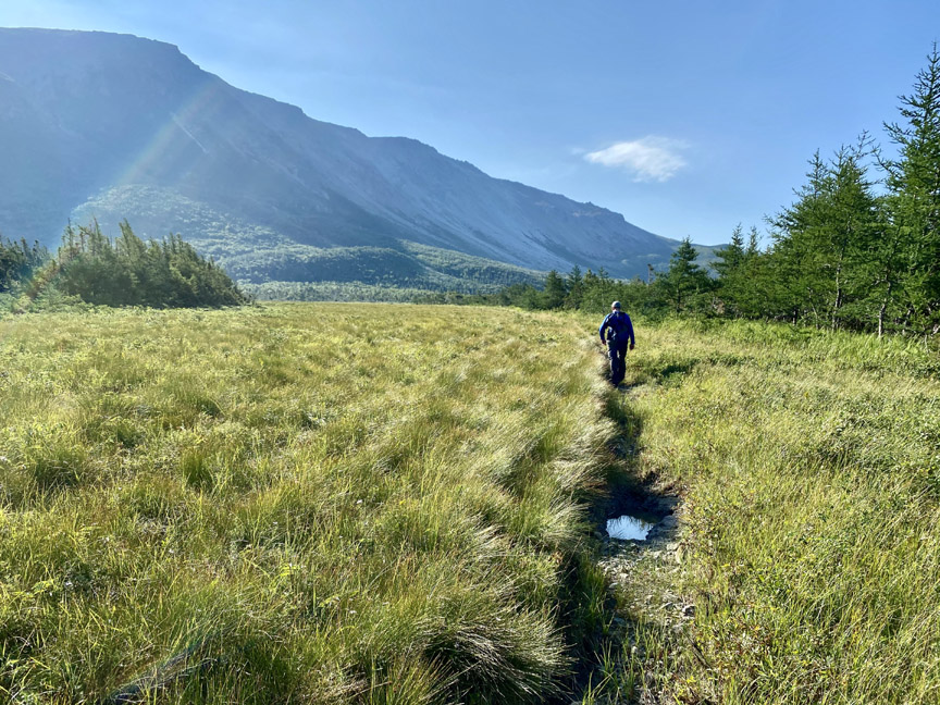
It is only a short walk back to Wild Cove Pond on the same foothill ledge and coastal wetlands that stretch intermittently 6kms from mountain to sea.

Once at the pond the sun is low in the sky, and thankfully it’s only a 6.5km walk back to the parking lot in York Harbour on an easy to walk and follow – even in dark – ATV trail.