As one of the most spectacular and remote canyons on the island of Newfoundland, Simms Gulch on the south side of the Blow Me Down Mountains requires inclusion on any diehard adventurer’s bucket list.
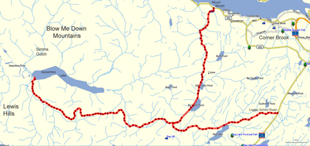
Located above the northwest corner of Serpentine Lake, it is accessed by gravel logging road after a 1.5 hour drive from either the Trans Canada Highway or town of Mount Moriah on the south side of the Bay of Islands.
In the 1960s this pristine wilderness area, along with the northeast corner of the Lewis Hills, was held in reserve to be developed into a major provincial park. However with the designation of Gros Morne National Park surrounding nearby Bonne Bay, the plan was abandoned and the picturesque Serpentine Valley became a hunting and fishing playground for the determined few with the knowledge and means to get there.

With the creation of the National Park and parallel developments in the theory of plate tectonics, there was also a new appreciation for the geological significance of the Bay of islands (Ophiolite) Massifs, including the Lewis Hills and Blow Me Down Mountains.
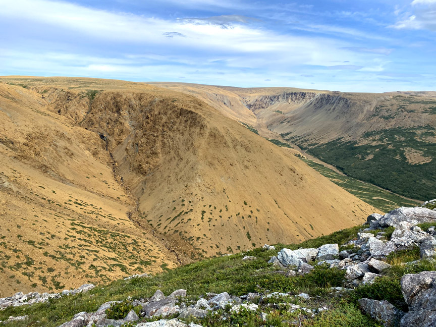
Like Blow Me Down Brook Gulch on the north side of the mountains, Simms Gulch is characterized by a collision between the gray gabbro of the ocean crust to the west with rust-colored peridotite (e.g. harzburgite and dunite) of the earth’s mantle to the east.
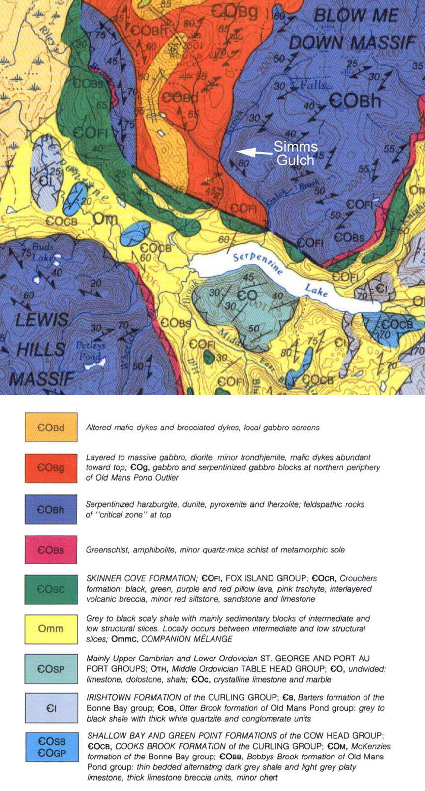
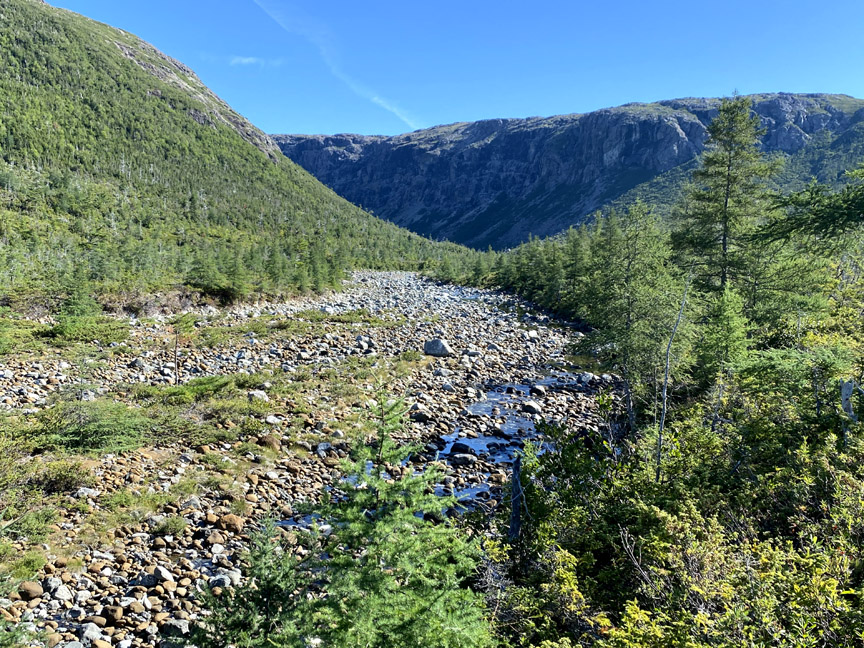
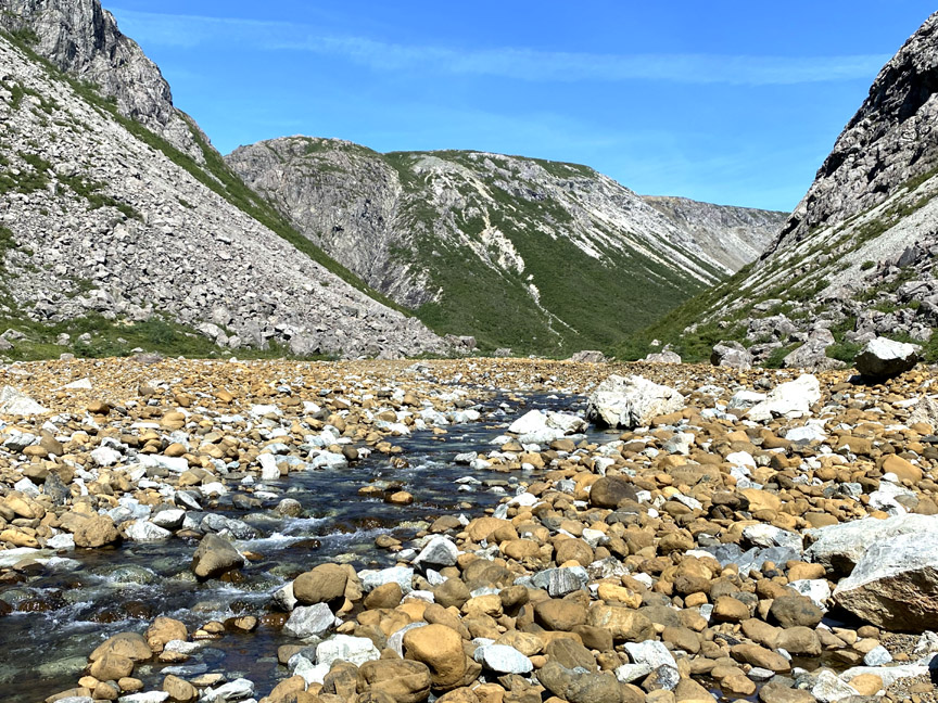
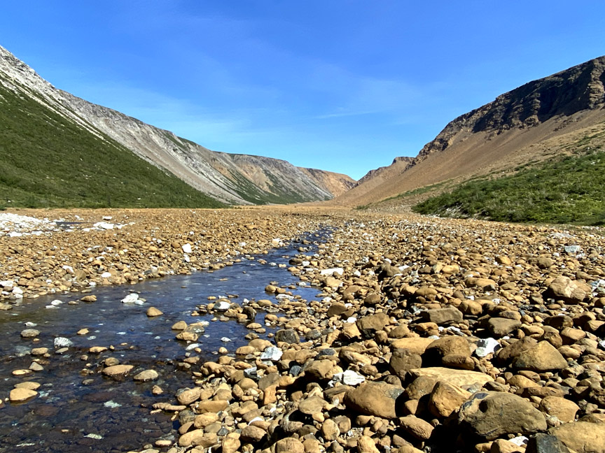
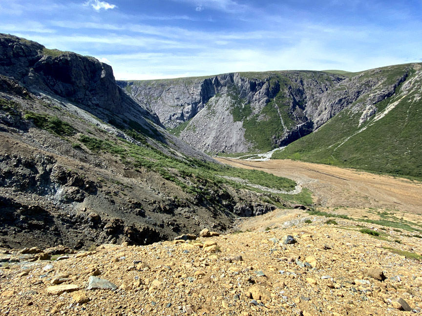
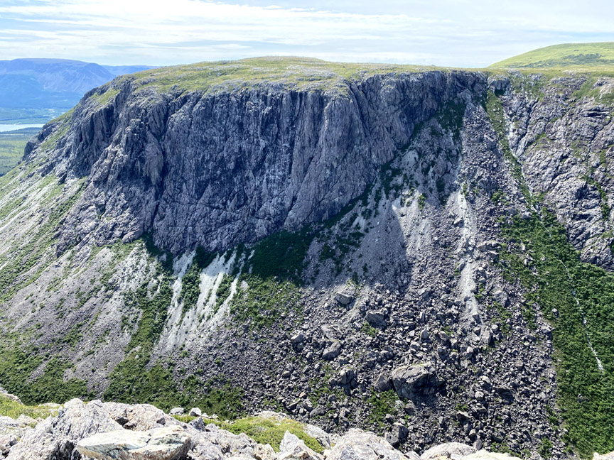
However unlike its interior walls which rise to a height of 600 meters (2,000ft), the entrance to the gulch is defined entirely by sheer 300 meter (1,000ft) gabbroic cliffs surrounded by tree and scrub-covered foothills composed primarily of pillow lavas and interlayered volcanic breccia, sandstone and limestone.
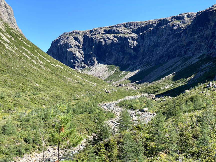
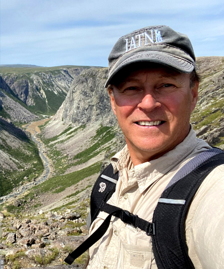
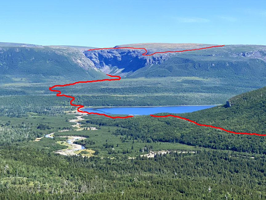
To enter the gulch, hikers must first cross the western end of Serpentine Lake at road’s end, which by late June after Spring snowmelt is generally knee-deep. On August 25, when IATNL/CABOX Director Paul Wylezol made his exploratory trek to map a new route across the top of Simms Gulch’s east rim, water levels were exceptionally low and Paul was able to walk the entire length of a now-exposed gravel beach and only required to cross a 25 foot wide shin-deep Serpentine River.
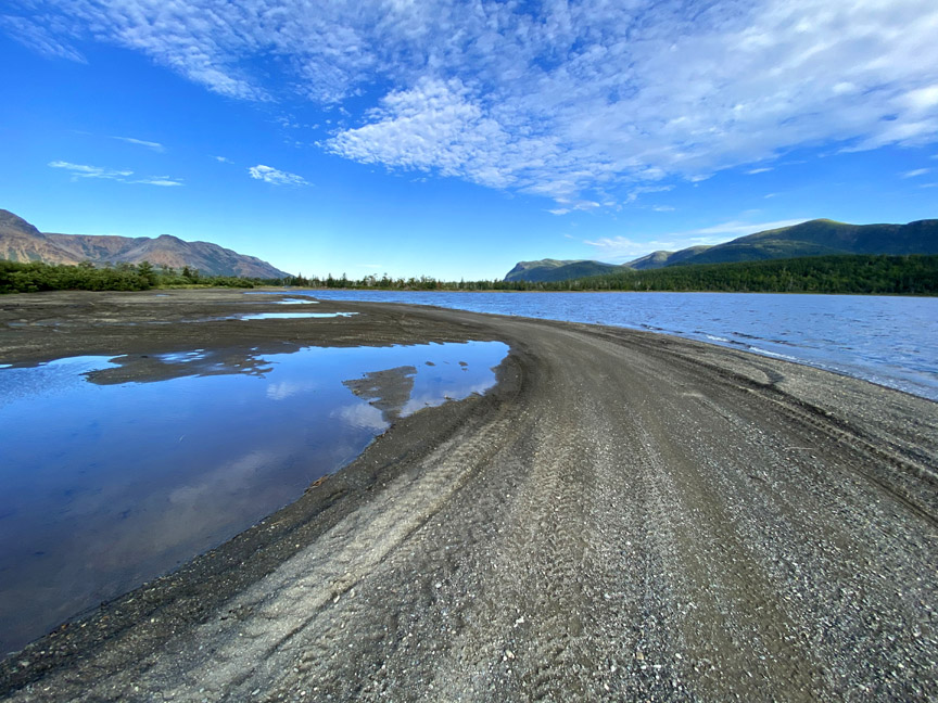
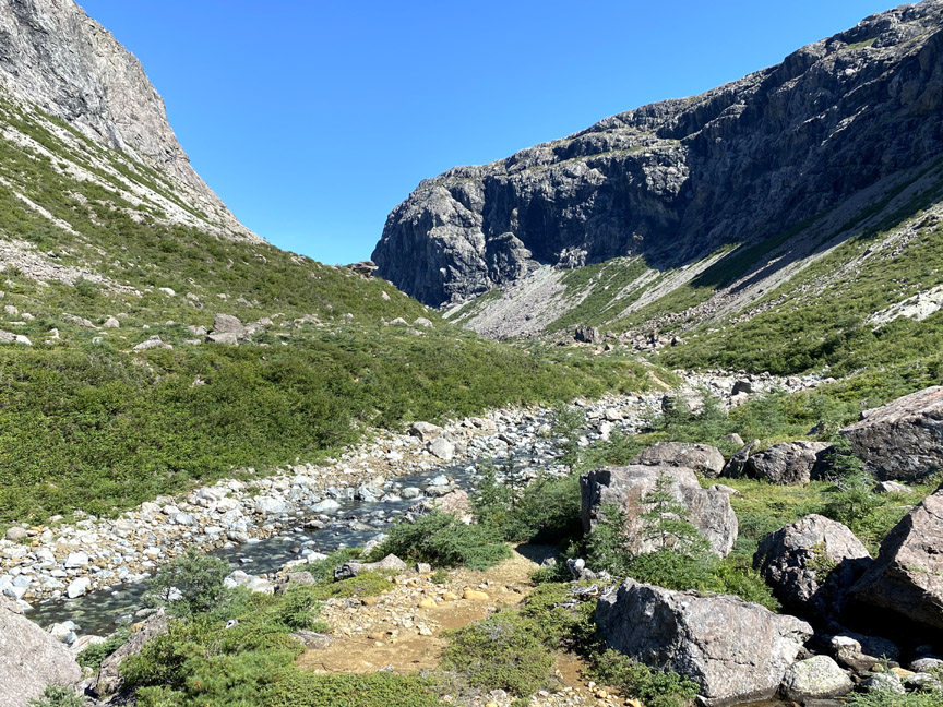
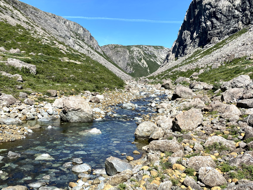
Once across the lake, hikers into Simms Gulch must follow the IATNL Blow Me Down Mountain Trail which winds its way up over the lower foothills then along the right bank of Simms Brook until it descends the riverbank and follows along the rocky streambed into the gulch.
The trail route was created 10-12 years ago by the International Appalachian Trail Newfoundland and Labrador and extends across the mountains to Cape Blow Me Down, then on to Frenchman’s Cove at the entrance to Humber Arm, Bay of Islands.
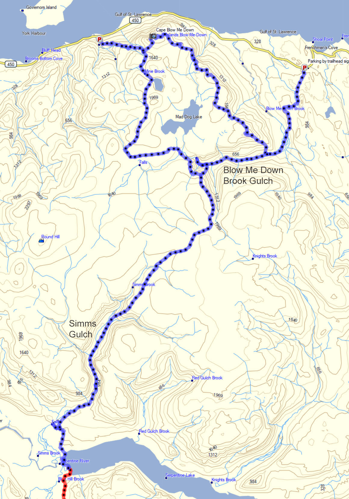
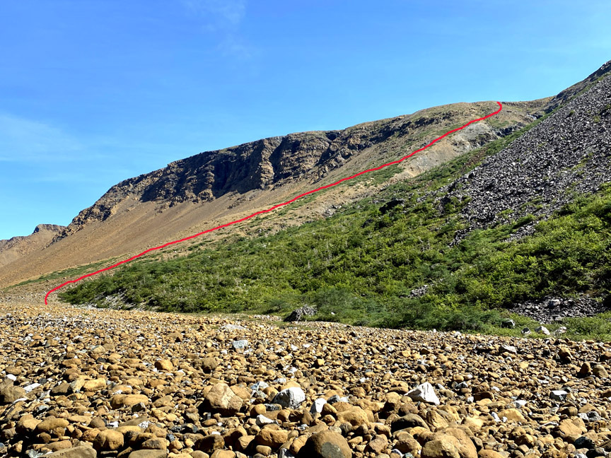
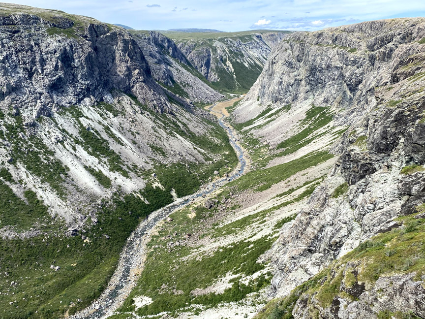
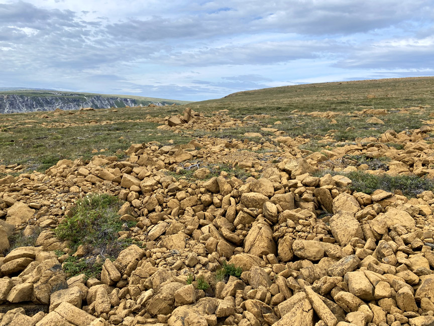
The route through Simms Gulch follows along the brook – which eventually disappears under a gabbro and peridotite “stone glacier” – until it reaches the upper end of the canyon, where it climbs out of the gulch on the sloped headland between the east and north forks.
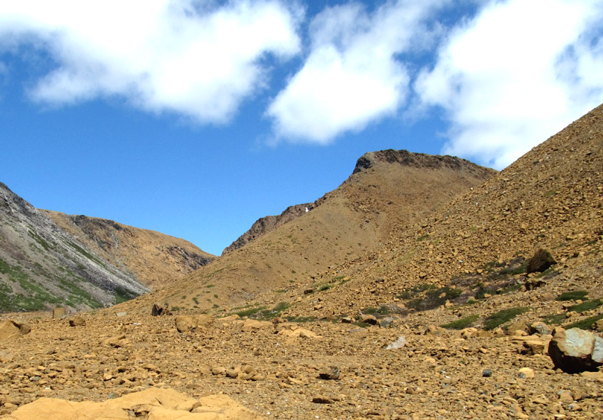
Paul’s quest was to find a not-too-difficult hiking route out of the gulch to the top of the east rim
which provides greater views the higher one climbs.
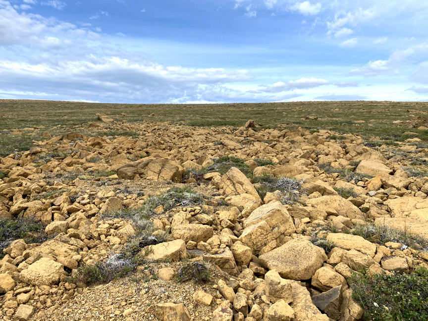
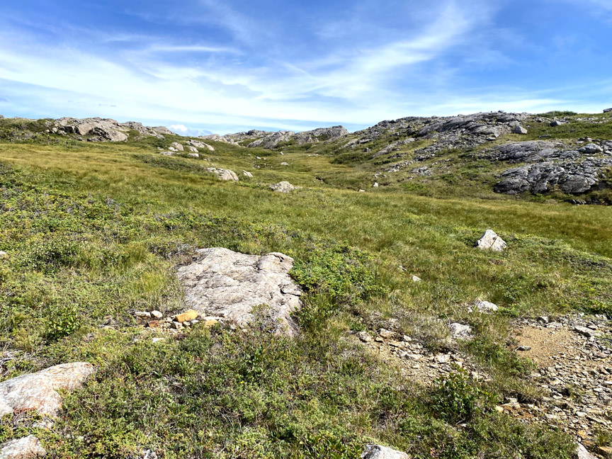
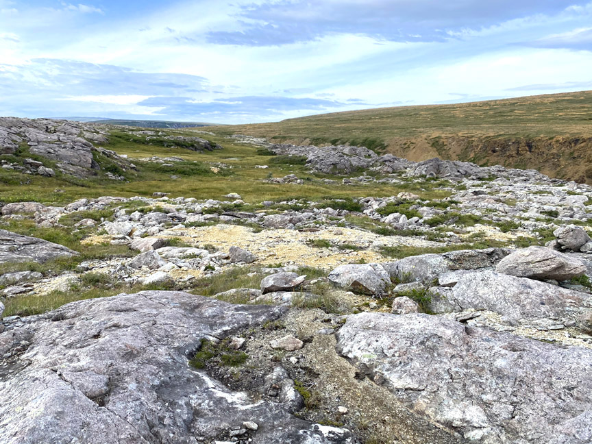
As luck would have it, the only possible route was just such a route, providing good access to the serpentine barrens at the center of the eastern plateau between Simms Gulch and Red Gulch.
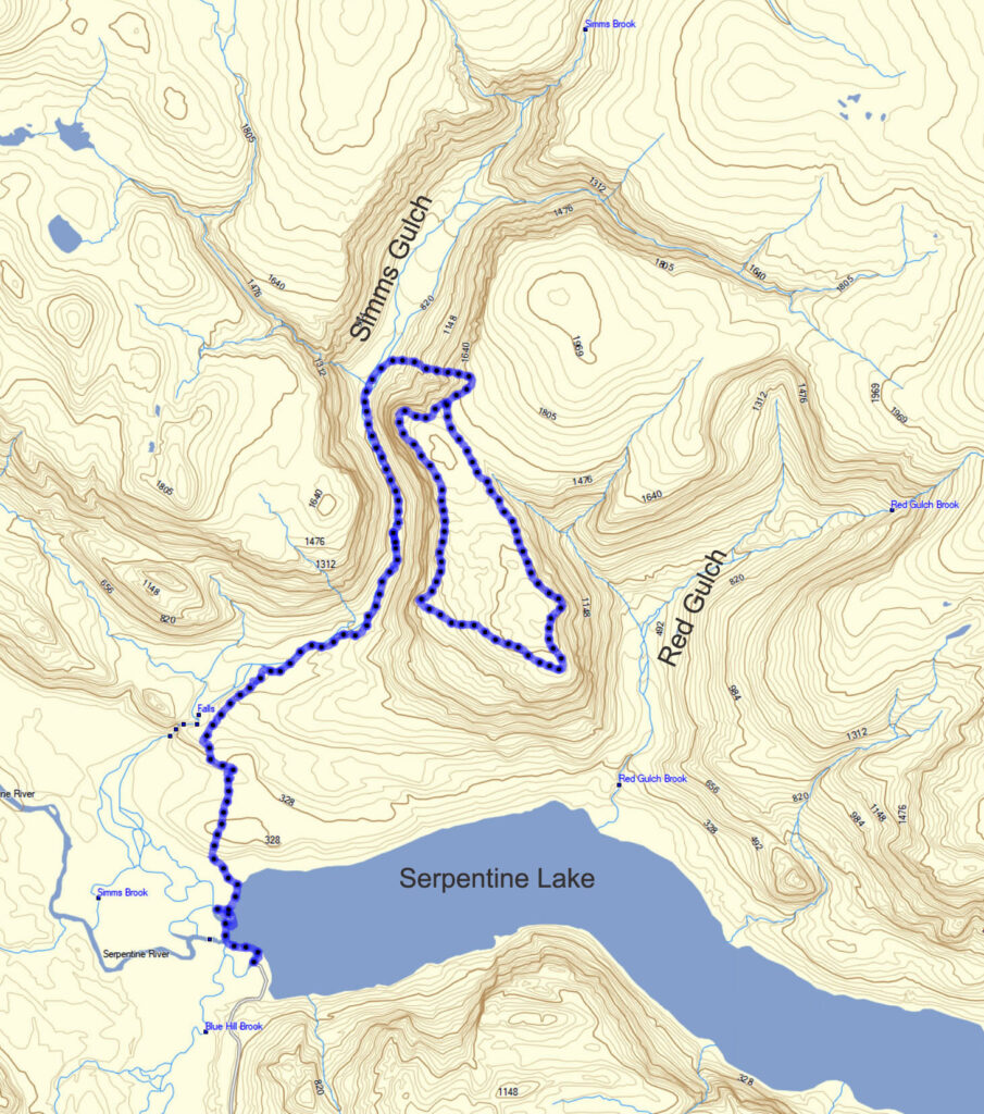
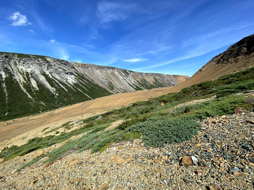
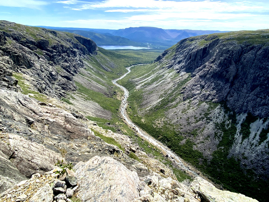
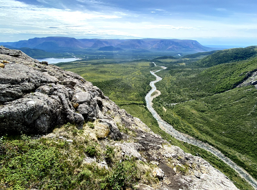
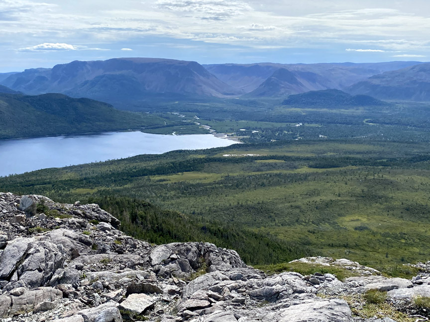
Once on top, Paul tracked south along the rim, which provides terrific views to the north, west and south.
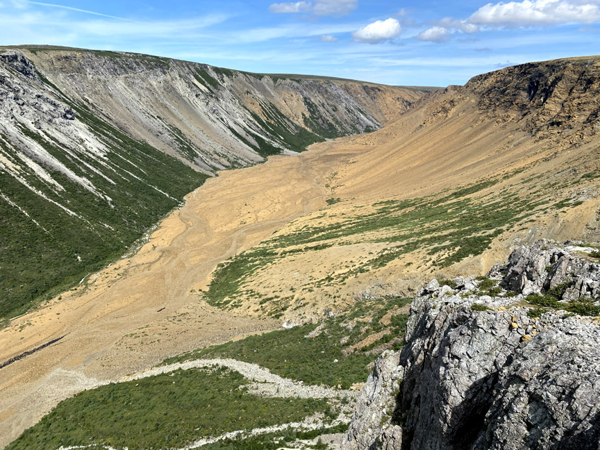
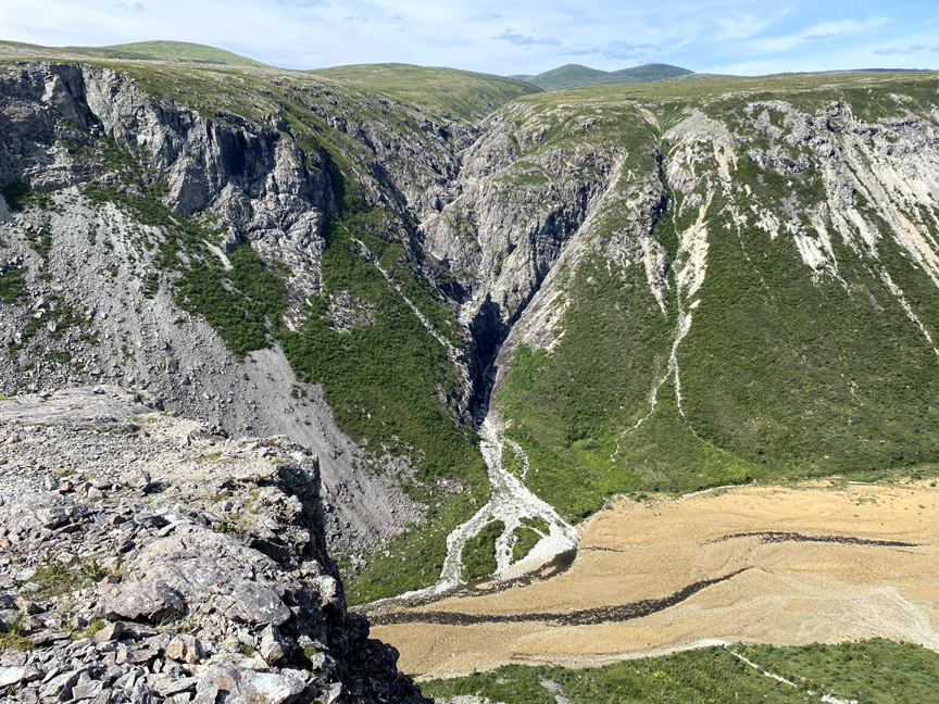
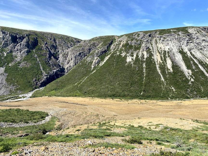
Once above the entrance to the gulch, the view into it is unrivaled
while the view to the south reveals Serpentine Lake and Valley
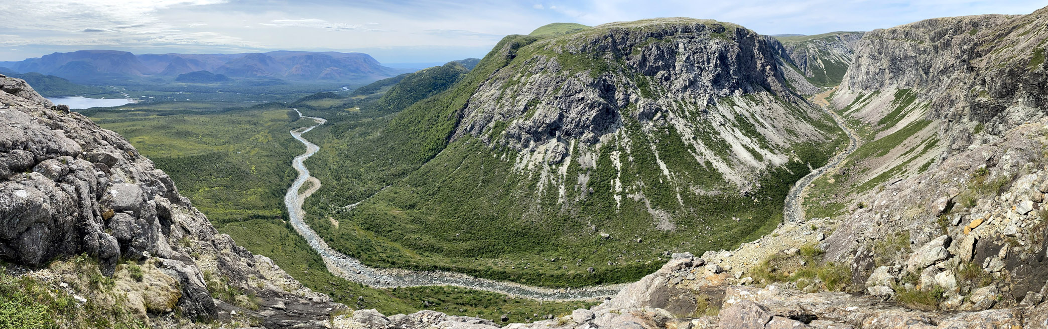
with more of Simms Brook and the Lewis Hills beyond.
From the southwest corner of the east rim, Paul headed east across a grassy gabbroic plateau
in the direction of Red Gulch, in order to take in spectacular views of its rust-colored subterranean mantlescape
before looping back to the top of the east rim ascent.
Though only 16kms in length, Simms Gulch’s east rim trek took approximately 7 hours to complete at a leisurely pace, plus 3 hours of round-trip driving time.