On October 22, representatives of Cabox Aspiring Geopark, Memorial University of Newfoundland’s Grenfell Campus, College of the North Atlantic’s Corner Brook Campus, and the Canadian Forest Service gathered at Corner Brook’s Rotary Arts Center (RAC) for the first official meeting of the newly formed Cabox Collaborative.

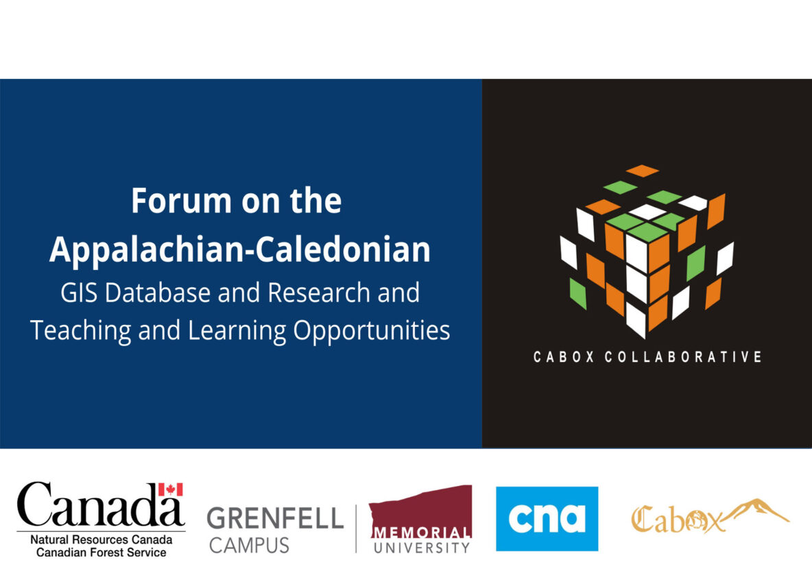
The group first met August 20 over lunch at the Saltbox Restaurant in Benoit’s Cove to discuss ways in which the Aspiring Geopark and local academic institutions might cooperate. One project that stood out was the Appalachian-Caledonian GIS Database Website for which Cabox was recently approved for federal and provincial funding. That in turn led to October’s Forum on the Appalachian-Caledonian GIS Database and Research, Teaching and Learning Opportunities.
The goal of the database project is to develop an educational website designed to identify, compile and present the geological, ecological and sociological features of the Appalachian-Caledonian region, from the southeastern United States to Newfoundland, and across the Atlantic Ocean to Greenland, Ireland, the United Kingdom and Norway. Emphasis will be placed on global, regional and local characteristics and the relationships between them.

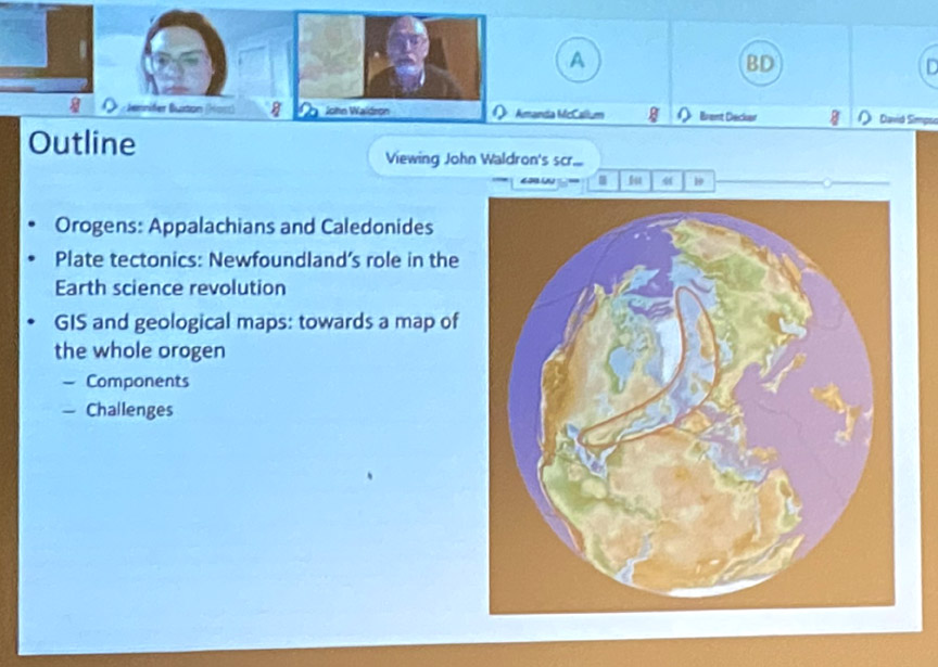
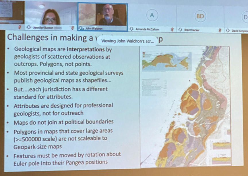
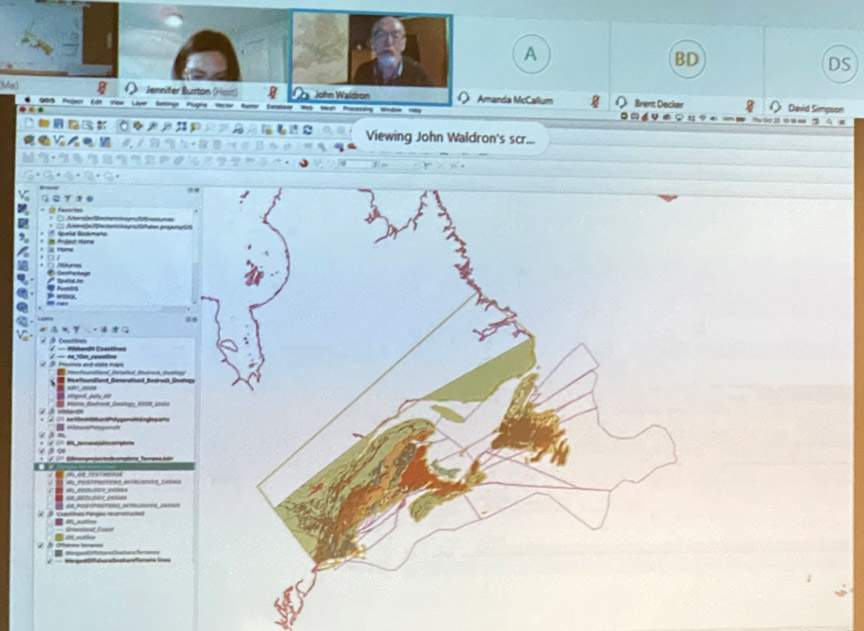
As per COVID-19 protocols, PPE and social distancing procedures were followed, with some participants including Dr. John Waldron of the University of Alberta, appearing remotely.
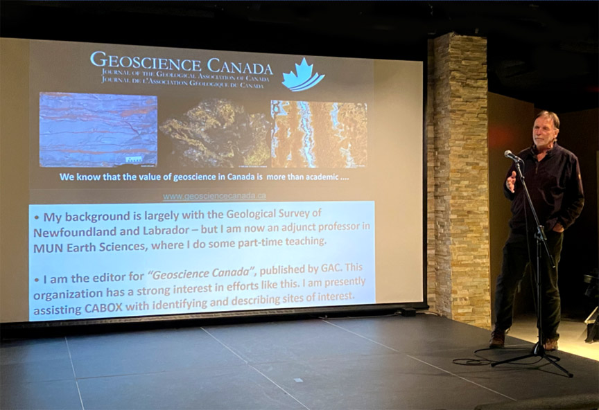
After Cabox Chairperson Paul Wylezol gave a summary of the project, Dr. Waldron gave a remote presentation on Newfoundland’s role in the theory of plate tectonics and the geological mapping of the Appalachian Orogen.
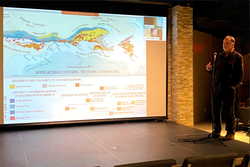
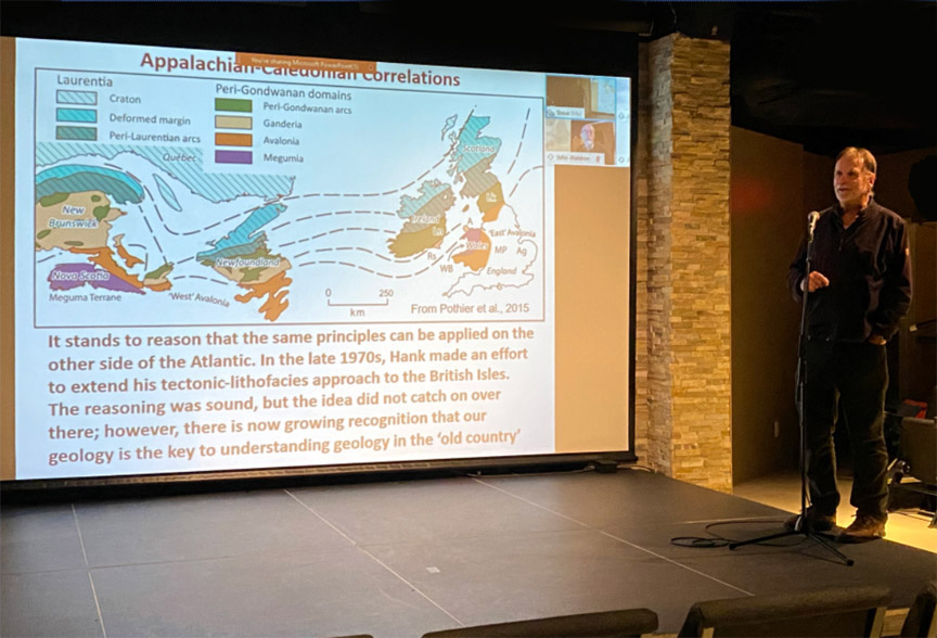
Dr. Waldron was followed by Dr. Andy Kerr of Memorial University of Newfoundland who gave a presentation on Harold “Hank” Williams’ Tectonic Lithofacies Map of the Appalachian Orogen and the geology of Newfoundland. Andy spent most of October identifying geosites in the Humber Valley, Bay of Islands and Trout River area.
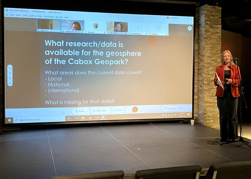
After the presentations, Dr. Kelly Vodden, Associate Vice-President Research and Graduate Studies at MUN’s Grenfell Campus, facilitated discussion on the creation of the Appalachian-Caledonian GIS Database Website.
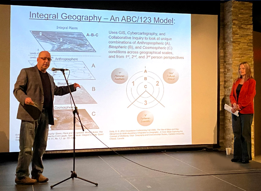
Dr. Brian Eddy, Research Scientist at the Canadian Forest Service, introduced the concept of Integral Geography, an ABC/123 cartographic model that utilizes GIS, cybercartography and collaborative inquiry to examine unique combinations of anthropospheric, biospheric and cosmospheric conditions across geographical scales, and from 1st, 2nd, and 3rd person perspectives.
After Dr. Robert Scott, Associate Professor of Environment and Sustainability at MUN’s Grenfell Campus, discussed environmental issues and ecological mapping, Dr. Vodden made a motion requesting coordinators for each of the three GIS categories. Dr. Scott agreed to coordinate the ecological layer, with Dr. Eddy stepping up to coordinate the human layer and Paul Wylezol coordinating the geological layer.
Stay tuned for the next step in the Appalachian-Caledonian GIS Database Website: creation of the website layout.