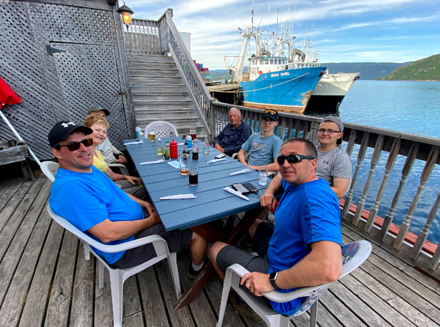
On Friday, June 25, after 2.5 years of intermittent work, the International Appalachian Trail Newfoundland & Labrador (IATNL) launched the Elephant Trail on the south side of Trout River Pond
with a group hike of 12 people.
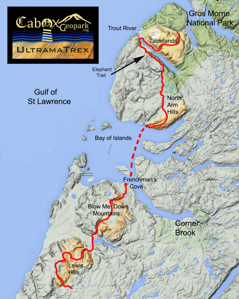
The trail is at the northern end of the 3-day North Arm Traverse
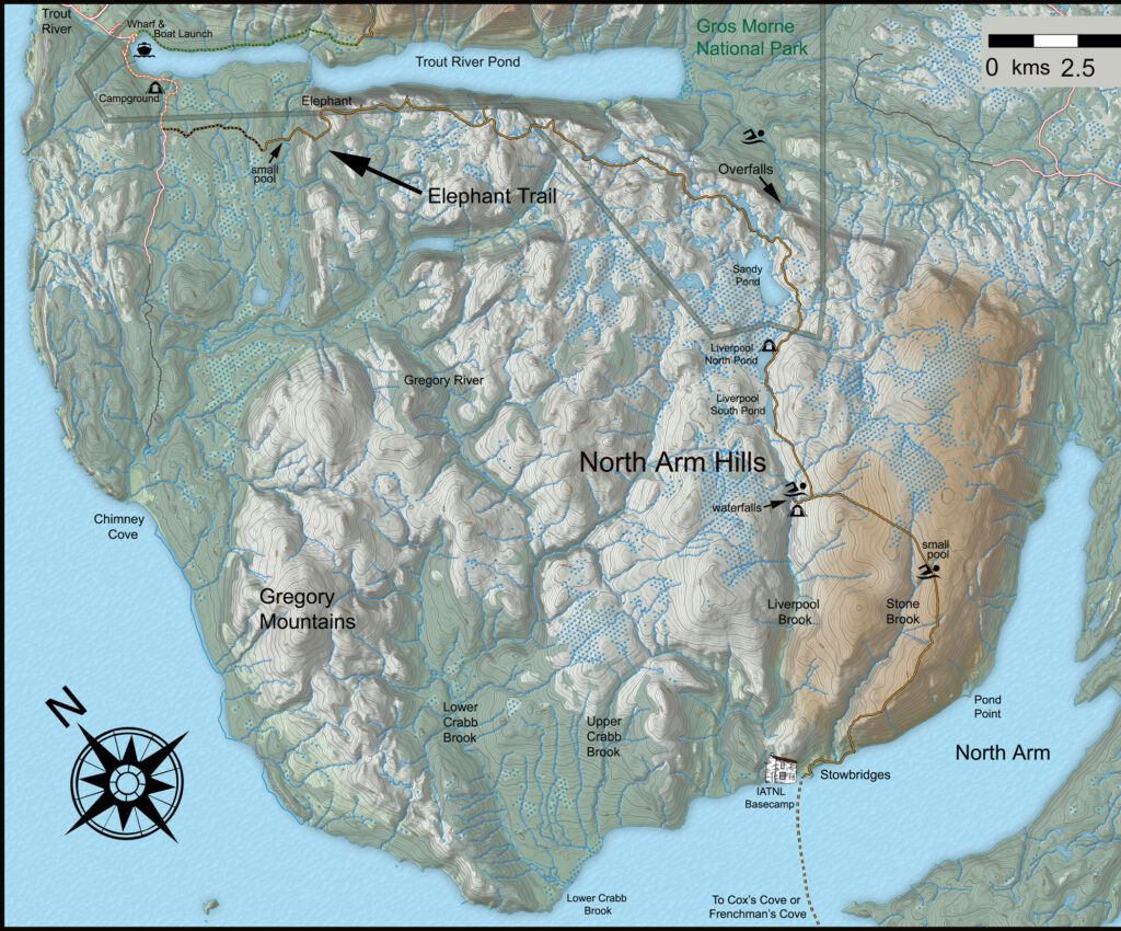
with the southern end located at the IATNL Basecamp at Stowbridges on the north side of North Arm, Bay of Islands.
The North Arm Traverse is itself Stage 2 of the 4-stage UltramaTrex long-distance hiking route which follows the rust-colored “ultramafic” (i.e., high in magnesium and iron) sections of the four Bay of Islands Ophiolite Massifs, with the other three being Table Mountain (aka Tablelands) to the north, and Blow Me Down Mountains and Lewis Hills to the south, across Bay of Islands.
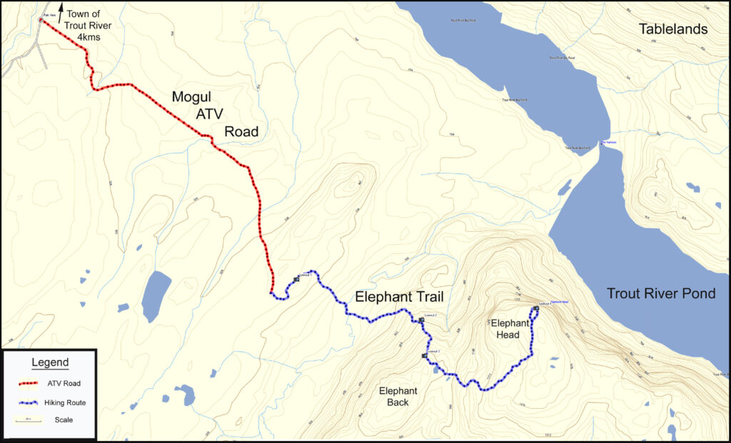
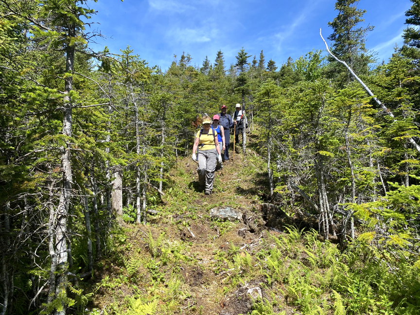
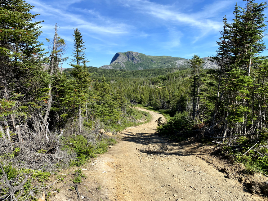
The June 25 inaugural trek of the Elephant Trail began with a 50-minute 3km walk on Mogul ATV road, which intersects Chimney Cove gravel road near a cow bridge 2kms past Trout River Campground, which in turn is 2kms past the parking lot for Trout River Pond in Gros Morne National Park.
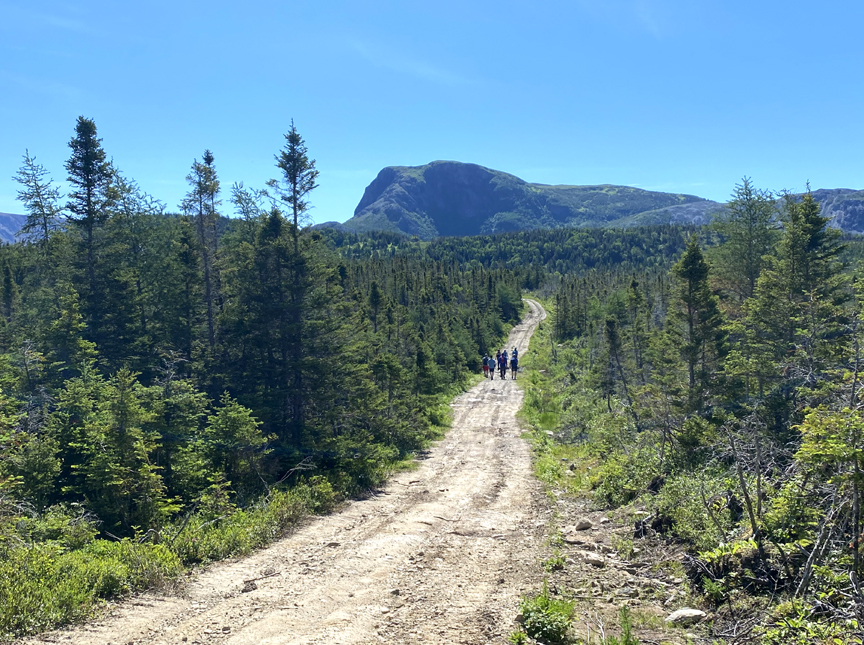
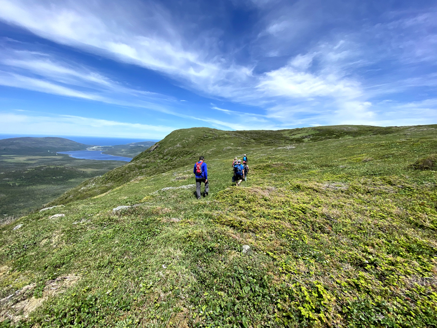
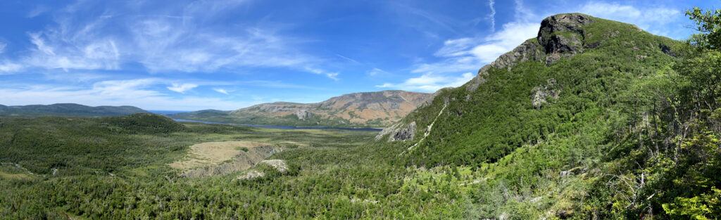
After turning onto the Elephant Trail, a short 10-minute walk brought the group to the first of several good vantage points, this one of the Elephant Head and Tablelands across Trout River Pond.
From there it was downhill “through verdurous glooms and winding mossy ways”
to a rock hop across Narrows Brook
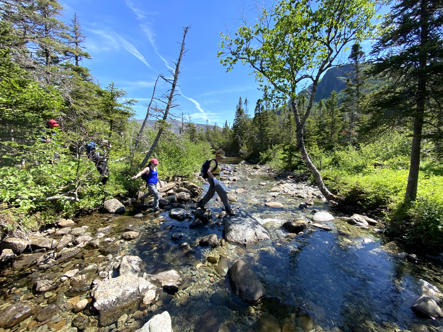
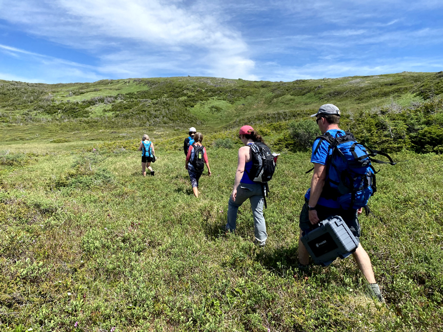
followed by a steady incline to the base of the Elephant’s flank.
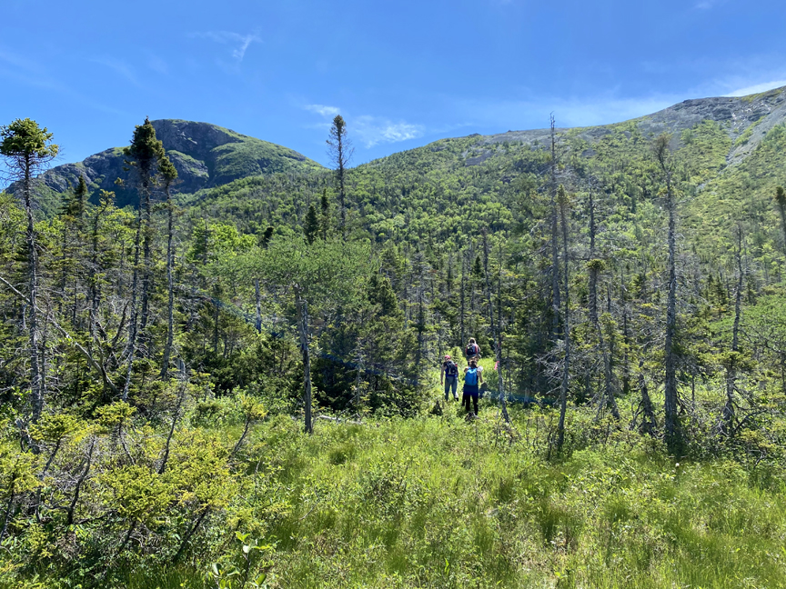
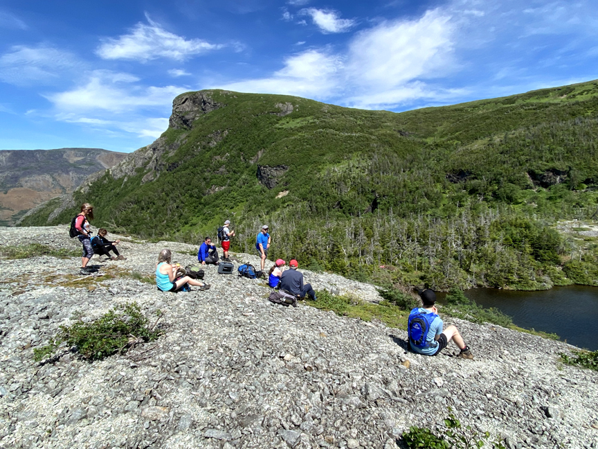
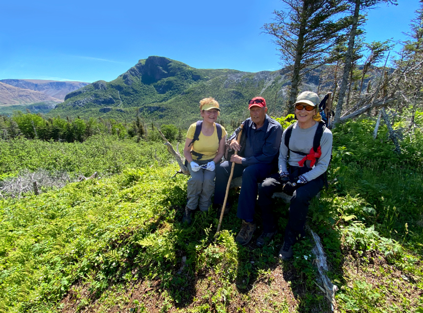
A 100-meter climb to LookOutCrop earned a well-deserved photo op stop
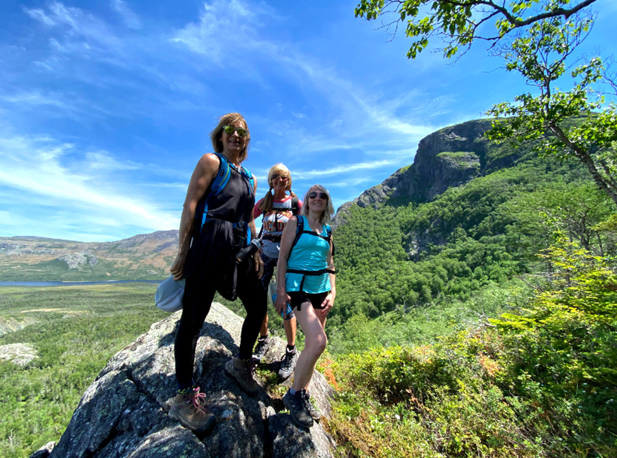
before another 100-meter climb to the top of a gabbroic ridge
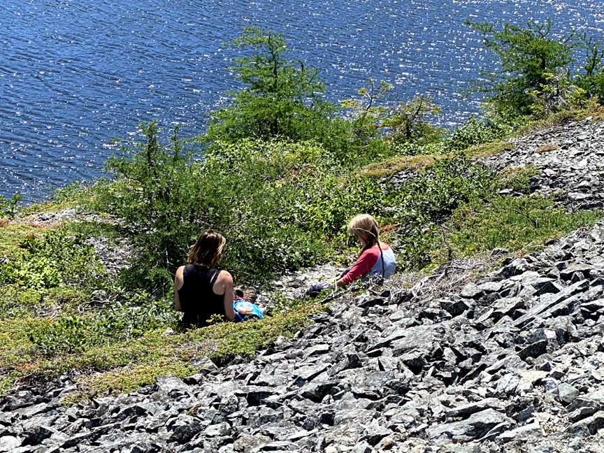
sheltering a small mid-mountain pond.
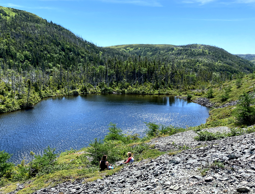
A great place for a lunch break!
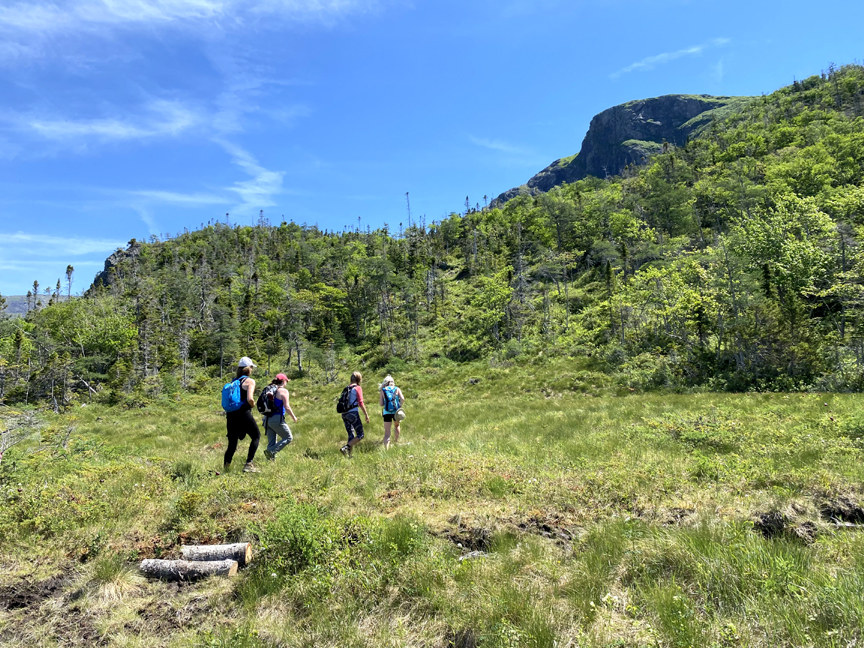
After a little R&R, it was time for the last 125-meter climb to the top of the Elephant’s Back
where the rolling landscape is devoid of trees and defined primarily by spongy moss, ground-hugging shrubs, wetland grasses, and occasional patches of 1-2 meter scrub.
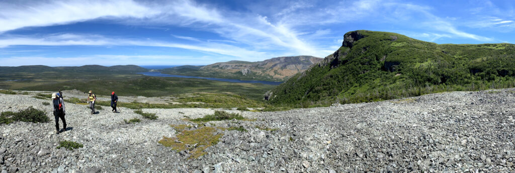
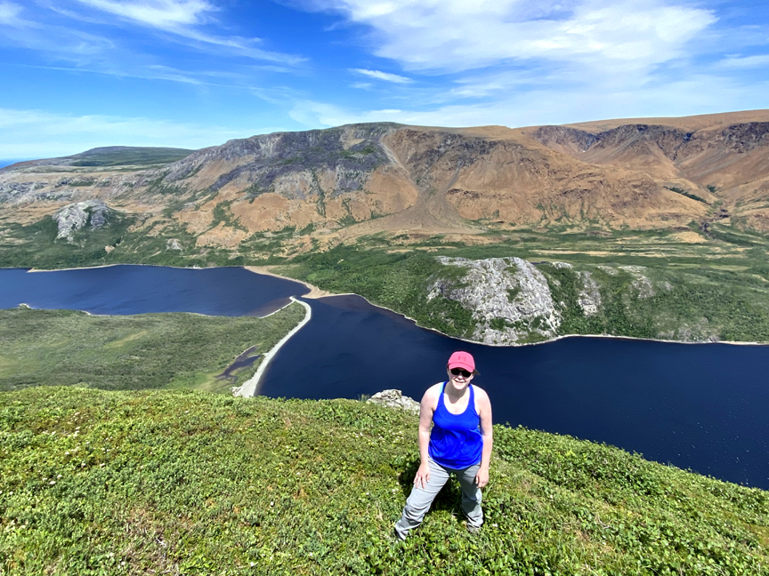
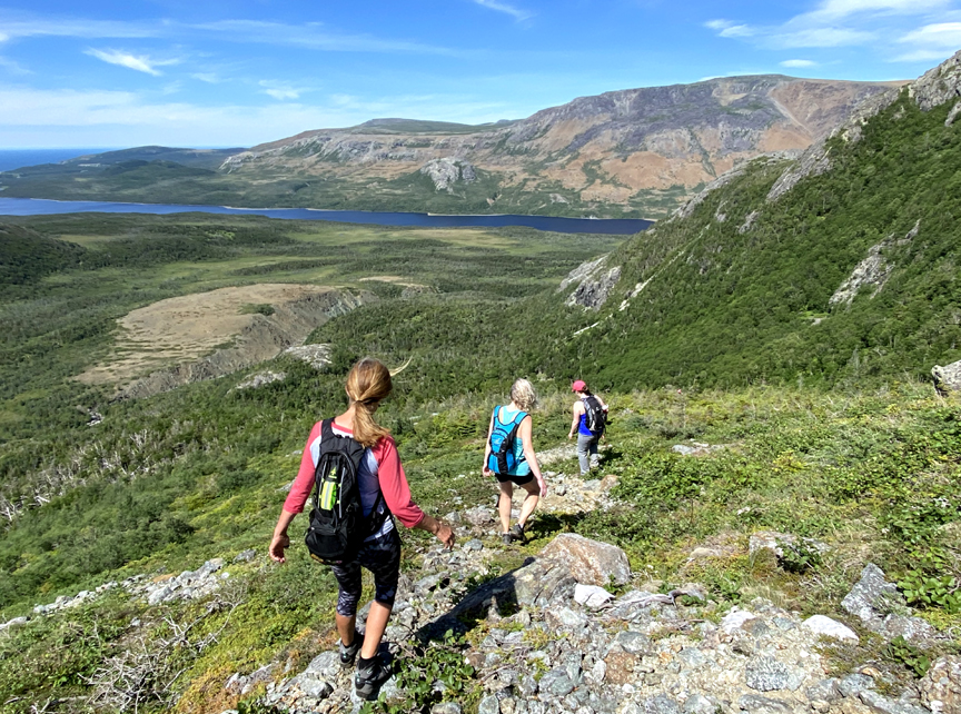
From here it was only a 15-minute walk across the boundary of Gros Morne National Park to the top of the Elephant’s Head and one of the most spectacular views in Western Newfoundland.

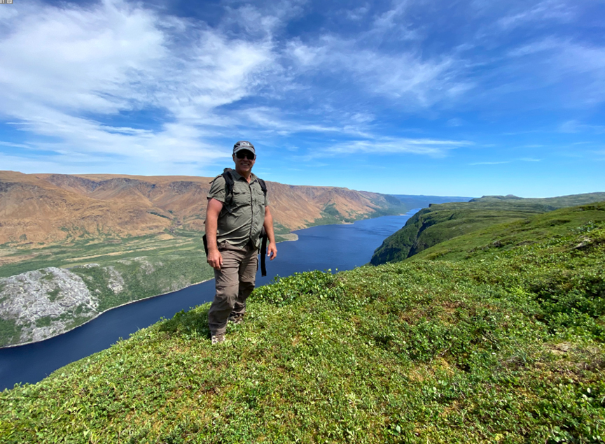
This vantage point offers hikers a view of the entire length of Trout River Pond, the entire south side of Table Mountain, the town of Trout River and the Gulf of St. Lawrence, all with a southern exposure.
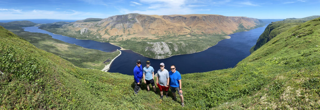
The Elephant’s Head also provides a commanding view of the Narrows, the small navigatable channel between Trout River inner and outer ponds.
Once on top of the Elephant, hikers who can add a day can continue along the south rim of Trout River Pond to the Overfalls waterfalls, where the IATNL Overfalls Trail connects to the eastern end of the pond and a 45-minute boat ride back to the wharf on the edge of town.
But on this day in June, our group of 12 retrace their steps and descend the side of the Elephant.
After one last look at their route

they walk back out Mogul ATV Road
and head to the Merchant Warehouse in Woody Point for a well-deserved ice cold beer and delicious meal, while recapping their latest trek and planning the next!