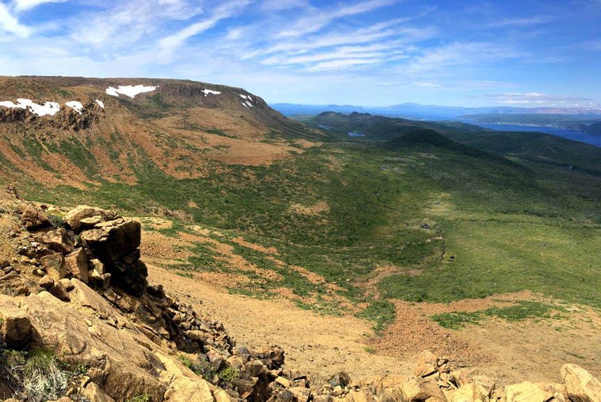
On May 21, IATNL Directors Paul Wylezol and Delano Pittman took advantage of a beautiful day during an ideal time of year to make an exploratory bushwhacking trek up a prominent ridge in the lower Humber Valley to find a new scenic route to Arne’s Lookout, 1.6 kms (1 mile) west of Man In The Mountain above Humber River. The new 1.5 km route would begin 130ft above sea level near the current western trailhead and rise to 1110 ft, and provide spectacular new views of the Humber Valley, Humber Arm and Blow Me Down Mountains.
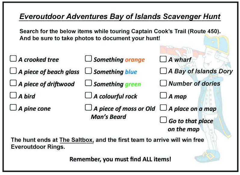
Everoutdoor Adventures Scavenger Hunt & Coloring Book
If it feels like you’ve spent the last couple of … Read More
Cabox Commemorates 250th Anniversary of Cook Chart
On May 10, Cabox Aspiring Geopark commemorated the 250th Anniversary of the publication of Cook’s General Chart of the Island of Newfoundland by posting a 3-minute video which summarizes Cook’s life and ends with a spotlight on the technically innovative map of Britain’s first overseas colony, an important fishing ground and nursery for sailors. The chart was published in London in 1770 under the authority of the British Admiralty by Thomas Jefferys, Geographer of the King, while Cook was off the east coast of Australia during his first voyage to the Pacific Ocean. It was published as part of his ‘Collection of Charts of the Coasts of Newfoundland and Labradore, &c’,
Cabox Develops WebVR for Geopark Website
During summer 2019, Cabox Aspiring Geopark ramped up its Virtual Reality (VR) program started in 2017 under the EU-funded Drifting Apart project. After acquiring its own 360° VR camera (with 6 lenses) in 2018, Cabox filmed 8 additional sets of hotspot scenes to compliment the 9 hotspots it filmed in 2017 for the GeoVR program, which in 2019 was stationed at Saltbox Restaurant and Geopark Information Center in Benoit’s Cove. The GeoVR program requires the use of a VR headset such as Oculus Rift to view hotspots in 3D virtual reality, creating a realistic effect similar to viewing the sights in person.
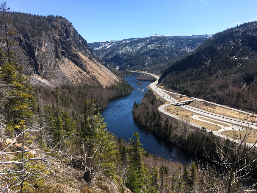
A Winter Tour of the IATNL Blow Me Down Mountain Trail
On April 15, IATNL/Cabox Geopark Director Paul Wylezol and friends Delano Pittman, Katie Broadhurst, Caroline Swan and Jamie Harnum took advantage of a beautiful late winter/early spring day to take a snowmobile ride on Cabox Geopark’s Blow Me Down Mountains, following the route of the IATNL Blow Me Down Mountain Trail. In the north, the trail starts near Frenchman’s Cove on Route 450 (Captain Cook’s Trail) on the south side of the Bay of Islands. From there the trail passes the Hummock foothills before entering Blow Me Down Brook Gulch (ie., Valley) at the “Sands”, the long sandy slope were the brook makes a right angle turn west and bisects the Blow Me Down Ophiolite Massif.
Geopark Reps Visit Appalachian Trail Southern Terminus
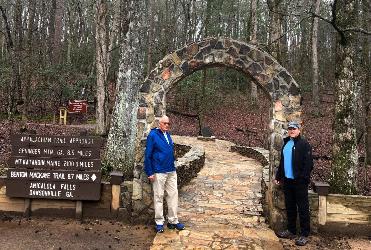
On March 15, Cabox Representatives and IATNL Directors Paul Wylezol and Arne Helgeland visited the Appalachian Trail Basecamp in Amicalola Falls State Park near the southern terminus of the AT at Springer Mountain, Georgia. The basecamp is also located near the southern end of the Appalachian Mountains and is the starting point for south to northbound treks of the Appalachian Trail from nearby Springer Mountain to Mount Katahdin in Maine, then onward along IAT North America through northern Maine, New Brunswick, Gaspe Peninsula of Quebec, PEI and Nova Scotia to Cabox Geopark, then on to Crow Head on the tip of Newfoundland’s Great Northern Peninsula.
Cabox Presents at ACAP Monthly Meeting
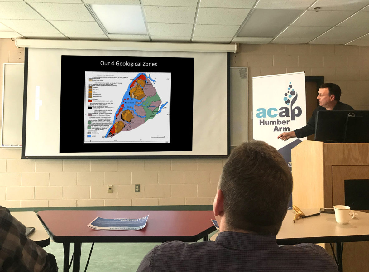
There was a good turnout Thursday, February 27, for Cabox Aspiring Geopark’s presentation at the ACAP Humber Arm lunchtime meeting at the Forestry Centre on MUN’s Grenfell Campus in Corner Brook. Cabox Chairperson Paul Wylezol presented on the UNESCO Global Geopark program and Western Newfoundland’s Cabox project, from its history and development to the application process.
Cabox VR Inspires Participants at HNL Fun Night at Marble
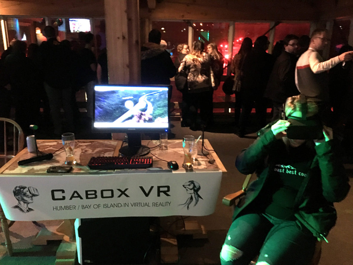
It was an awe-inspiring evening for participants of Hospitality Newfoundland and Labrador’s (HNL’s) Fun Night at Marble Mountain on Wednesday, February 26! In addition to the torchlight parade, many of those in attendance got to try out Cabox VR, the Cabox Aspiring Geopark component of the Drifting Apart project’s GeoVR program. Geopark Vice Chair Rob Thomas walked people through several iconic viewpoints of the Humber Valley and Bay of Islands Ophiolites in virtual reality.
STAR Report Identifies Keys to Developing Tourism
City of Corner Brook staff are stressing the importance of a collaborative tourism approach with the completion of the STAR (Strategic Tourism for Areas and Regions) Report. The report, a tourism plan developed for the Corner Brook/Bay of Islands/Lower Humber Valley region, was released publicly Nov. 18. Darren Charters, director of community, engineering, development and planning for the city, said they will continue to collaborate with partners, including the public, tourism industry, provincial and federal governments and other communities around the Bay of Islands. The report lists 31 strategic recommendations and tactics, including Cabox Geopark, but Charters identified five broader areas of focus for the city and its partners.
IATNL Humber Valley Trail part of 2020 STEEP ULTRA
On September 5, 2020, nearly 200 trail runners will descend on the Humber Valley to participate in Newfoundland’s first 100-kilometer ultramarathon trail race or shorter 50km race, both including the entire length of the IATNL Humber Valley Trail from Ballam Bridge to Humber Village. The region’s first ultramarathon, STEEP ULTRA, will enable runners to “experience breathtaking ocean views, majestic rolling mountains and vast, remote landscape.”