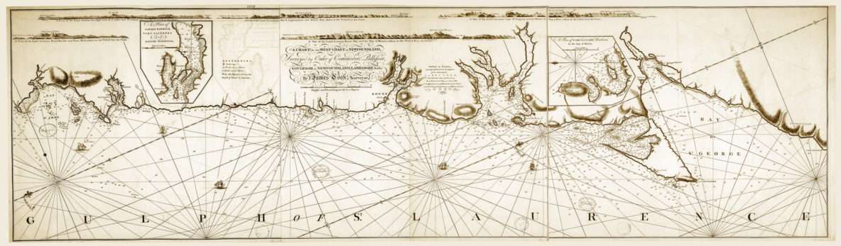
On October 26, 2018, Cabox Geopark in Western Newfoundland commemorated the 250th Anniversary of James Cook’s ‘Chart of the West Coast of Newfoundland’. A large version of the map was installed at the Geopark’s new Saltbox Information Center in Benoit’s Cove on the south side of the Bay of Islands. Other copies of the Chart were (and will be) installed at key locations around the bay, including along the newly designated James Cook Heritage Trail in Blow Me Down Provincial Park in Lark Harbour.
Cabox Information Center Launches at New Saltbox Restaurant in Benoit’s Cove
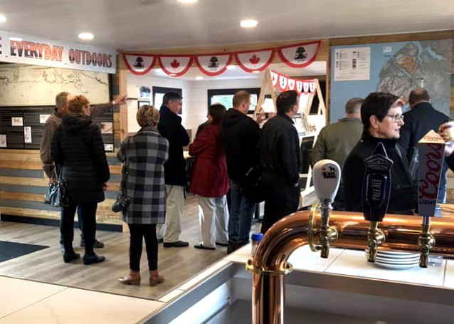
On October 26, 2018, Cabox Geopark and the soon to be Saltbox Restaurant in Benoit’s Cove launched the first Cabox Geopark Information Center. Located approximately halfway along Route 450 on the south side of the Bay of Islands, the center will provide natural heritage and outdoor adventure information to both residents and tourists. Opening day included storyboards on renowned surveyor James Cook, who surveyed Newfoundland’s west coast in 1767, and the region’s diverse geology as mapped by a long list of geologists including Newfoundlander Harold “Hank” Williams who colored in Cook’s maps.